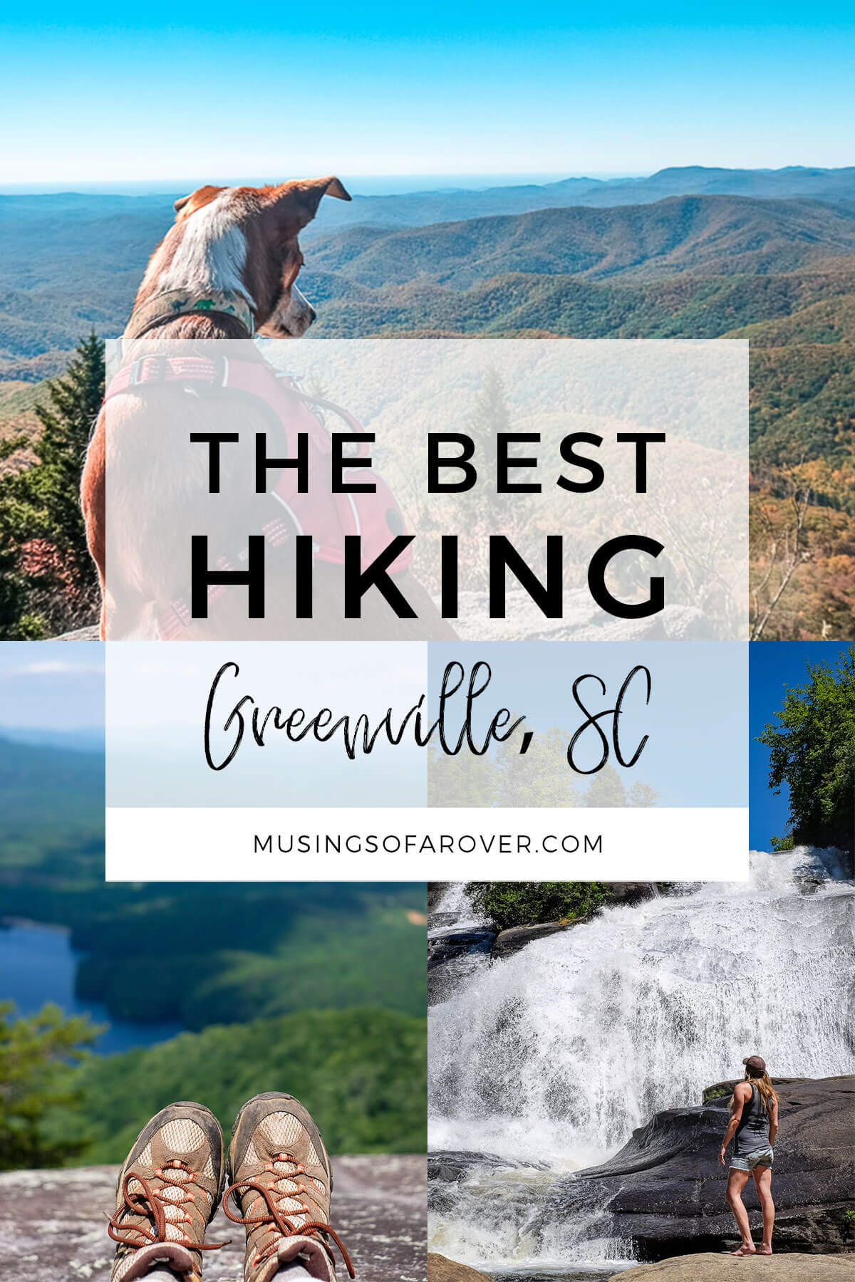
Are you an outdoors lover? Or are you just looking to get out of your house for a few hours? Either way, Greenville has you covered. With so many state parks within an hours drive and with the Blue Ridge Mountains nearby, there’s so much to explore. Here are my favorite places to go hiking near Greenville, SC.
Now “the outdoors” and Greenville have both grown in popularity recently. Anyone who lives in Greenville knows that people are moving here everyday. So more and more people are hitting the trails.
What I mean by all of this is that, well, many of the places featured here are now very popular. Expect trails to be more crowded and parking lots to fill up by 9am on weekends year round (you can thank our mild winters for that).
So if you want to escape the crowds, try to go to the less popular areas or trails. This may mean you’ll miss the view, but, on the other hand, you may not have to share your hike with hundreds of others.
One last thing to consider are the fees to enter the below parks and such. When considering your outing, be aware entry fees may apply. For example, South Carolina State Parks have an entry fee. I don’t mind paying a small entry fee to help my parks. But it’s something to keep in mind.
Table of Contents
- Under 1 Hour Away From Greenville
- Conestee Nature Preserve
- Cedar Falls Park
- Table Rock State Park
- Jones Gap State Park
- Caesars Head State Park
Hiking Near Greenville SC
Under 1 Hour Away From Greenville
Paris Mountain State Park
Travel Time: 15-20 minutes
This is the closest state park to Greenville, SC and it’s the one I head to most often when I just have a couple of hours and don’t want to overthink it. I’ve hiked most of the trails in the park. For a longer description of each trail, check out my Paris Mountain Hiking Guide.
Trails are dog friendly with a 6ft leash.
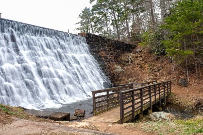
Lake Placid Loop
- Difficulty: Easy
- Length: .75 miles (under 1 hour)
- I love the waterfall by the dam.
Upper Mountain Loop
- Difficulty: Easy
- Length: 3 mile loop (1-1.5 hours)
- I’m not sure what to call this route, but it’s a loop of the upper trails (Brissy Ridge-> Kanuga -> To Firetower -> Firetower -> Sulphur Springs). It’s fairly level and is my number 1 go to hike.
Sulphur Springs Trail
- Difficulty: Moderate
- Length: 3.6 mile loop (2 hours)
- This longer loop goes from the lower section of the park up to the top and back down again. It’s a fairly tough climb if you’re not in hiking shape, so make sure you’re prepared. And I’d do the loop counter clockwise so you’re coming down the steepest part.
Read Next: Paris Mountain Hiking Guide
Conestee Nature Preserve
Travel Time: 15-20 minutes
When I want something more than just a walk but less than a state park, I like to head to Conestee Nature Preserve. Plus they recently did a lot of maintenance in the Preserve and the trails now have blazes and better signs, and there’s a new map with route suggestions to help you navigate.
Check out the map (a link to the latest should be found on that page) before you go. You can also find the map at most entrances (check the kiosks) as well as at a few intersections within the Preserve.
Trails are dog friendly with a 6ft leash.
Yellow Route
- Difficulty: Easy
- Access: Via the Reedy River Bridge Entrance (E2) at the back of the North Entrance to Conestee Park.
- Length: 2.2 mile loop (1-2 hours)
- This loop heads into the park towards the Swamp Rabbit Trail. It’s got a good mix of paved walkways, boardwalks, and observation decks. It’s fairly busy as I feel like this is the main entrance to the Preserve. But if you’re looking for more trails, there are loads of them in this area. (Want a route with a more natural surface? Try the green route!)
Pink Route
- Difficulty: Easy
- Access: Near the Conestee Mill off of Spanco Dr (S1). The parking lot here is small.
- This out and back and trail is an extension of the Swamp Rabbit Trail. The trail is paved and is a nice little walk, but it is farther away from the other trails in the Preserve. It also feels farther away than the bustling area around Conestee Park.
Cedar Falls Park
Travel Time: 30 minutes
This small county park has a lot to offer. You can piece together a few of the walking trails for a nice little hike. The Reedy River widens here and you can see remnants of old dams as well as a few small waterfalls as the river cascades over the rocks and boulders. Plus restrooms, sand volleyball, and a big playground.
Trails are dog friendly with a 6ft leash.
Forest + River + Nature Trail
- Difficulty: Easy
- Length: ~2 miles (1 hour or so)
- If you park at the main lot (the one by the shelter & bathrooms) and head towards the waterfall along the paved Forest Trail. Then you can head down to take in all the dams/rapids. (And even learn a little about the Cherokee who lived here and the dams you can still see the remnants of.) Then head back along the longer Nature Trail to make this a decent little hike.

Table Rock State Park
Travel Time: 40 minutes
I think Table Rock is one of the icons of the Upstate. Every time I see it along Highway 11 it still strikes me with its beauty. And though the quintessential hike is the hike to the top of Table Rock, the park has several other options to choose from.
Trails are dog friendly with a 6ft leash.
Carrick Creek Trail
- Difficulty: Easy
- Length: 2 miles (1 hour or so)
- I like this trail as it’s a bit more difficult than the Lakeside Loop Trail, but doesn’t include intense climbs. You’ll have wonderful views of small waterfalls along the creek.
Table Rock Trail
- Difficulty: Strenuous
- Length: ~7 miles (5-6 hours)
- I consider this to be the main hike in the park. It’s a tough climb up to the top of Table Rock, but the views are amazing. If you’re not up to hiking the whole way, there is a halfway point that has one hell of a view.
Read Next: Hiking the Table Rock Trail [Trail Guide]
Jones Gap State Park
Travel Time: 40 minutes
Jones Gap is a beautiful, but small state park. The parking there is very, very limited. In fact on the weekends and holidays, you have to reserve your parking spot in advance (and pay an additional fee).
Trails are dog friendly with a 6ft leash.
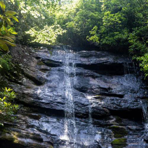
Jones Gap Falls
- Difficulty: Easy to Moderate
- Length: 3.2 miles (2ish hours)
- This trail follows the Middle Saluda River. It definitely goes up, but there aren’t any intense steep sections. The waterfall will be on your right as the trail keeps going uphill following the stream.
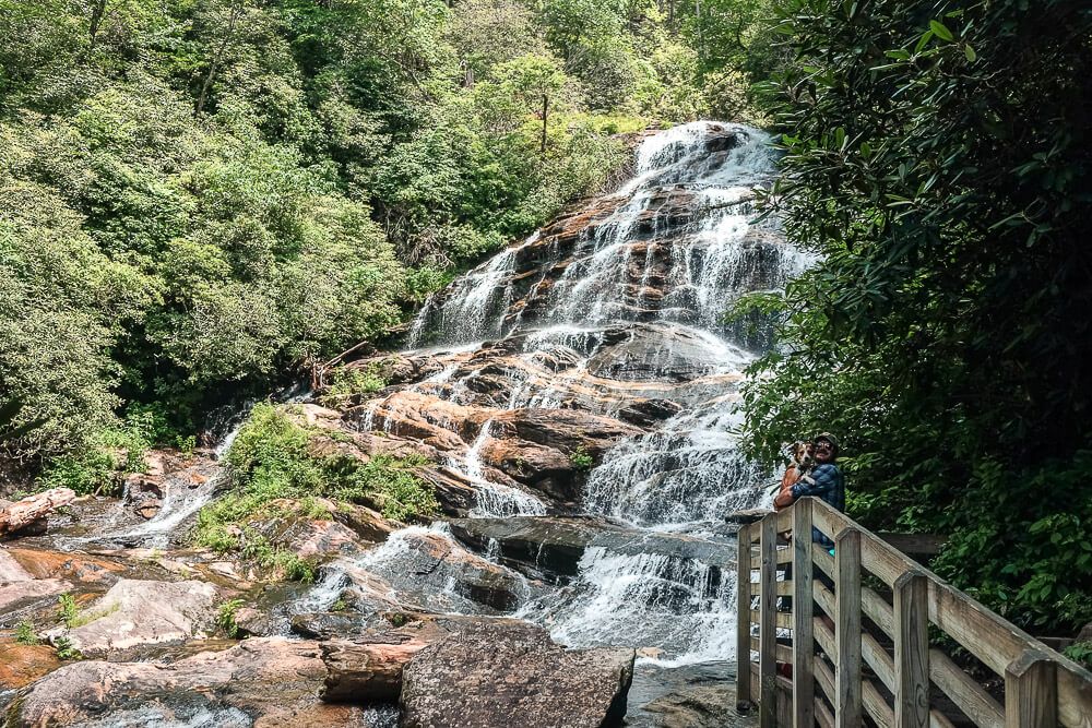
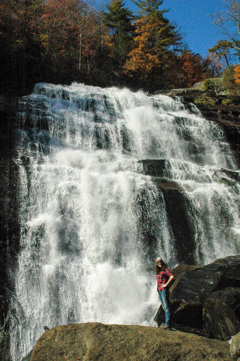
Rainbow Falls
- Difficulty: Moderate
- Length: 4.4 miles (2.5-4 hours)
- The first mile or so of this trail isn’t so bad as it follows the Middle Saluda River. After it crosses over the river though, the trail starts to climb. And climb. (There is over 1,200ft of elevation gain here.) If you’re up for it though, the waterfall at the end is beautiful.
Caesars Head State Park
Travel Time: 55 minutes
Part of the Mountain Bridge Wilderness Area, Caesars Head seems like a small park, but it’s got loads to offer. The Raven Cliff Falls hike was the one of the first hikes I did in the area. If you hike any of the less popular trails, I would stop by the visitor center to snag some proper maps.
Some trails are dog friendly. Some are not. I’ve indicated which below. Check at the Park Office for details on others.
Raven Cliff Falls
- Difficulty: Moderate
- Length: 4 miles (3 hours)
- Dog Friendly: Yes
- Trailhead: One miles past the Visitor Center
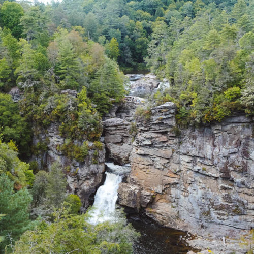
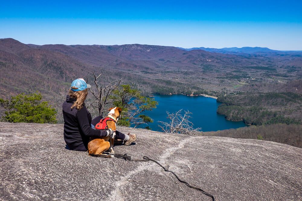
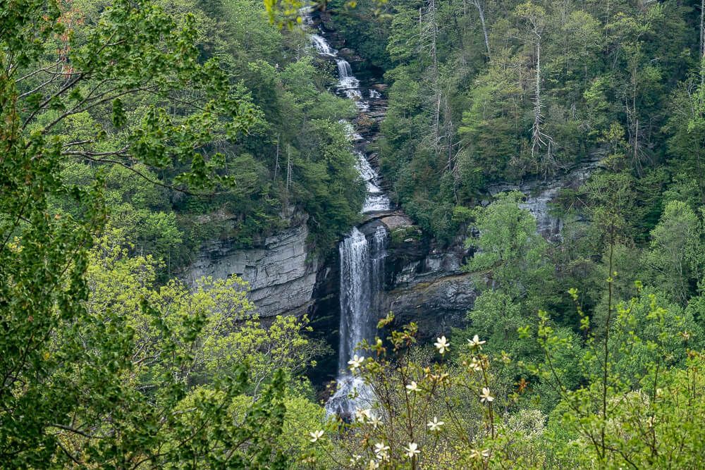
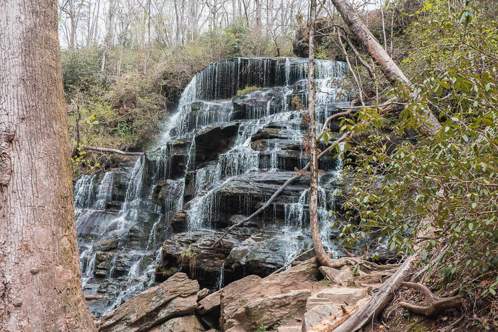
- This trail will take you to the Raven Cliff Falls Overlook (which is across a small valley from the waterfall). The trail does have a fair amount of up and down (specifically down to the viewpoint), so be prepared for that. And though the view of the 420ft Raven Cliff Falls is set far back, it’s still pretty impressive.
1 – 1.5 Hours Away From Greenville
Dupont State Forest
Travel Time: 1 hour 5 minutes
Dupont State Forest is located over the border in North Carolina and it’s an amazing location. There are dozens of trails and different kinds of hiking opportunities. Plus so many waterfalls. But this forest is very popular. Be sure to get there early.
Trails are dog friendly with a 6ft leash.
Three Waterfall Hike
- Difficulty: Moderate
- Length: ~5.5 miles (3+ hours – factor in time at the waterfalls)
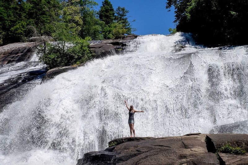
- This hike is pretty amazing. All three of these waterfalls (Hooker Falls, Triple Falls, and High Falls) are super impressive waterfalls. And if you want to cool down, you can wade in the waters beneath Hooker Falls & High Falls.
Stone Mountain
- Difficulty: Moderate
- Length: 2.8 miles (2-2.5 hours)
- Stone Mountain is the highest point in the area and has some impressive views (especially if the leaves are down). And it’s not as popular as some of the waterfall trails in the area.
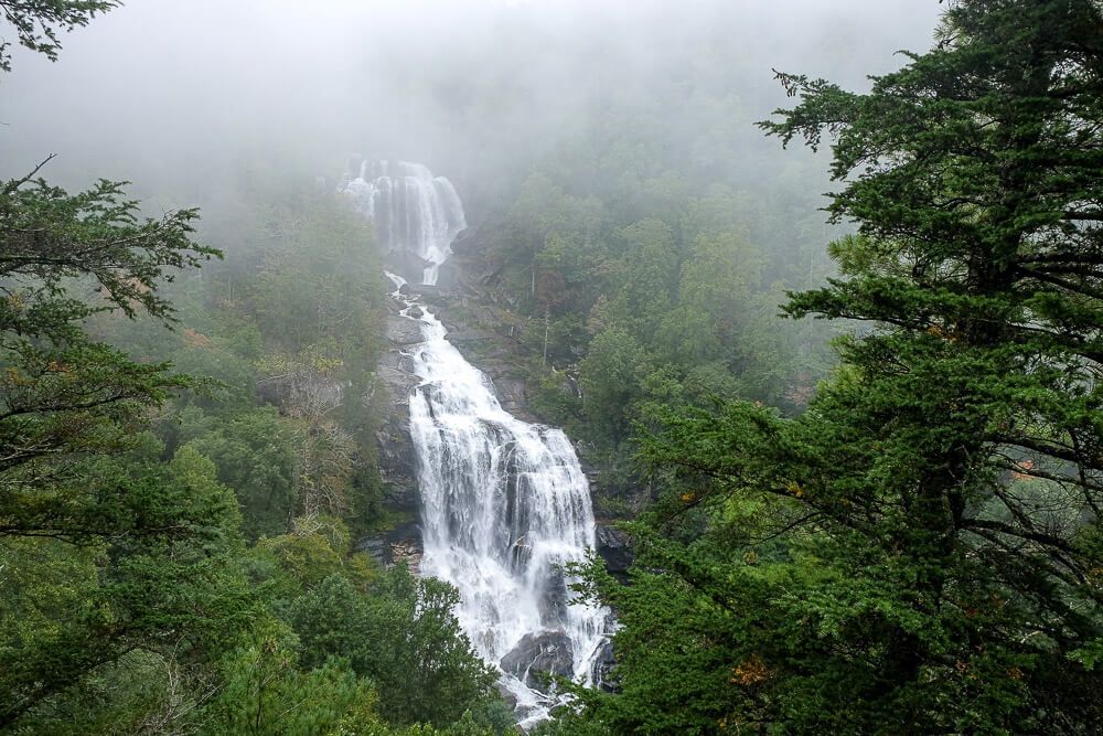
Whitewater Falls
Travel Time: 1 hour 10-15 minutes
Want to see to the tallest waterfall this side of the Rockies? Enter Whitewater Falls. Now this waterfall is split into 2 sections that are accessed very differently. The Upper section is in NC, and has a short walk to a viewing platform. The Lower section is definitely a hike, is less busy, but is no less impressive.
Trails are dog friendly with a 6ft leash.
Lower Whitewater Falls
- Difficulty: Moderate
- Length: ~4.6 miles
- Trailhead: Located on Bad Creed Rd (off of SC-130)
- The viewing platform for the lower falls is set across the valley from the waterfall. You’ll see most of it through a break in the trees. I still really enjoyed the hike and the view, but don’t expect to be close.
Upper Whitewater Falls
- Difficulty: Easy
- Length: ~0.6 miles (less than an hour
- Trailhead: Located off of NC 281
- Walk to the back of the parking lot and follow the paved trail. You can see a glimpse of it when you reach the end of the trail. But for a closer look, take the stairs to your right down to the viewing platform.
Read Next: Hiking the Whitewater Falls Trails [Upper & Lower Trail Guide]
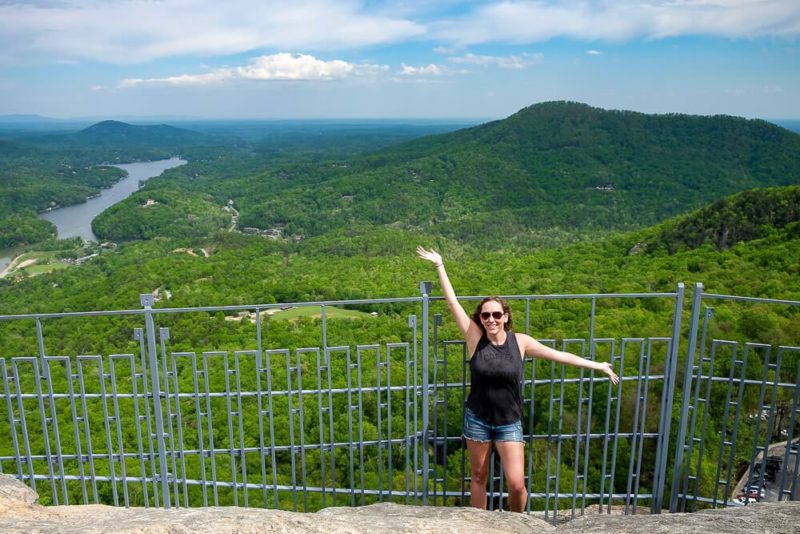
Chimney Rock State Park
Travel Time: 1 hour 15 minutes
This small but super impressive state park is known for Chimney Rock – monolith that’s become an iconic site in this part of North Carolina. As well as taking in the sites from Chimney Rock itself, there are a few hikes in this area.
Trails are dog friendly with a 6ft leash.
Exclamation Point
- Difficulty: Easy
- Length: less than a mile (30 minutes)
- This short trail starts opposite the stairs to Chimney Rock and continues up the mountainside. You’ll stop by the Opera Box, Devil’s Head, and end at Exclamation Point with sweeping views of the Hickory Nut Gorge around you. If you want more, continue along the Skyline Trail.
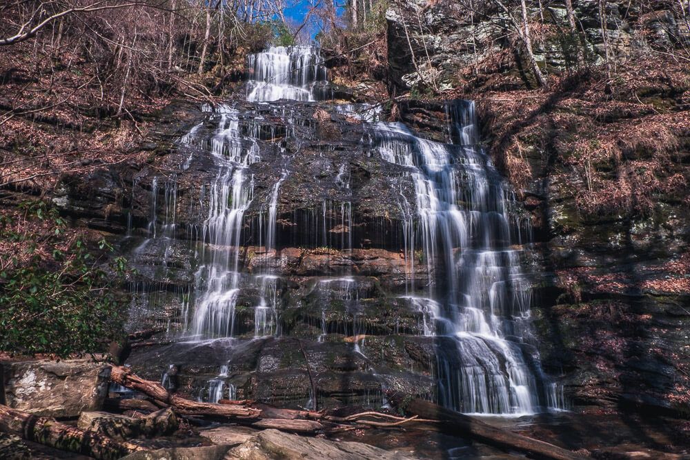
Hickory Nut Falls Trail
- Difficulty: Easy
- Length: 1.5 miles (1 hour)
- If you want an easy, mostly flat trail, then this one is for you. Plus it’ll take you to the base of Hickory Nut Falls (a 404ft tall waterfall). A viewing platform is position right at the base where you’ll almost fill the mist on your face.
Sumter National Forest – Andrew Pickens District
Travel Time: 1 hour 15 minutes
Sumter National Forest is broken into 3 districts. The Andrew Pickens District is in the north west corner of the state in Oconee County. This beautiful area has an abundance of mountains and waterfalls to explore.
Trails are dog friendly with a 6ft leash.
Station Cove Falls
- Difficulty: Easy
- Length: 1.75 miles (1 hour + factor in time at the waterfall)
- Trailhead: Small pull off .3 miles past the Oconee Station State Historic Site entrance.
- This is a mostly flat and easy trail. Just a simple out and back to a beautiful 60ft tiered waterfall. The parking area is quite small, but you can also park at the Oconee Station State Historic Site and take the nature trail over.
Station Cove Falls Trail Guide
Yellow Branch Falls
- Difficulty: Easy
- Length: 3 miles (1.5-2 hous)
- Trailhead: Off of SC 28 near Walhalla, SC
- This is easy trail will take you to a beautiful 50ft waterfall. There’s two parking areas here so be sure to head to the one in the back
Yellow Branch Falls Trail Guide
Pisgah National Forest – Pisgah Ranger District
Travel Time: 1 hour 15-30 minutes
Pisgah National Forest is a huge area in North Carolina and is actually split into three different regions. The Pisgah Ranger District is the closest district to Greenville. You’ll find some easy hikes, loads of waterfalls, and great views here.
Trails are dog friendly with a 6ft leash.
Moore Cove Falls
- Difficulty: Easy
- Length: 1.2 miles (1 hour + factor in time at the waterfall)
- Trailhead: Along 276 in Pisgah National Forest (between Looking Glass Falls & Sliding Rock)
- You can actually walk behind (or even under) this 50ft waterfall. Since it’s a fairly easy hike, many people go out in their bathing suits.
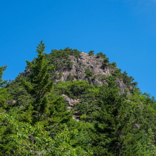
Looking Glass Rock Trail
- Difficulty: Strenuous
- Length: ~6 miles
- Trailhead: Located on National Forest 475 Rd (off of US-276)
- I would say Looking Glass Rock is one of two iconic sites for this district. And climbing to the top of it was the first thing I wanted to do when I saw it. And the views from it were outstanding. However, the slope of the granite is very steep at the top. If you are afraid of heights, I would stay away.
Read Next: Hike to the Top of Looking Glass Rock [Trail Guide]
Gorges State Park
Travel Time: 1 hour 30 minutes
Hiking to Rainbow Falls was one of the first hikes we did in North Carolina when we moved to the Upstate. (Rainbow Falls is a popular name for a waterfall – see one in Jones Gap & the Smokies.) But Rainbow Falls isn’t the only hike (or waterfall) here. Be sure to check the state park website for more trails!
Trails are dog friendly with a 6ft leash.
Rainbow Falls
- Difficulty: Moderate
- Length: 3 miles
- It’s a bit of a hike down to this waterfall (and therefore back up), but this is one large waterfall. And I’ve heard that you can continue past Rainbow Falls to see a smaller Turtleback Falls.
1.5 – 2 Hours Away From Greenville
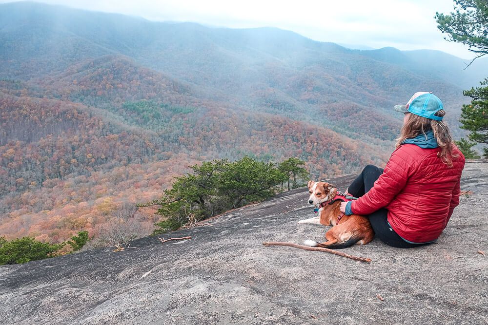
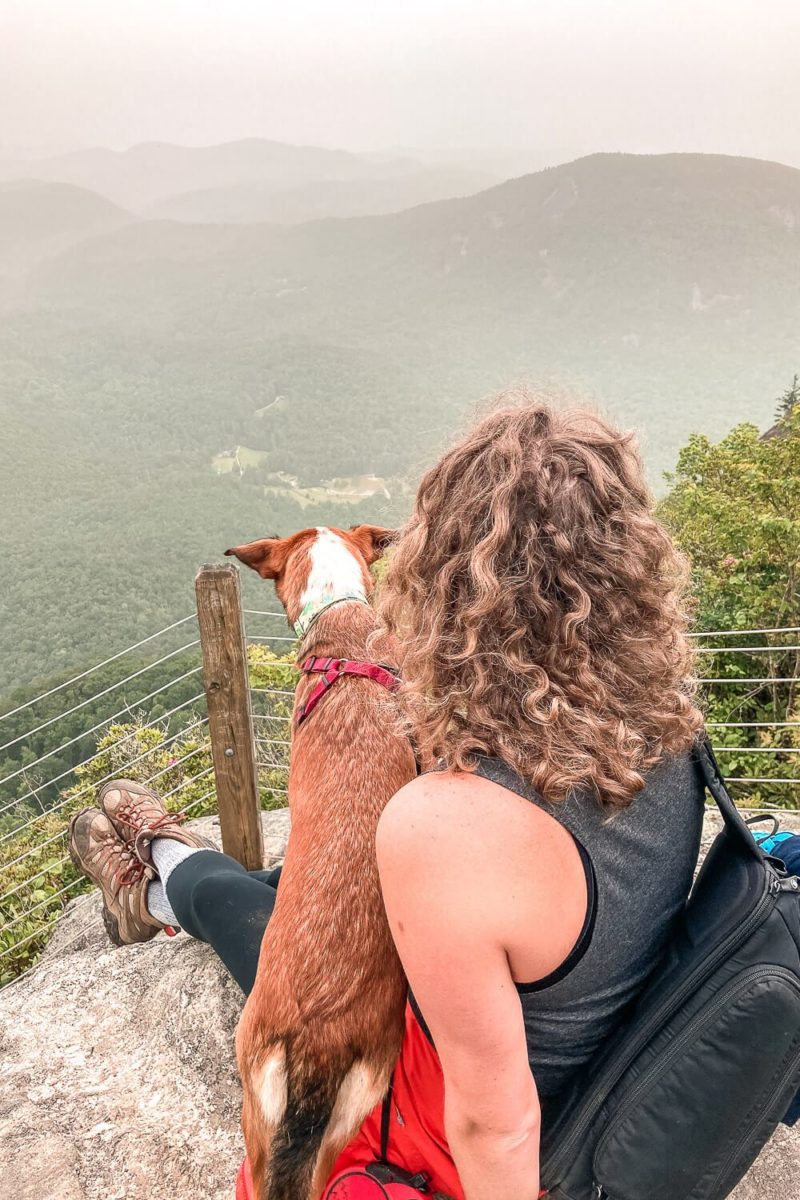
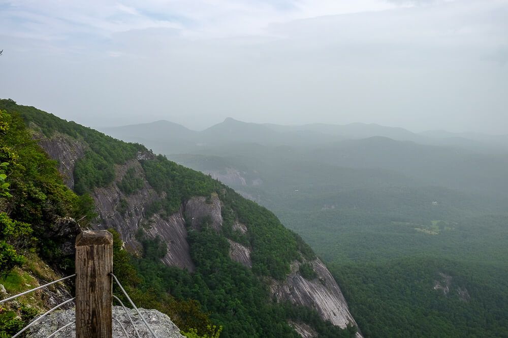
Whiteside Mountain Trail
Travel Time: 1 hour 40 minutes
- Difficulty: Moderate
- Length: ~2 miles
- Dog Friendly: Yes
- Trailhead: Outside of Highlands off of Highway 64
- This mountain (and its trail) near Highlands, NC is a loop trail that will take you up to the top of Whiteside Mountain and along the top of it for some pretty amazing views. I was really blown away by them (even on a cloudy day). Be sure to walk the whole loop to get the full experience.
Read Next: Your Dog Friendly Weekend Guide to Highlands NC
Blue Ridge Parkway
Travel Time: 1 hour 45-55 minutes
The Blue Ridge Parkway is pretty amazing. I’ve driven the entire Parkway with my dog (camping along the way). But here I’m trying to highlight my favorite trails that you can reach within 2 hours of Greenville.
Trails are dog friendly with a 6ft leash.
Devil’s Courthouse
- Difficulty: Easy
- Length: a little less than a mile (30min – 1 hour)
- Trailhead: Park at the Devil’s Courthouse Overlook (MM 422ish)
- This trail is super short, but will give you some of the best views in the area. However it is a tough climb up to the viewing platform, so be prepared.
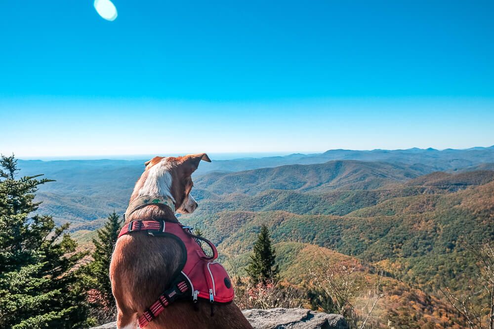
Black Balsam Knob
- Difficulty: Easy
- Length: 1.5 miles (1ish hour)
- Trailhead: Located on Black Balsam Road (off of the Blue Ridge Parkway)
- This is an easy out and back trail that will take you into the Shining Rock Wilderness and to the top of the Black Balsam Knob for some amazing views of the surrounding region.
Read Next: Black Balsam Knob Hike [Trail Guide]
Glen Falls Trail
Travel Time: 1 hour 55 minutes
- Difficulty: Moderate
- Length: ~2 miles
- Dog friendly: Yes
- Trailhead: Along Glenn Falls Road outside of Highlands, NC
- This trail, like the Whiteside one above, is also outside of Highlands, NC. The trail switchbacks down the mountain, looping back towards the creek several times. And there are some pretty good views of the cascades on the way down. But know that it’s all downhill, and then all uphill.