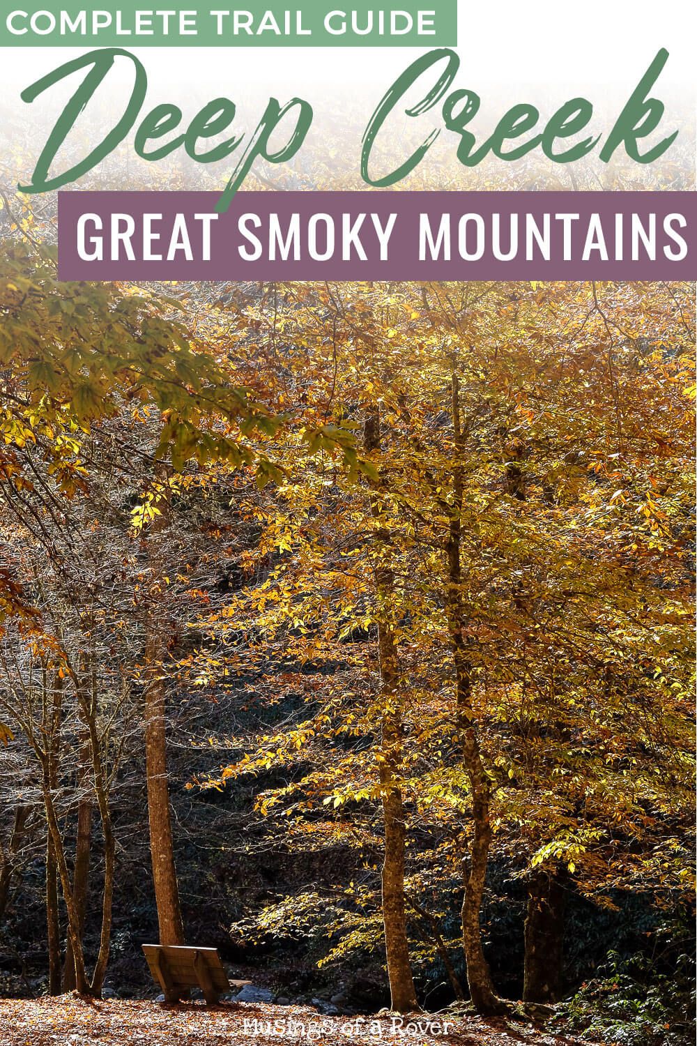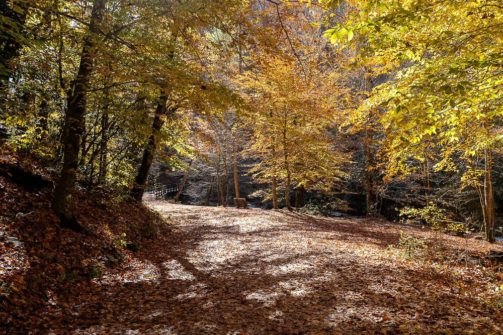
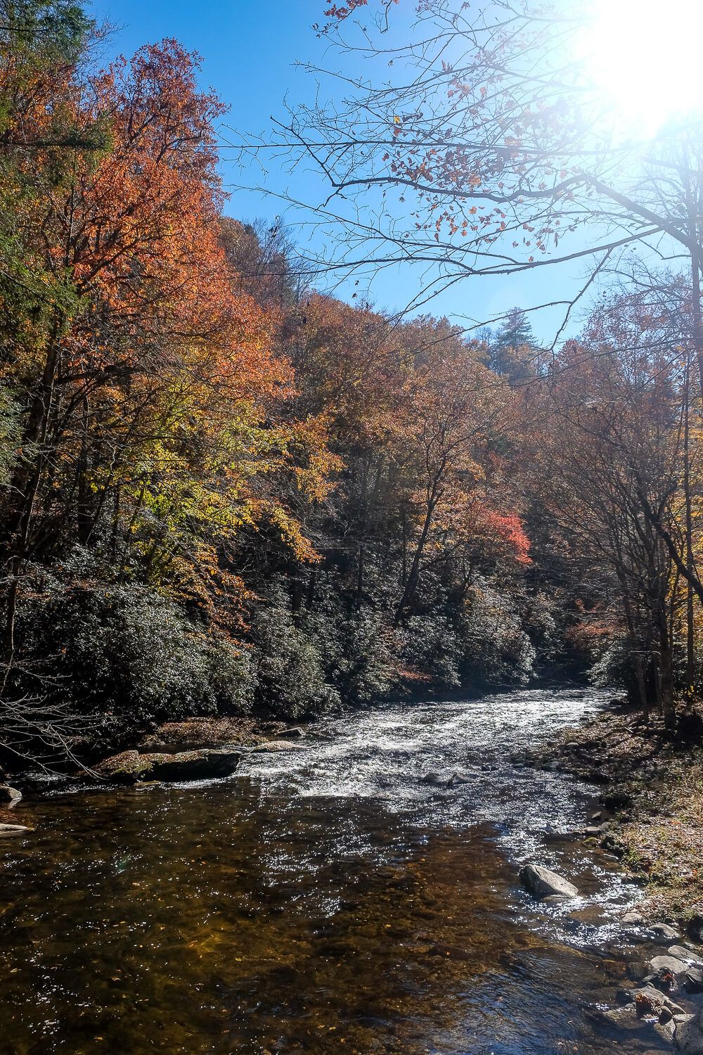
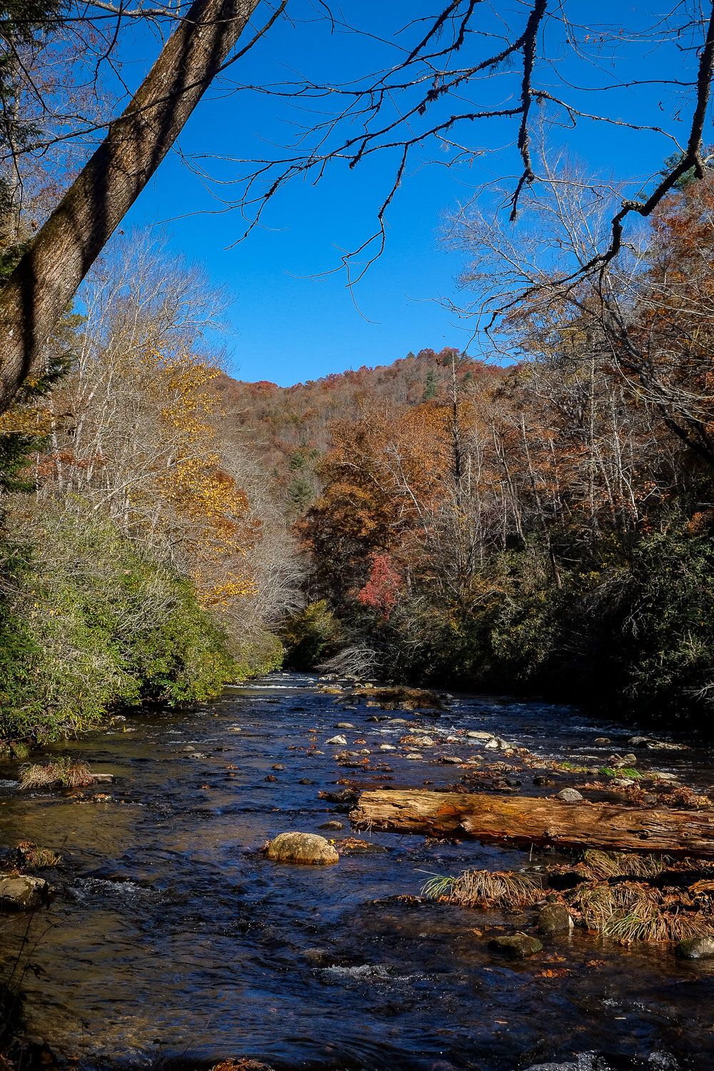
The Deep Creek Trail is a beautiful and relatively easy hike in the Smoky Mountains. Located just outside Bryson City, North Carolina, this loop hike is spectacular all year. It does have 3 waterfalls. But I found it to be showstopper in the fall when the trees are out in force.
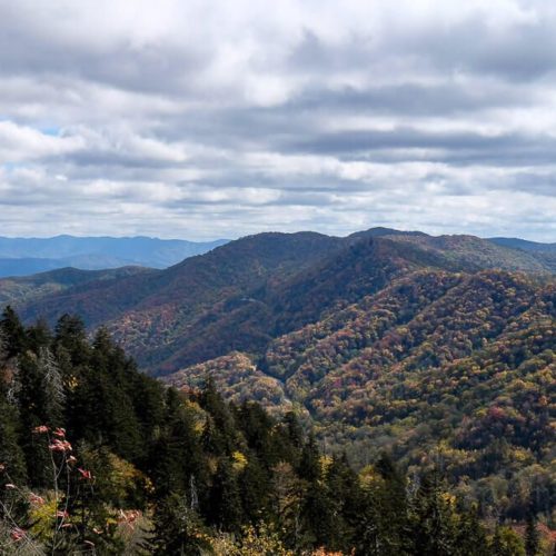
Now autumn is considered one of the busiest times of the year for the Smokies. In fact I’ve read that the high season for the park is June, July, August, and October. And if you’ve been lucky enough to visit during the fall, it’s obvious as to why. The mountains are painted in color.
But due to the elevation of the park, autumn starts early. If you want to see fall color from the Newfoundland Gap, you’ll definitely want to visit in October. Any later and the trees will have dropped a lot of their leaves.
Living in South Carolina, only 2 hours or so from the Smokies, this sometimes catches me off guard since our autumn only really starts at the end of October or sometimes even November.
If you’re like me and are craving some fall beauty, but it’s the start of November, then you’re in luck! The lower elevations of the the National Park may still have their leaves. And that includes the Deep Creek area of the Smoky Mountains. The photos here are from November 10th, and it was one of the most beautiful fall days I’ve seen in awhile.
Depending on how much time you have or just how much hiking you want to do, you have some options. If you’d just like to take a short walk, see some fall color, you can make your way to the Tom Branch and Indian Creek falls and then turn around.
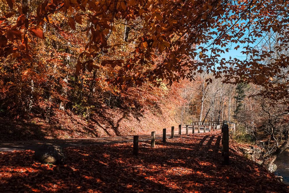
But if you’re up for it, I definitely suggest hiking the full loop. It’ll take you away from the busier sections of the trail (traffic falls off after Indian Creek Falls). But this loop isn’t flat.
The Smokies are, you know, mountains so most hikes in them aren’t exactly level. And though this loop hike does have some tough uphill segments, it’s relatively easier than a lot of others. So if this looks doable to you, I’d recommend giving it a shot.
If you’d like to make the Deep Creek Trail your own, check out the map at the bottom of this post for all the options here!
Distance: ~5 miles roundtrip
Difficulty: Moderate
Dog Friendly: Yes
Trailhead: The Deep Creek Trailhead is located just north of Bryson City near the Deep Creek Campground.
Fee: There is no fee.
Elevation Change: ~575ft
Time: 3 hours
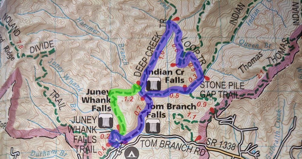
Deep Creek Trail Loop
The Deep Creek Trailhead is located just north of Bryson City near the Deep Creek Campground. There is parking right by the trailhead, but if it’s full (like it was for us), you can park in the picnic areas of the campground and walk to the trailhead.
Now this is a loop hike, so even though this guide follows these trails in a counter clockwise direction, you can hike it either way.
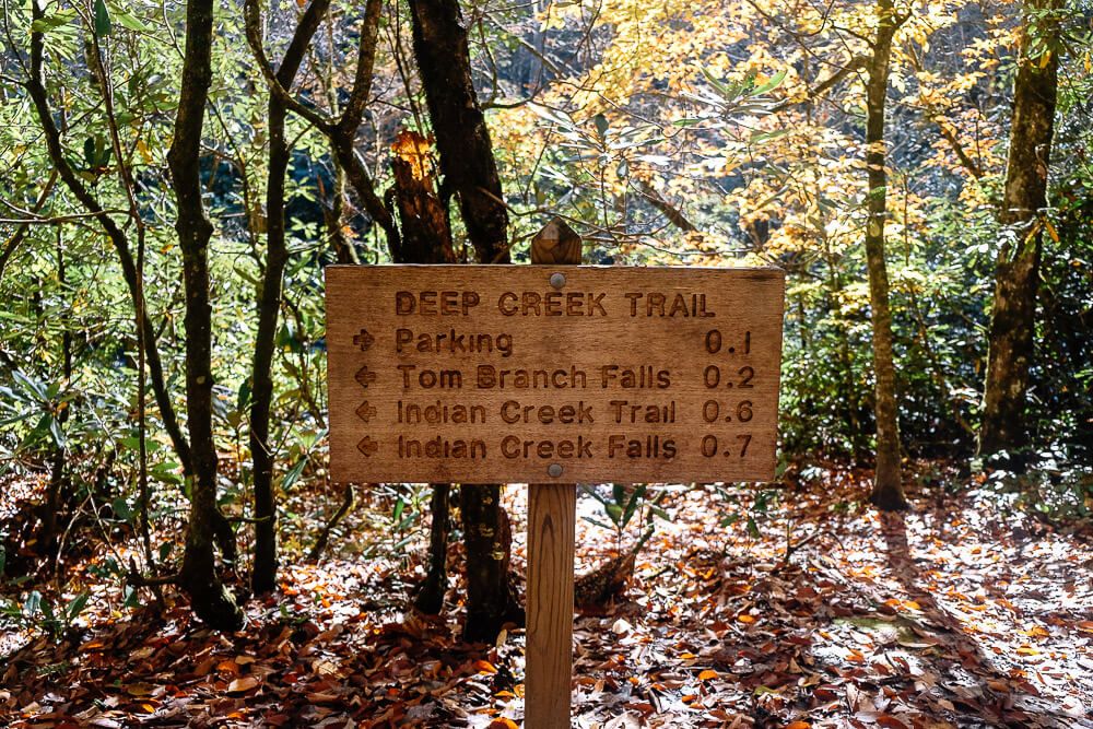
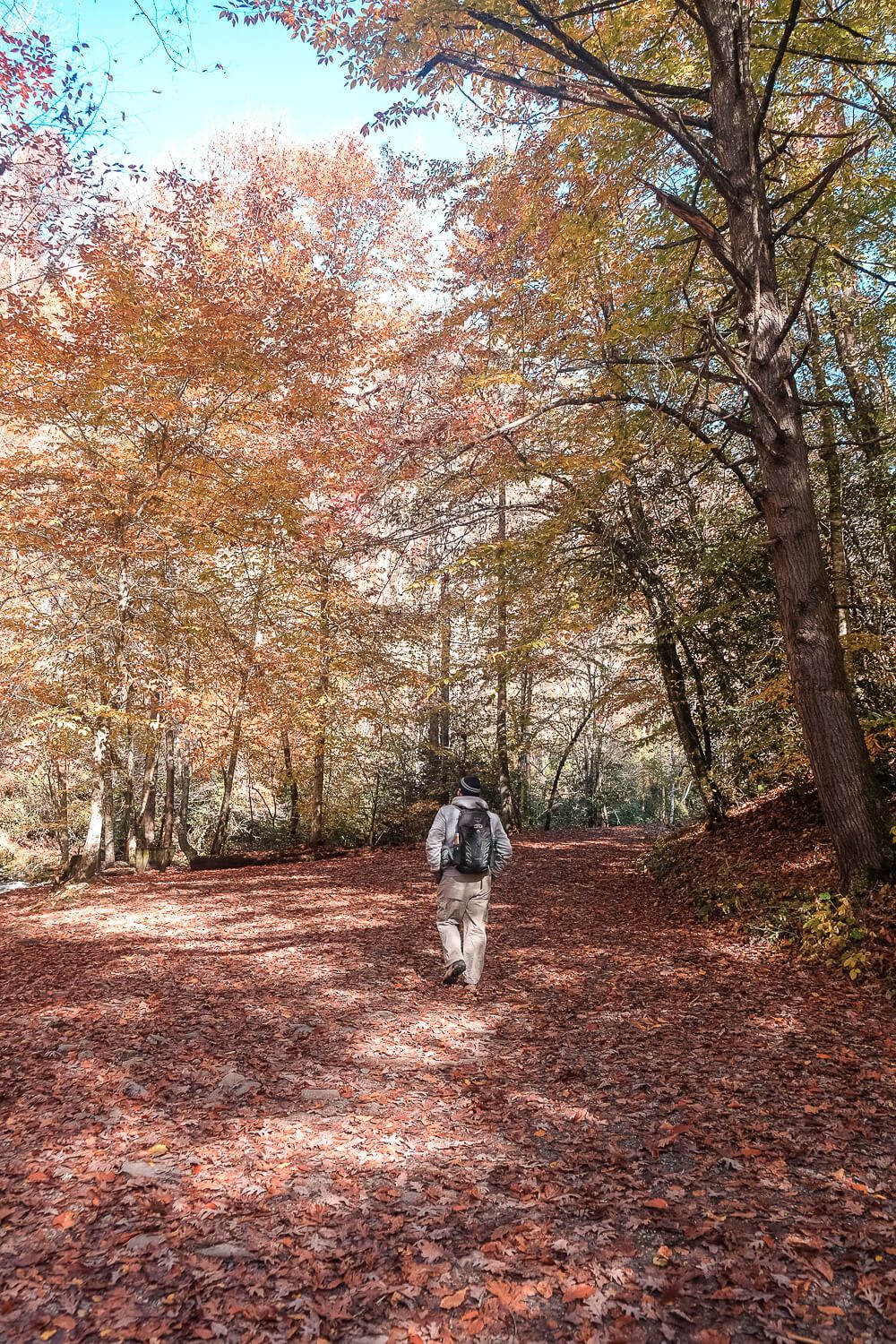
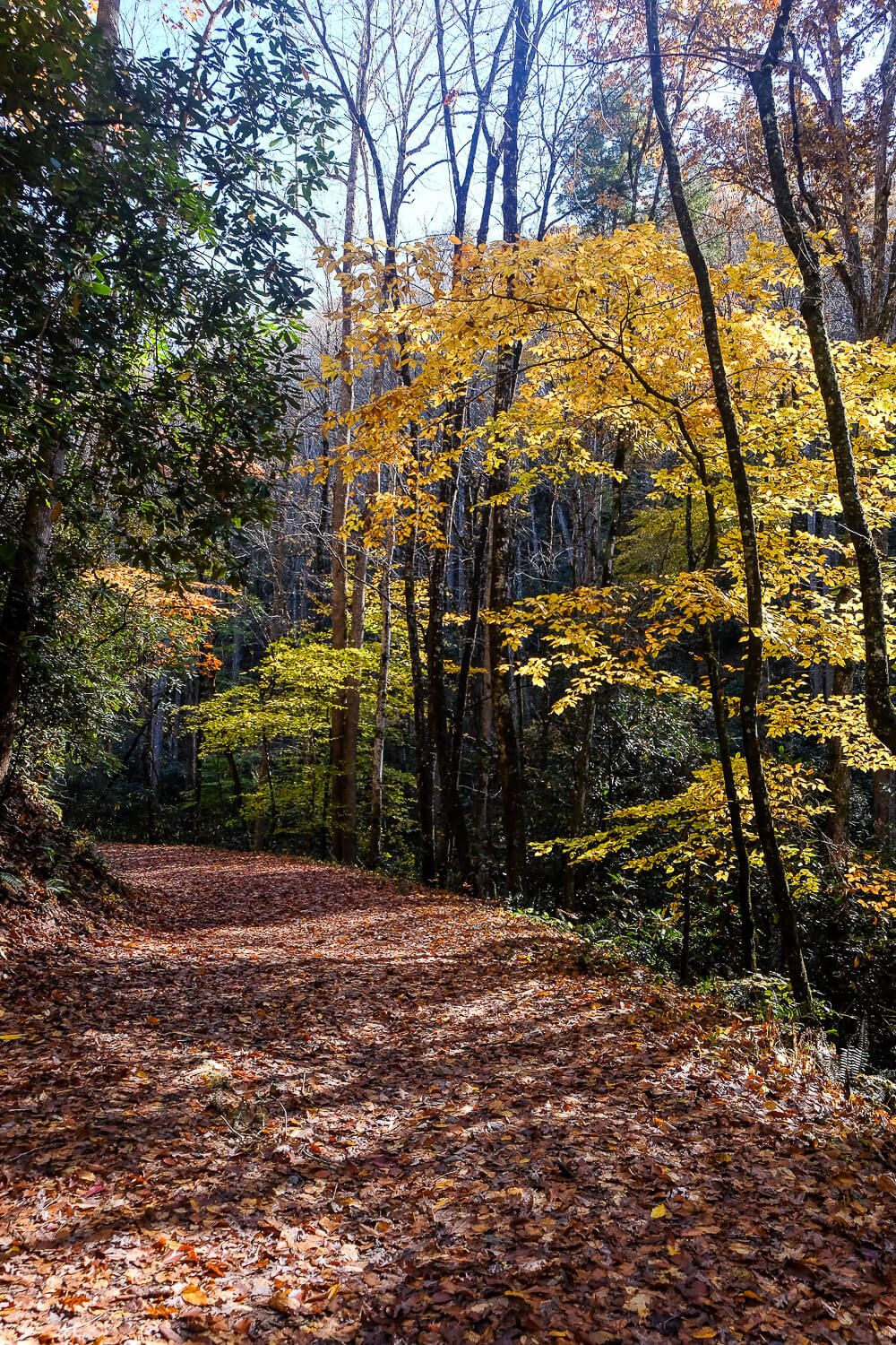
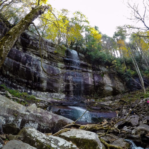
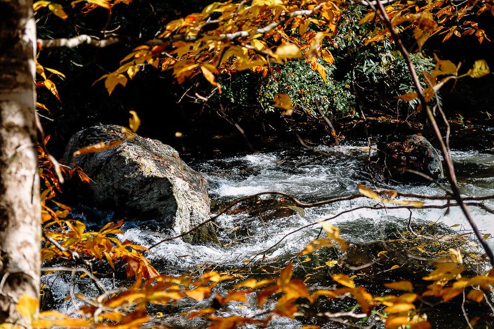
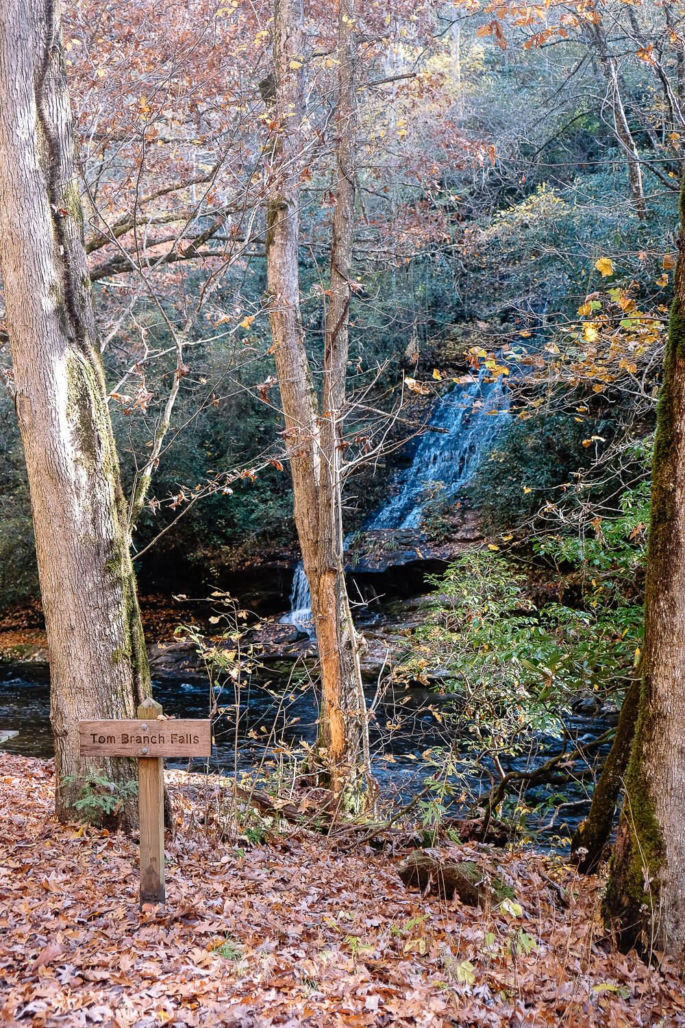
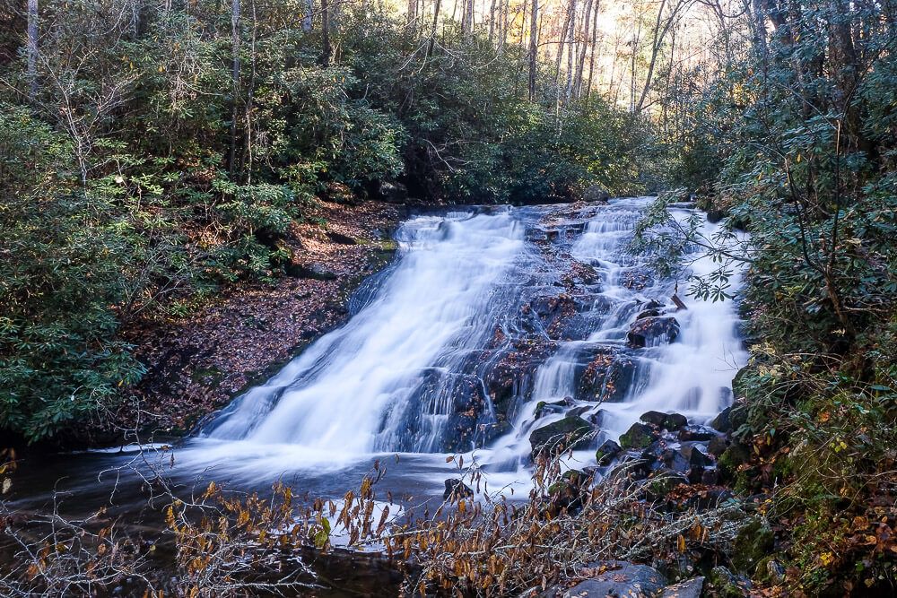
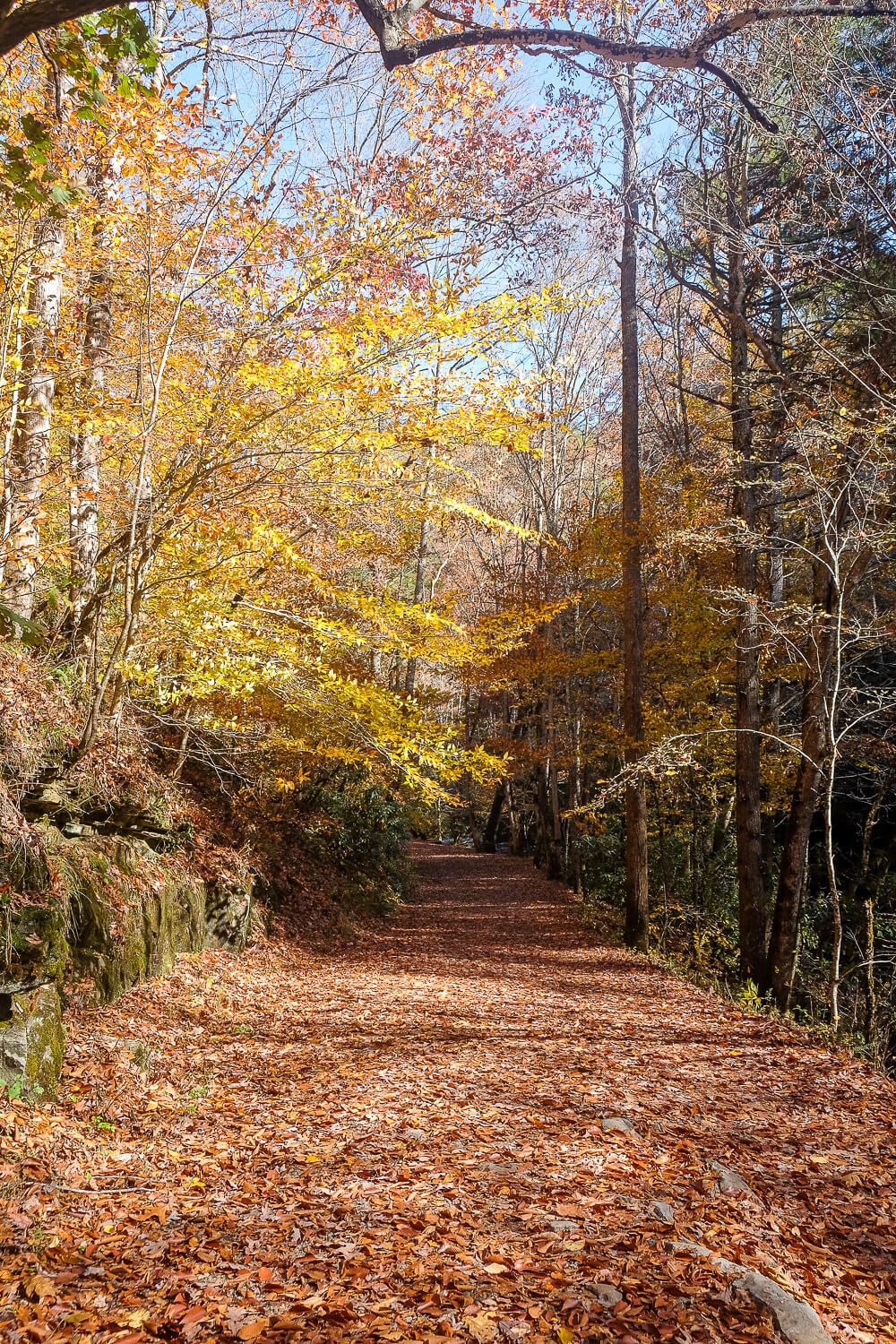
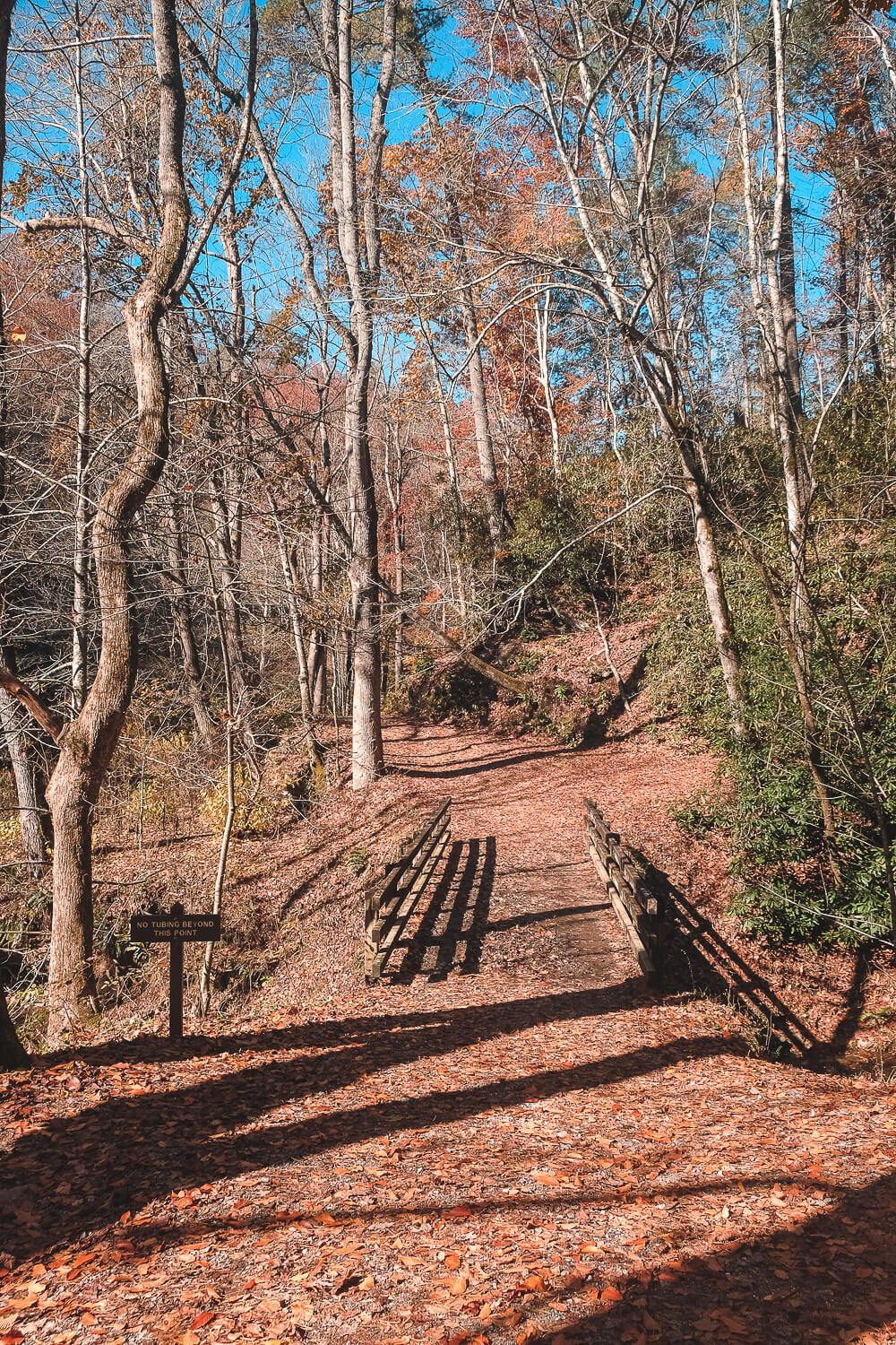
To start the hike, head north on the Deep Creek Trail. This part of the trail is relatively flat and wide, and after only about a quarter of a mile, you’ll reach your first waterfall – Tom Branch Falls.
Tom Branch Falls is a smaller waterfall (though it is about 80 feet tall) and depending on the time of year and rainfall, it may be a bit quiet.
The park has sat up several benches across from the falls that you can use to sit back and enjoy the waterfall. If you have people in your group who aren’t up for hiking, letting them hang out here may be a good option.

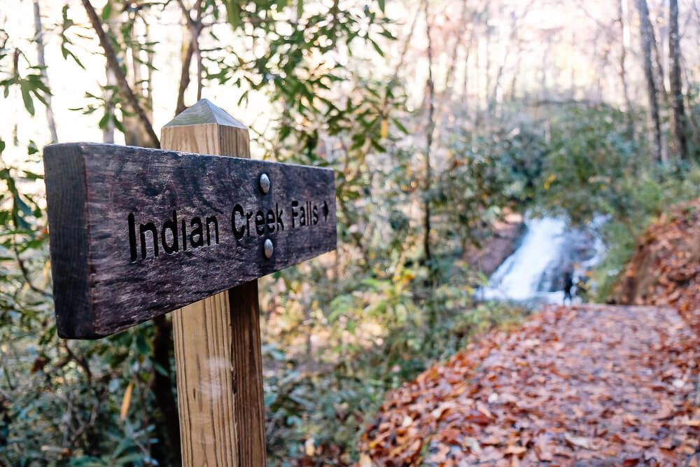
Leaving Tom Branch Falls behind, you’ll soon reach the intersection with the Indian Creek Falls Trail. Head right on this trail and in just a tenth of a mile, you’ll reach the Indian Creek Falls.
I found this waterfall to be much more impressive even though it is quite shorter (~45ft). Make sure to head down the spur trail towards the base of the waterfall to see it in all of its glory.
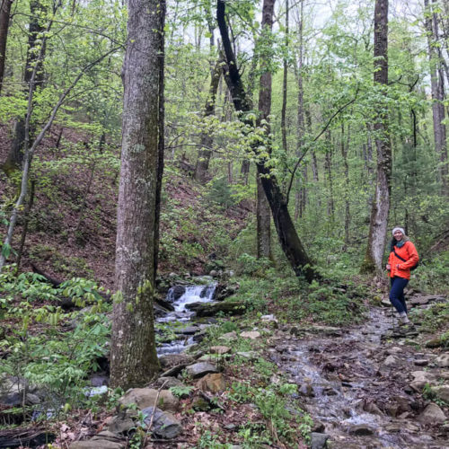
After you’ve had your fill, continue on the Indian Creek Trail. The trail will start to lean upwards, but the grade won’t be so bad. You’ll pass by the Stone Pile Gap Trail to your right, but continue on the Indian Creek Trail.
About .7 miles from the waterfall, you’ll reach the intersection with the Loop Trail. Take a left here. Now begins the hard part of this hike. The next half mile is basically all uphill towards the Sunkota Ridge. You’ll climb about 350 feet which is tough. Tougher than I thought. But it’s definitely doable.
We passed only one other person on this part of the trail. And I graciously stepped off to the side so that they could get by and so that I could take a mini break. (All while trying to hide my labored breathing.)
However it’s only a half mile hike up. And I don’t have many photos of this because, well, I wasn’t in great shape and I needed to focus on hiking.
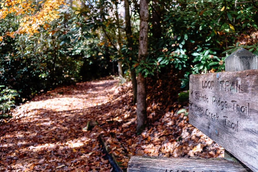
At the top of the ridge, the Sunkota Ridge Trail will head to you right, but you’ll want to continue straight on the Loop Trail.
After about .6 miles, you’ll reach the Deep Creek Trail. Make a left to head back towards the parking lot.
Around 1 mile from the turn onto the Deep Creek Trail (and just a tenth of a mile from the Indian Creek junction), a horse trail will appear on your right. This 1.2 mile trail will take you to the last waterfall, Juney Whank Falls.
You don’t need to hike this horse trail to reach the Juney Whank Falls, but it is an option. And to be honest, we didn’t hike it. But if you’re looking to make this more of a proper loop hike, I’d recommend giving it a shot.
To reach Juney Whank Falls, we instead headed back towards the start of the Deep Creek Trailhead. Right before the parking lot, you’ll see the trail sign for Juney Whank Falls. It’s only about .3 miles to the falls. But be warned, this is a very steep .3 miles.
The Horse Trail I mentioned above comes in almost right at the falls. So maybe taking that trail would help you cut off the steep climb up…but I’m not positive since we didn’t hike it. However I did want to point that out.
Juney Whank Falls is an ~80ft waterfall and you can take a bridge across it’s center or go up and over the top as well. Due to its proximity to the parking lot, it was much more crowded here and because of that I don’t have a great picture of it.
After crossing the bridge, we headed back down the other side of the Juney Whank Falls Trail towards the parking lot. The Juney Whank Falls does have its own trailhead in the same parking lot as the Deep Creek Trailhead (just on the west side of the lot). So you can just pop up to see the Juney Whank before or after hiking the Deep Creek loop.
Deep Creek Loop Trail Map
Below is a map of the falls and their intersections. Due to the size of the map and the close proximity of all the trail intersections, it can be a bit hard to see. Romantic Asheville has another map that I like.
We hiked the blue route and started on the Deep Creek Trail. We then did the loop you see below in a counter clockwise direction. We then came back down towards the lot and did the small Juney Whank Falls Trail loop at the end.
The horse trail I mentioned above is in green. It does make the entire hike a bit longer, but including it in would make this more of a proper look hike. I’d love to give it a shot next time.
Some of my favorite hiking gear:


My Great Smoky Mountains gear:


Planning your trip to the Great Smoky Mountains?
Great hiking trails:
(listed in order of difficulty)
- Laurel Falls Trail
- Abrams Falls Trail
- Deep Creek Loop Trail
- Andrews Bald Hike
- Rainbow Falls Trail
- Rich Mountain Loop Trail
Other things to do in the National Park:
- Visit Cades Cove
- Drive the Newfound Gap Road
- Go to the top of Clingman’s Dome
- Drive the Roaring Fork Motor Trail
Where to stay:
The national park is HUGE, so there are numerous entry and exit points. My suggestion would be to base yourself in a town near the area of the park you want to explore. Then you can usually found a hotel, a campsite (either with the park or not), or a house/cabin rental. For rentals I use Airbnb or VRBO.
Here are some of my suggestions and places I’ve stayed: