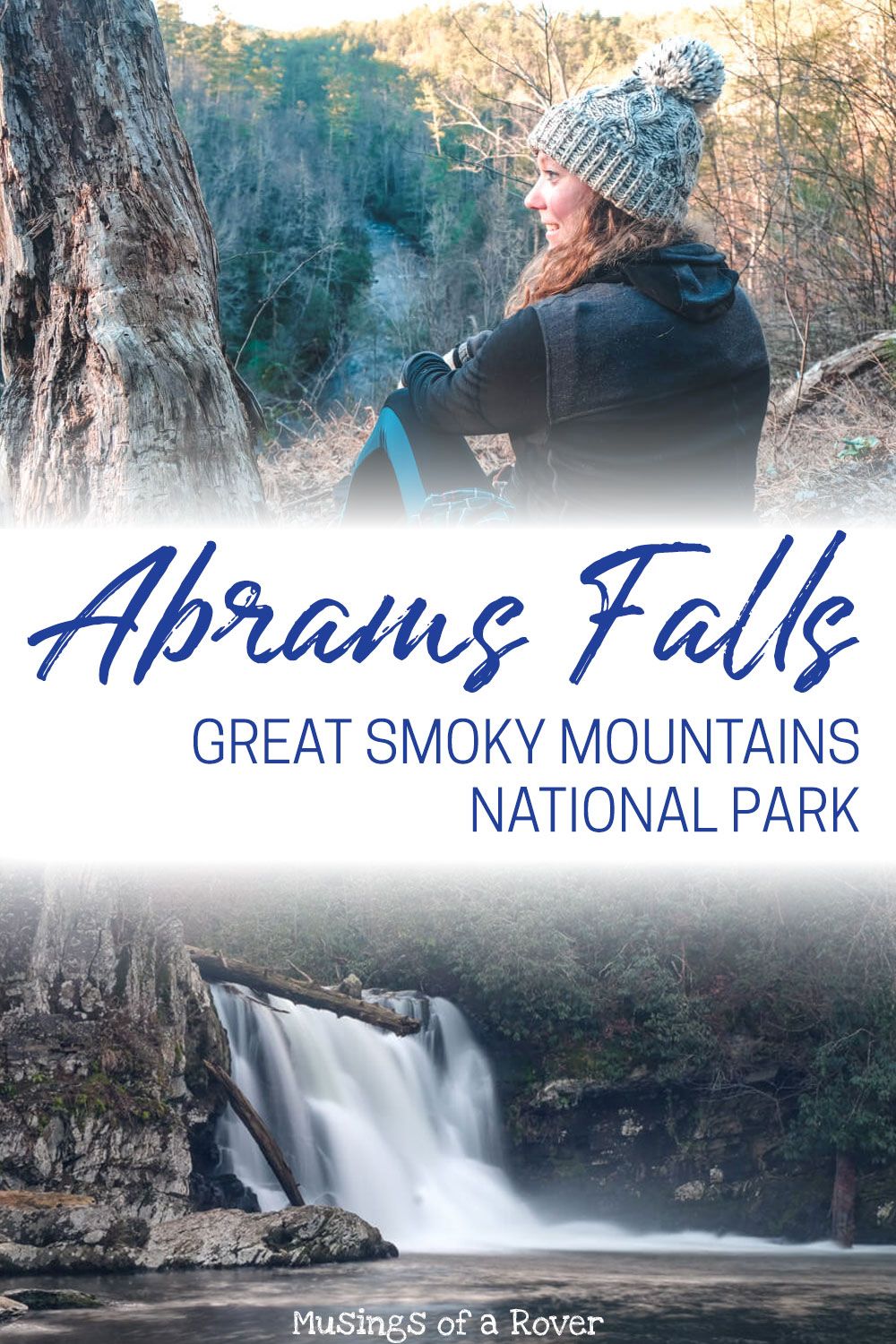
Are you driving the Cades Cove Loop Road and want to tackle one of the most popular hikes in the Smokies? The Abrams Falls Trail is a moderately easy 5 mile round trip hike to one of the most impressive waterfalls in the Great Smoky Mountains National Park. Definitely consider adding this to your trip to Cades Cove!
The Abrams Falls hike is already one of my favorites in the Smokies. It’s long enough that I get a good workout in without it being so steep that I’m dying by the time I reach the waterfall. And Abrams Falls is one beautiful waterfall.
Plus it’s located midway along the Cades Cove Loop so that it’s in a perfect place if you’re ready to stop and stretch your legs.
Read Next: My full guide to driving the Cades Cove Loop!
The Abrams Falls Trail
This hike is located along the Cades Cove Loop and is best done if you’re already staying out there (or relatively near it). Not sure what the Cades Cove Loop is? Find out in my full guide!
You can find the road to the trailhead about halfway along the loop in between stops 10 & 11. But don’t worry about missing it because there’s a sign pointing down the gravel road to your right. The main parking lot is quite large but gets full during the high season.
(Also the bathroom, which I’m guessing is more like a pit toilet situation, may be locked and closed in the off season like it was for me.)
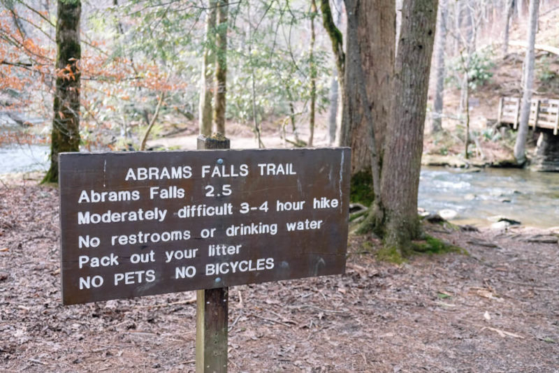
The Abrams Falls trail itself starts at the back of the lot and there are plenty of signs so you can’t miss it. Please also read the important warnings here as people have died at Abrams Falls before. I’ll explain more about this danger below.
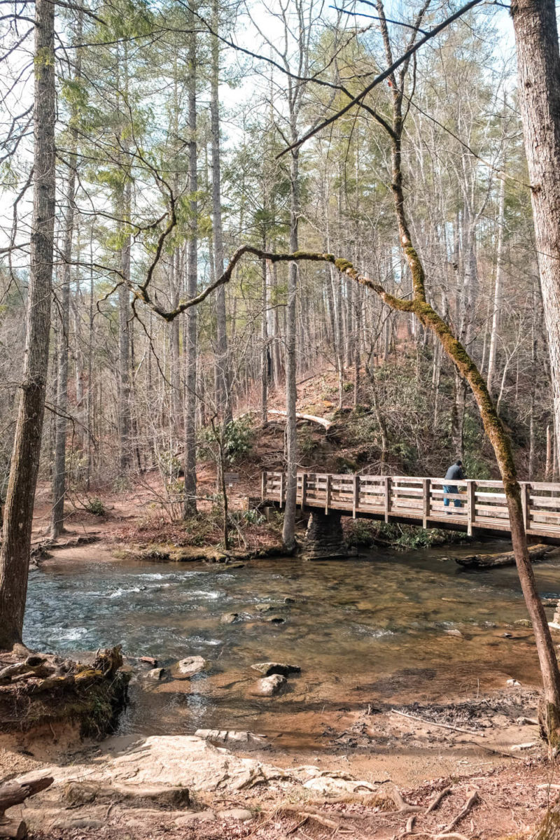
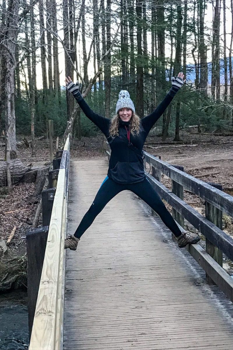
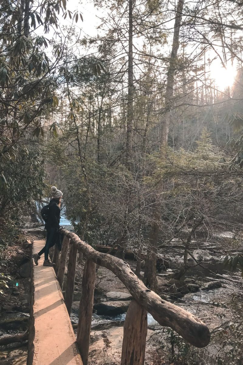
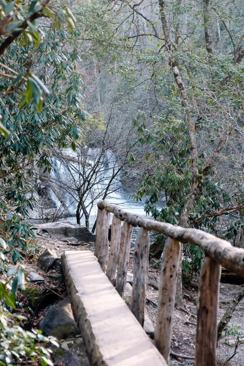
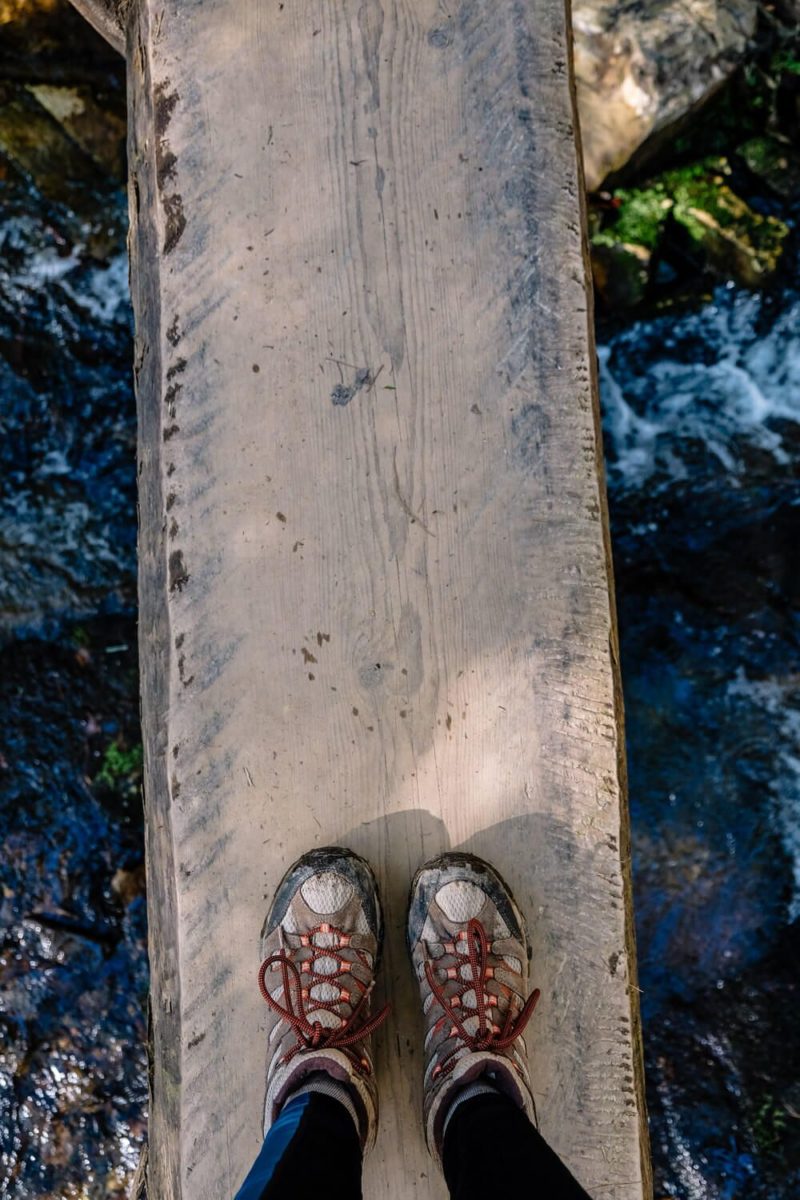
You’ll then cross one hell of a photogenic foot bridge (in my opinion at least) and make a left to start on the trail.
(If you go right you can hike to stop #10 on the Cades Cove loop if you haven’t seen the Elijah Oliver Place. It’s a ½ mile hike.)
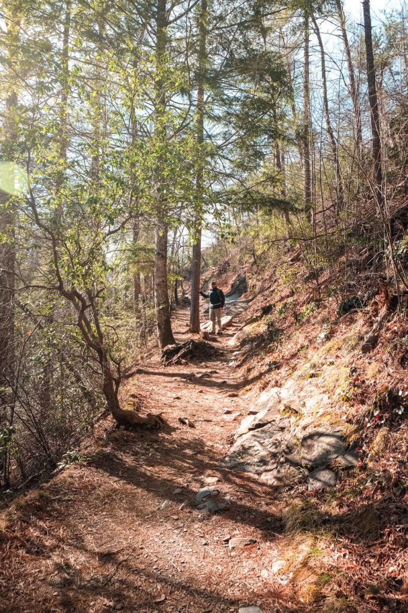
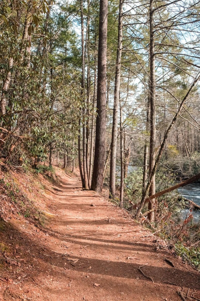
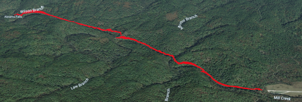
Now the trail itself mostly follows Abrams Creek, which is why it’s relatively flat. (Relative for the Smoky Mountains that is.)
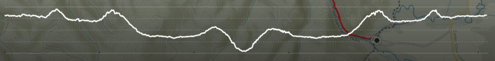
However it does cross a few ridges on its way to the falls. Three in fact. One at the ½ mile mark, one at the mile mark, and then one right before the falls.
The second rise was my favorite. It goes up and over Arbutus Ridge and the trail almost seems to cut through it. If you continue down the trail, when the leaves are down you can get an amazing view of the creek below.
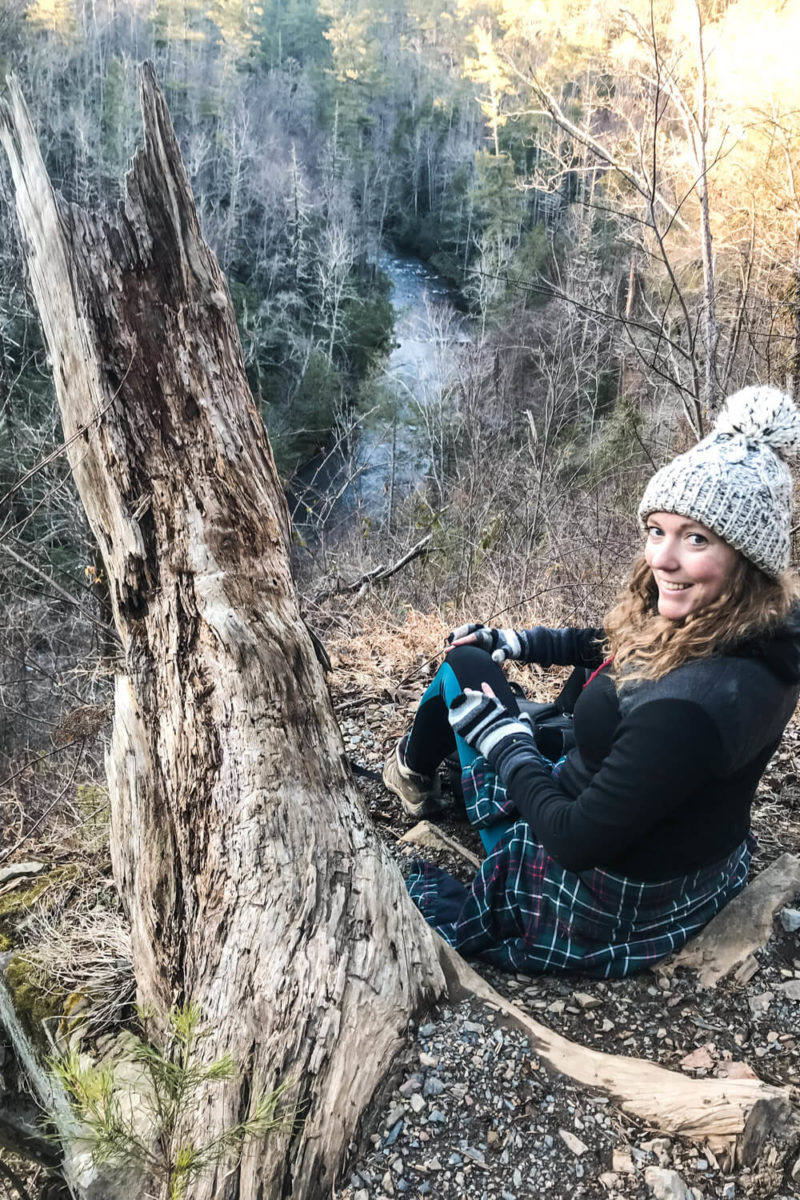
It was hard to capture in a photo but the creek balloons into a wide circle just west of the ridge and if you look north or south from the ridge (again when the leaves are down) you can see the creek curve like a horseshoe to start this circle.
I thought this was neat at least.
From Arbutus Ridge it’s mostly downhill to the falls. There’s one small rise and then a steep descent down to the creek. This descent (or really ascent on the way back) was the toughest part of the hike for me.
Though be on the lookout for wildflowers in the spring along the trail between Arbutus Ridge and the falls. We didn’t see any (in February) but if you’re here between March and June you may just get lucky!
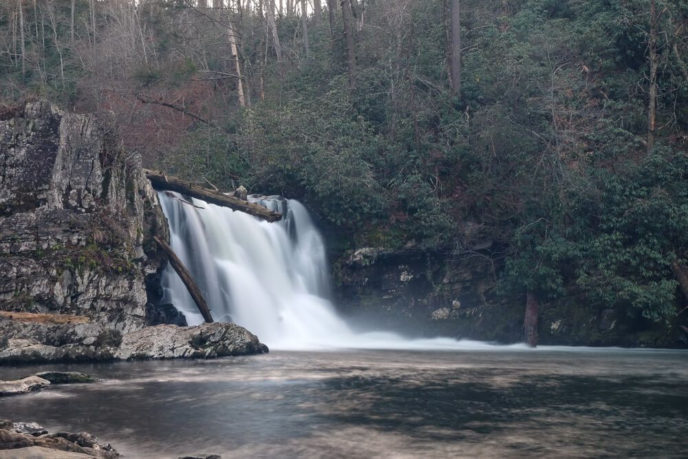
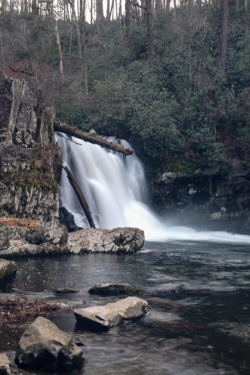
At around 2.5 miles you’ll reach the falls. There’s a sign pointing off to your left to the falls as the main trail continues another 1.7 miles or so.
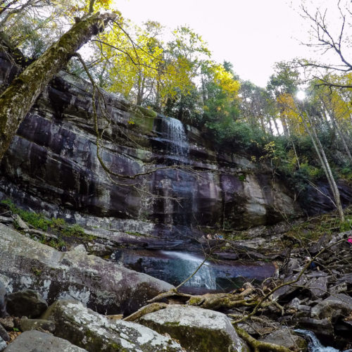
Now the falls themselves were super impressive I think! It’s 20-ish feet tall and there’s a ton of water coming over that ledge. And then it pours into a very scenic, wide pool.
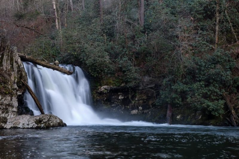
But don’t go for a swim!
Many people have died at Abrams Falls due to swimming in that pool. There are some super strong currents here and an undertow. So take all the photos you want outside of the water, but please don’t swim beneath the falls!
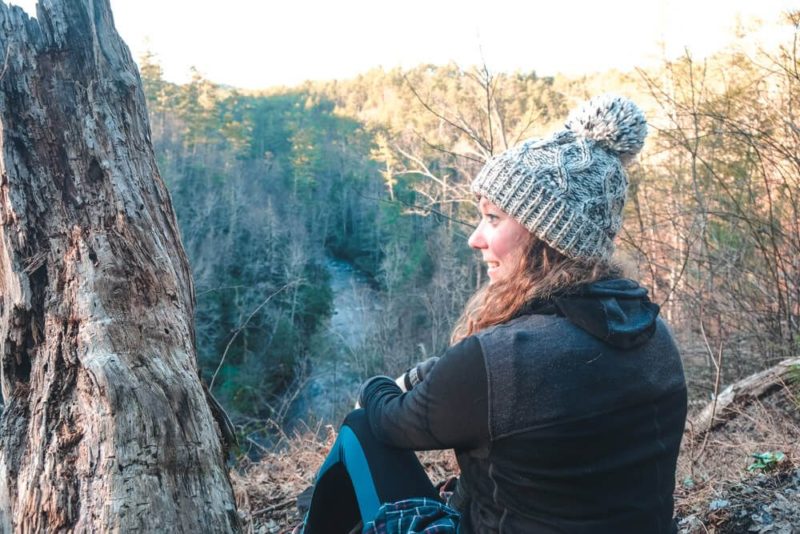
I enjoyed our time hanging around the falls. Since we hiked there on a Saturday afternoon in the month of February, we only shared our time at the falls with a couple other groups. (I think one family and one couple.)
After maybe 30 minutes to an hour of taking photos and relaxing, it was time to head back. If you spend less time at the falls and are a fast hiker, you could do this trail closer to the 2 hour mark (or even less).
Our total time for the hike was about 3 hours (moving time was closer to 2h 15m).
Beating the crowds
The Abrams Falls trail is one of the most popular trails in the park. And the Cades Cove Loop is one of the most popular things to do in the park. So I don’t think you’ll have this trail to yourself at any time. But there are a few things you could do to help.
First I’d recommend avoiding the high season months if you can or hiking this on a weekday. We went in February on a Saturday and saw a few people but not that many.


If you are going during the weekend in the high season, start your hike as early as you can. Gridlock is a real thing along the Cades Cove Loop. So if your goal is to hike this, I’d start here.
Plus starting early will help you beat the crowds who come to see the falls as well.
The Cades Cove loop though is closed to motorized vehicles every Saturday and Wednesday from early May to late September until 10am. So make sure you’re not driving here early on one of those days!
Where to park
The parking lot for the Abrams Falls trailhead is located about halfway along the Cades Cove Loop road. The sign and unpaved road pointing to the trailhead are located between stop #10 and stop #11.
Where to stay
If you want to camp, there is no Abrams Falls campground. Don’t be fooled by the Abrams Creek campground. It’s not located on this side of the creek. So your best is to stay at the Cades Cove campground or to stay in either Townsend or Gatlinburg for the quickest access.
Though the drive out to Cades Cove from Gatlinburg can take an hour so keep that in mind! This time is cut in half if staying in Townsend.
Read Next: Rainbow Falls is another great hike if you’re based in Gatlinburg!
What to pack for the hike
You’ll want to bring a water bottle and some good snacks to eat when you’re relaxing at the falls. 5 miles roundtrip isn’t an easy hike, so I always like to refuel with some energy bars.
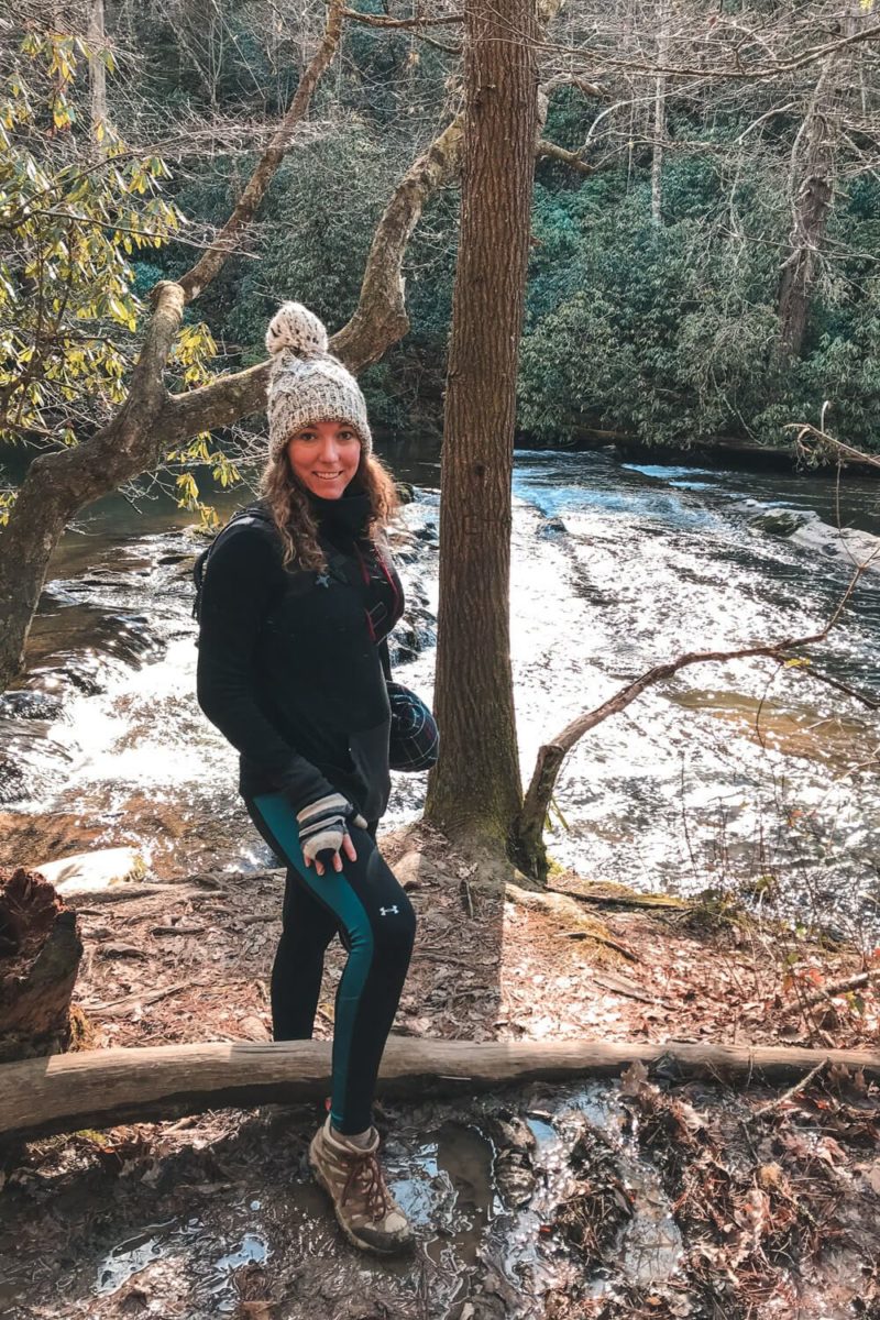
Hiking shoes (or athletic shoes) are recommended. The ascents along the trail are fairly gentle, but the path has some rocks and roots crossing it. And you’ll cross over three simple log bridges that may be slippery in wet conditions.
Also there’s no service on the trail (or in the Cades Cove Loop for me) so you may want a map. This is the map I use.
Lastly the trail runs close to the creek so maybe bring some bug spray and sunscreen.
Some of my favorite hiking gear:


My Great Smoky Mountains gear:


Abrams Falls map
Below is an Abrams Falls trail map and an elevation profile that I recorded as well!
If you’re looking for a cades cove map, check out my full cades cove guide.

Planning your trip to the Great Smoky Mountains?
Great hiking trails:
(listed in order of difficulty)
- Laurel Falls Trail
- Abrams Falls Trail
- Deep Creek Loop Trail
- Andrews Bald Hike
- Rainbow Falls Trail
- Rich Mountain Loop Trail
Other things to do in the National Park:
- Visit Cades Cove
- Drive the Newfound Gap Road
- Go to the top of Clingman’s Dome
- Drive the Roaring Fork Motor Trail
Where to stay:
The national park is HUGE, so there are numerous entry and exit points. My suggestion would be to base yourself in a town near the area of the park you want to explore. Then you can usually found a hotel, a campsite (either with the park or not), or a house/cabin rental. For rentals I use Airbnb or VRBO.
Here are some of my suggestions and places I’ve stayed: