I am constantly amazed by what is just an easy day trip away. Even after years of living in Greenville, each year as I get out and discover new places and trails, I’m still surprised. My trip to Highlands was definitely a wonderful discovery. And during our weekend away there, the hike along the top of Whiteside Mountain was a highlight.
Whiteside Mountain is a large mountain along the Eastern Continental Divide in the Nantahala National Forest between Cashiers and Highlands, North Carolina. If you’re driving US 64 between these two towns, keep an eye out and you’ll get a glimpse of it as you head up the mountain.
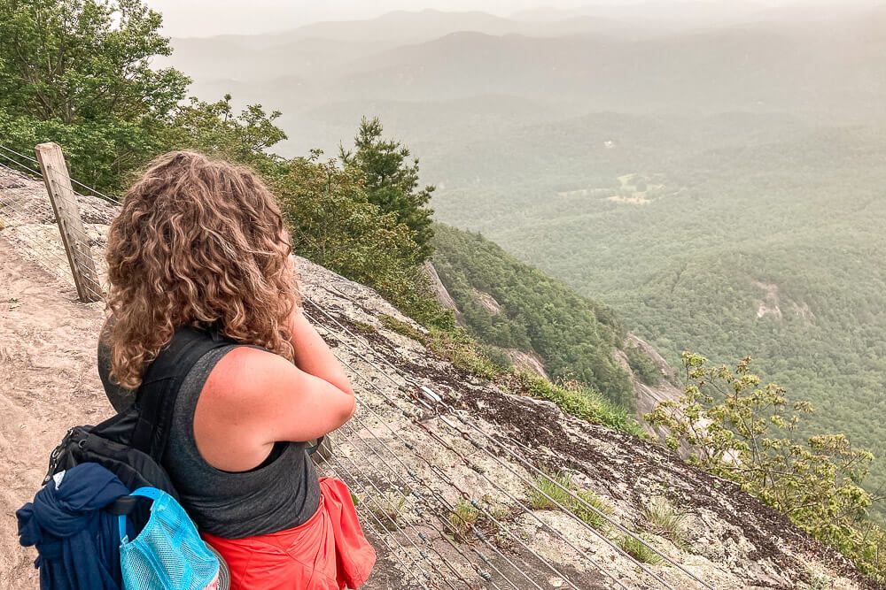
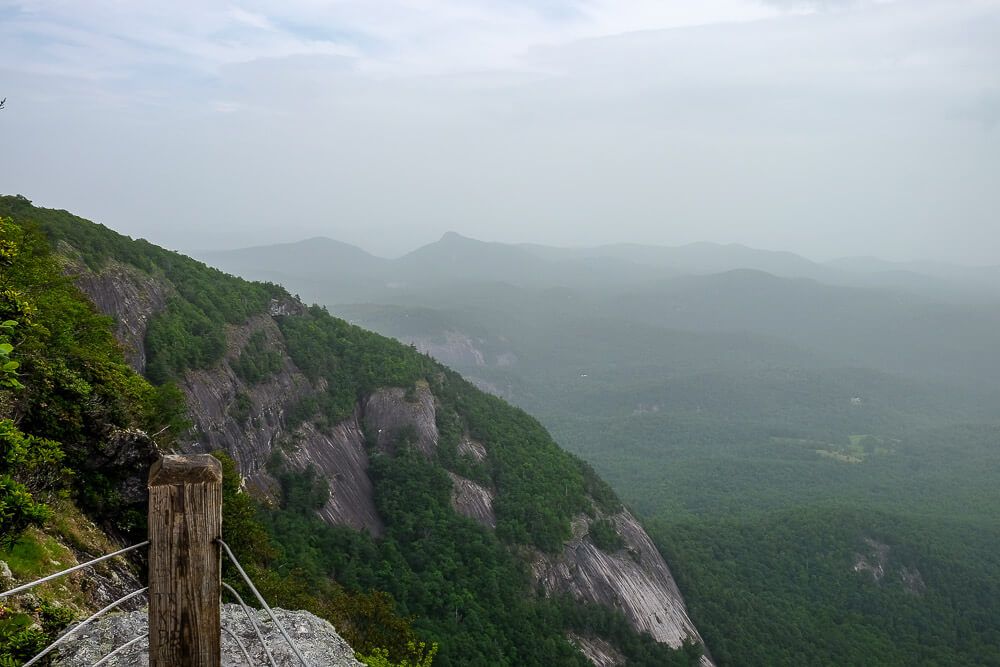
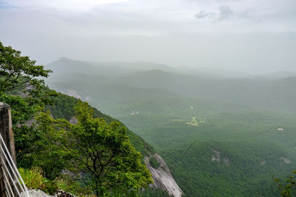
What makes Whiteside Mountain so special are its 750ft cliffs that look like they’ve been draped over the southeastern sides of the mountain. These cliffs make for some amazing views to the east, south, and west.
Read Next: Your Dog Friendly Weekend Guide to Highlands NC
Whiteside Mountain Trail
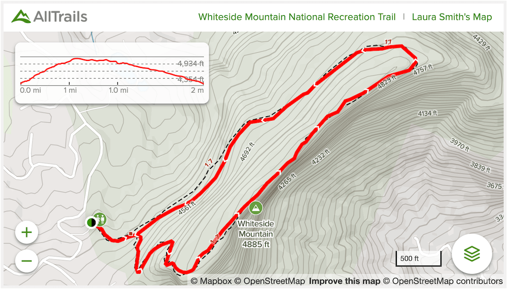
Distance: ~2 miles
Difficulty: Moderate
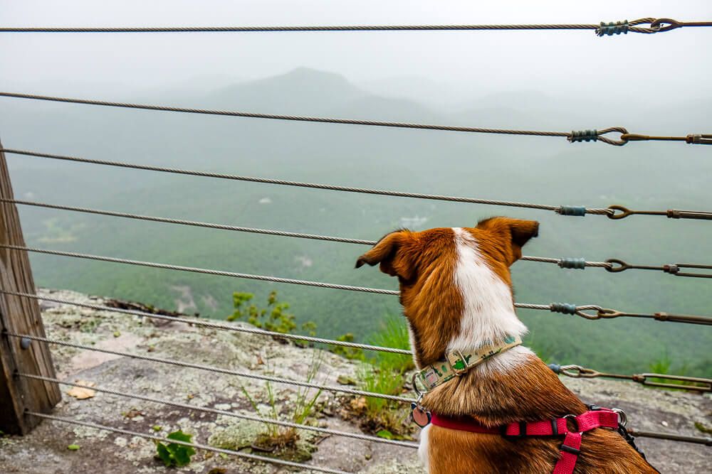
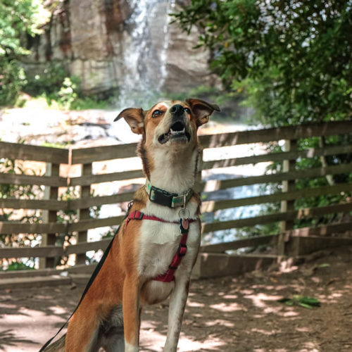
Dog Friendly: Yes
Trailhead: Located off US 64 between Cashiers & Highlands: Google Map to parking lot
Elevation Change: ~500ft
Time: 1-2 hours
The Whiteside Mountain Trail parking lot is very small. And it’s located off of a residential road so street parking isn’t really available if you can’t find a spot in the lot. So if you’re coming here on a weekend, get there early.
It was full when we got there on a Saturday in the late morning. And this was a on a foggy day where the views were sub par. We ended up waiting for a spot.
In the parking lot you’ll also see a large information board (the trees may be overhanging it a bit) with a map of the area and some more details on the wildlife and flora you’ll see on the hike.
There’s also a self service fee box there as well. It’s just $3 per vehicle and an additional $1 per person. I always encourage visitors to pay these fees. Your money goes to help preserving these parks, forests, and attractions. We should all do our part to make sure these sites can be maintained.
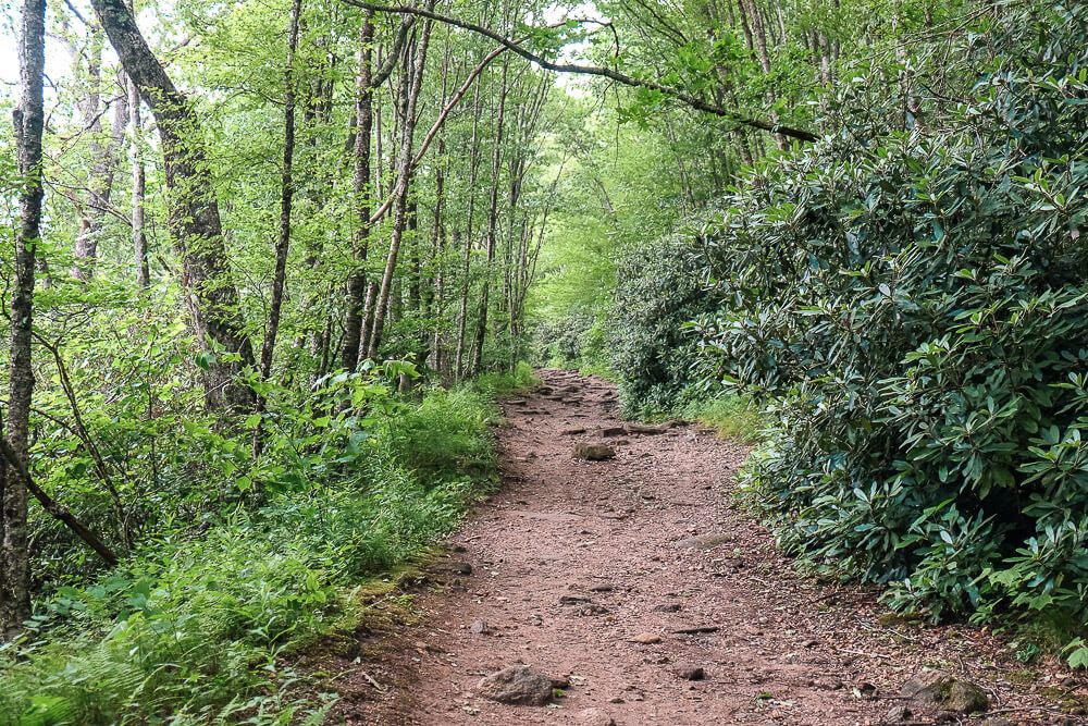
From there, you’ll head up the steps behind the information stand. You’ll want to keep to the left at the top of the steps and the trail will begin its long gradual climb up.
Now, this is a loop hike. Meaning that you’ll go up one side and come down the other. And well, one side is gradual and the other is steep. You can decide which to follow.
But I always prefer to hike up the gradual side. Even though coming down is hard on my knees, I’d prefer not to be a sweaty, panty mess at the top of the mountain if I don’t have to be.
After about a tenth of a mile, you’ll reach this decision point (see photo below). The path to the left is the gradual way up (the way we went), and the steep way to the right (with the stepping stones) is the way we came down.
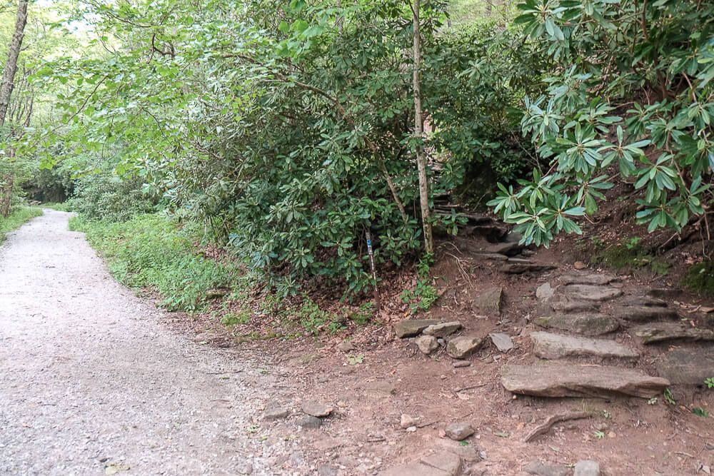
It’s not super clear though that they connect at the top. There’s a small sign that says the way to the right is more difficult, but that’s about it. We met a lot of people who asked us where the rest of the trail went at the top. And they were very surprised to find out it was a loop.
So we headed to the left. This trail isn’t and we enjoyed the gradual climb up. Plus the path is very wide through here so passing other groups wasn’t a problem.
Eventually we reached the top and we followed the trail to the right. This is the highlight of the hike.
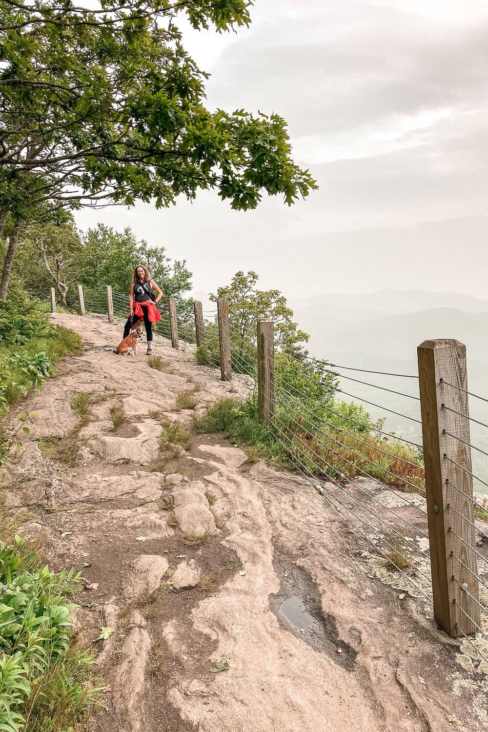
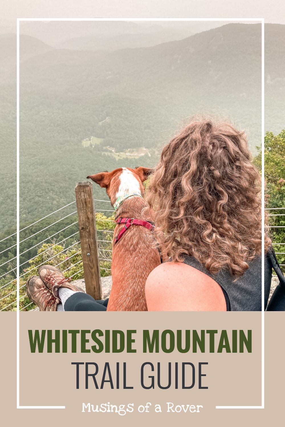
Once you reach the top, the trail will take you along the top of the cliffside before it swings back down the mountain. You’ll pass by many different viewpoints along the way. Some being better than others.
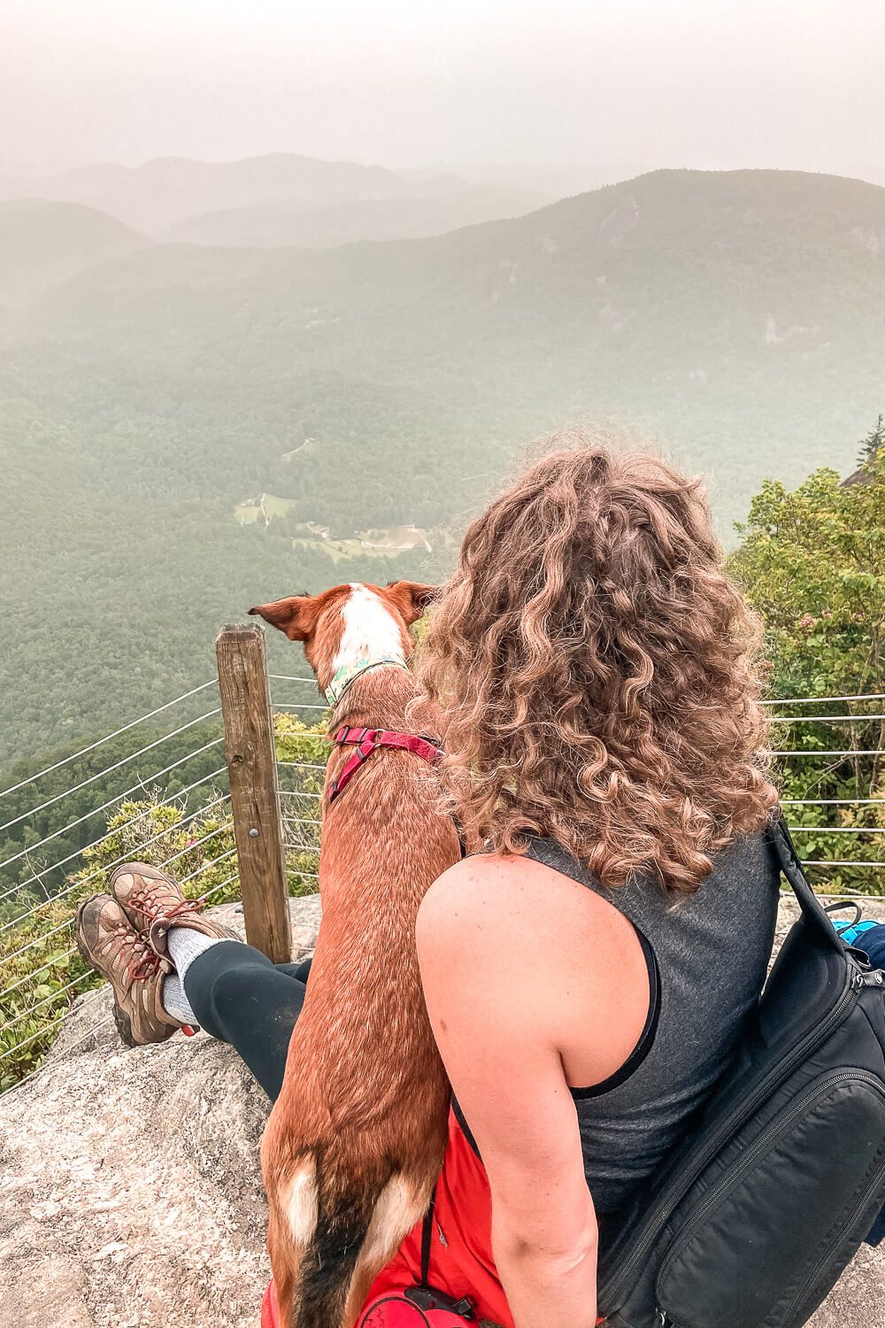
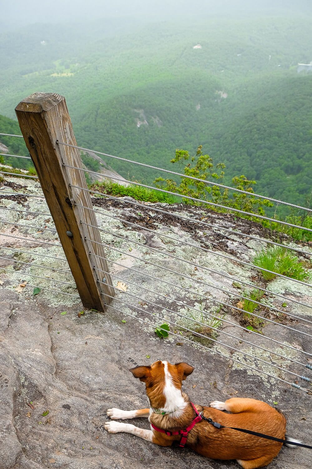
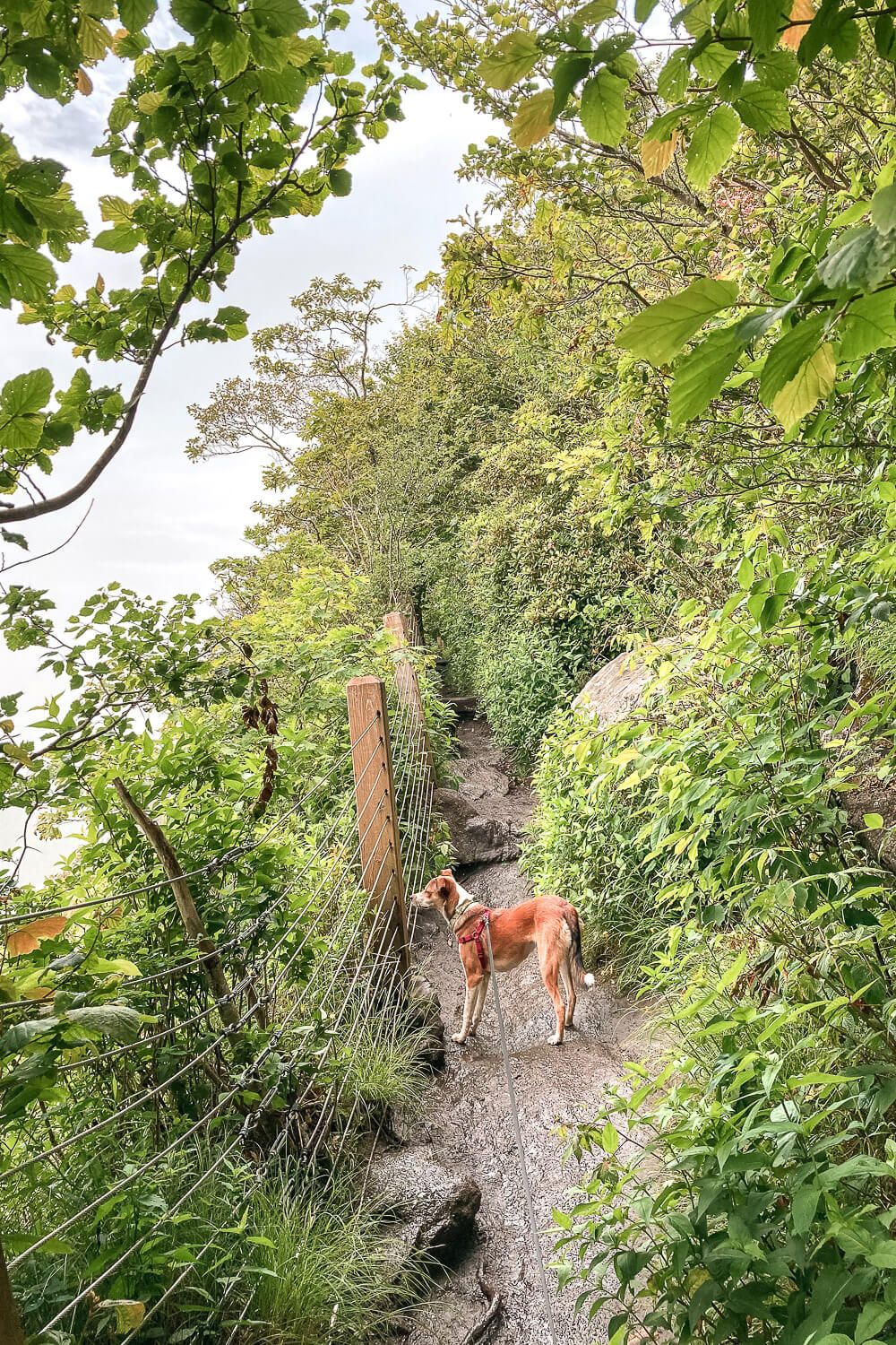
If you’re afraid of heights, know that there is a fence between the edge of the cliff and the trail, but it’s right up against it in some places.
Even in the fog, the views were very impressive.
Note that at different points along the trail, the path will become very narrow. I think this is where a lot of people turned back. But keep going and you’ll eventually reach additional view points along the way.
The trail will then turn away from the cliffs and make its way down the mountain. As mentioned this way is much steeper. There are a lot of stairs. I was very glad we did the hike in a clockwise direction.
This hike is not even 2 hours away from Greenville. You could easily make a day trip out of it. Head there early in the morning to hike Whiteside Mountain. Stop in Highlands for some lunch and maybe a beer.
Sounds like a pretty good day to me.
Trail Map
NOTE: This trail map shows the hike in a counter clockwise direction. My recording got totally messed up so this is just the generic trail map. But I hiked this in a clockwise direction and that’s what I’d recommend.
Click the image or the button to view the map in more detail.
![Hike the Raven Rock Loop [Trail Guide]](https://www.musingsofarover.com/wp-content/uploads/2022/03/raven-rock-loop-trail-guide-8-500x500.jpg)
![Hiking the Glenn Falls Trail near Highlands, NC [Trail Guide]](https://www.musingsofarover.com/wp-content/uploads/2020/07/things-to-do-in-highlands-28-500x500.jpg)