I discovered this trail while researching passages of the Palmetto Trail for their 22 hiking challenge. I wanted to hike a part of the Eastatoe Passage, so I took a closer look and noticed the Raven Rock Loop trail extends off of it. And I was shocked at how nice this loop was!
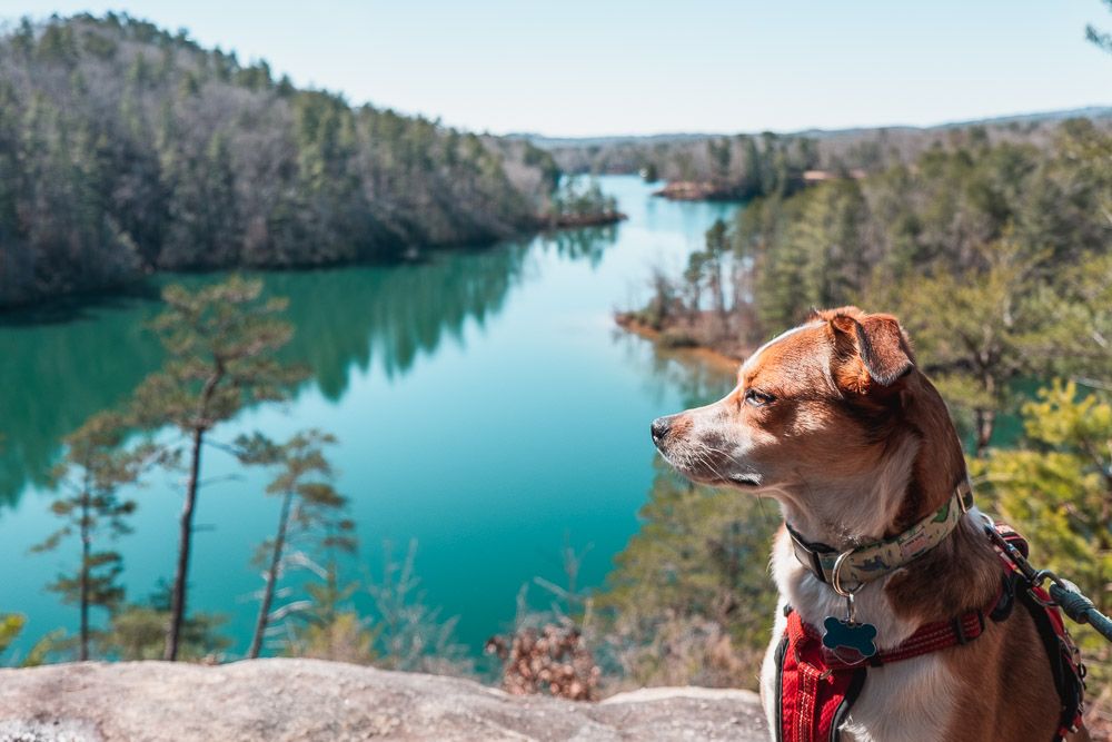
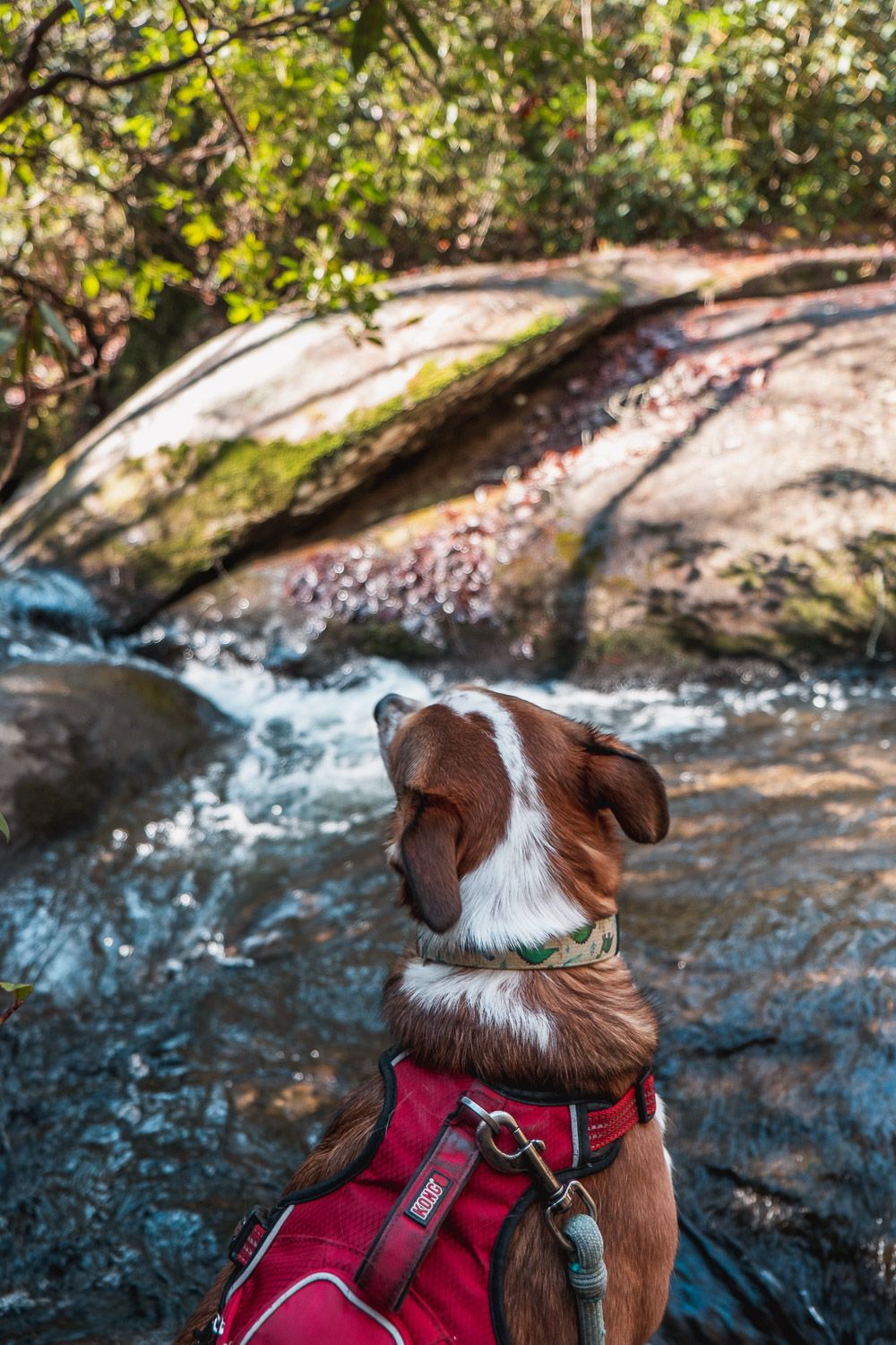
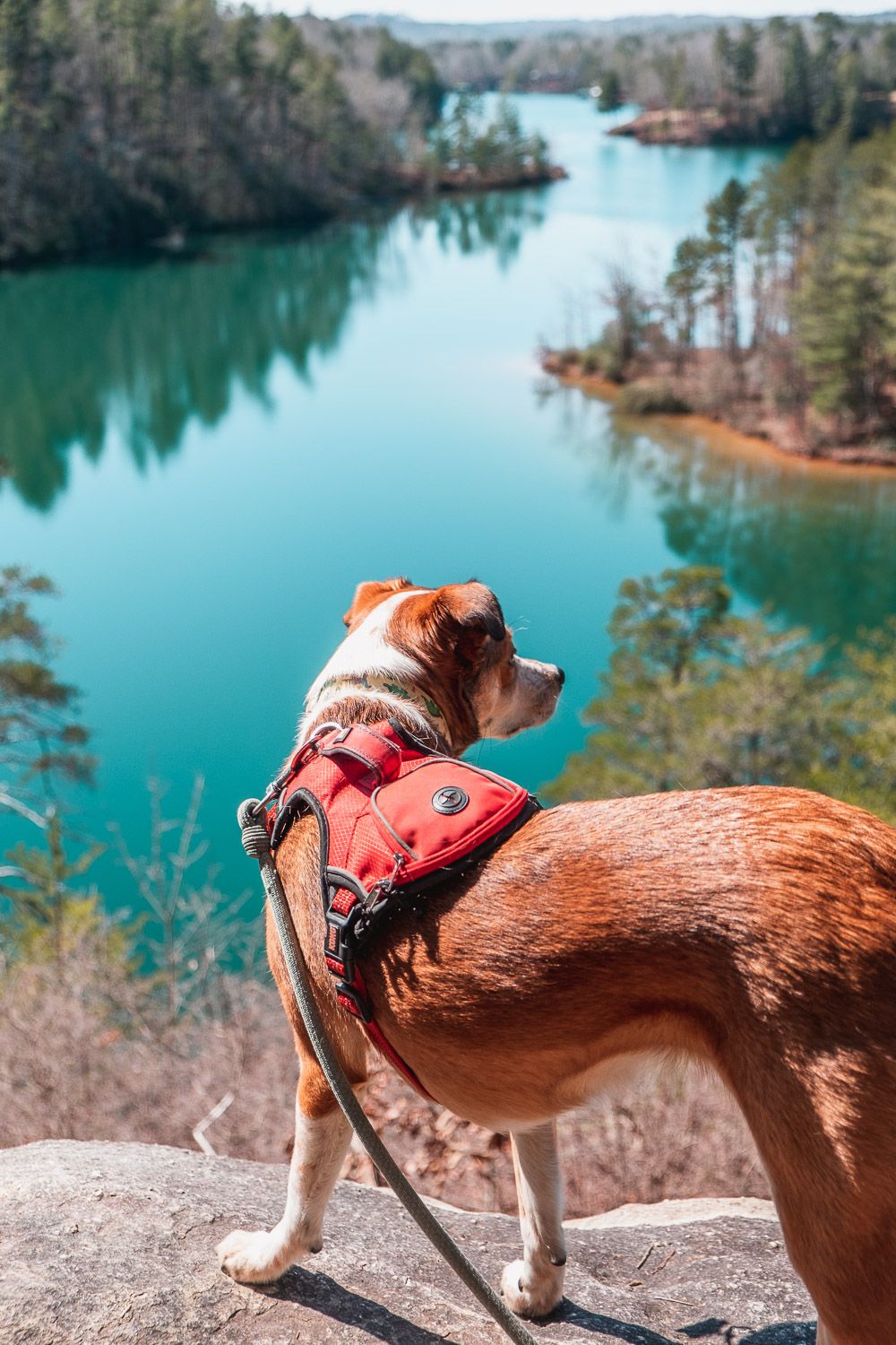
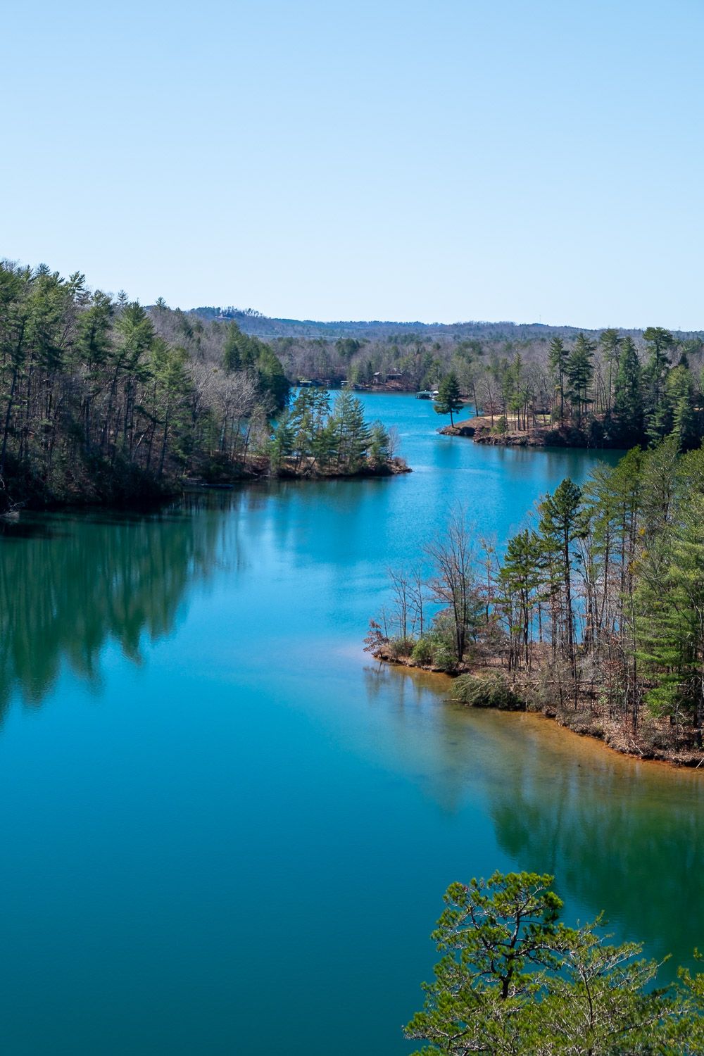
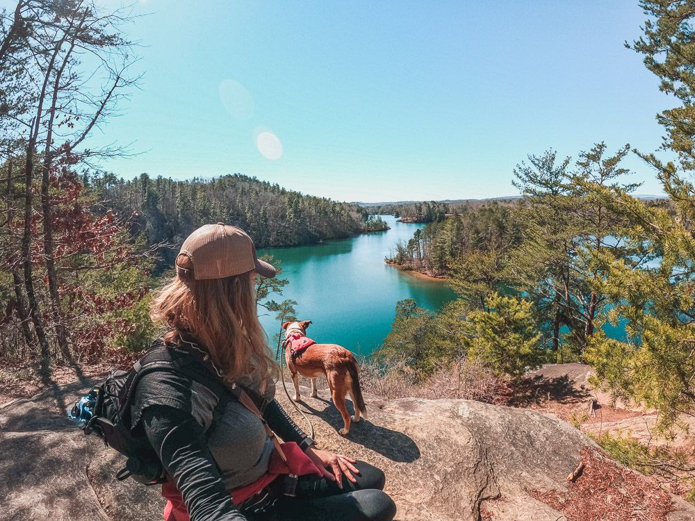
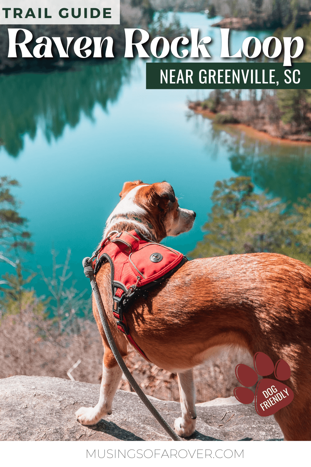
The highlight of the trail has to be Raven Rock itself – a rocky outcropping overlooking a section of Lake Keowee. But the Natural Bridge Trail (the first part of the hike) also has some great creekside views.
The Best Places to Go Hiking Near Greenville, SC
Raven Rock Loop Trail
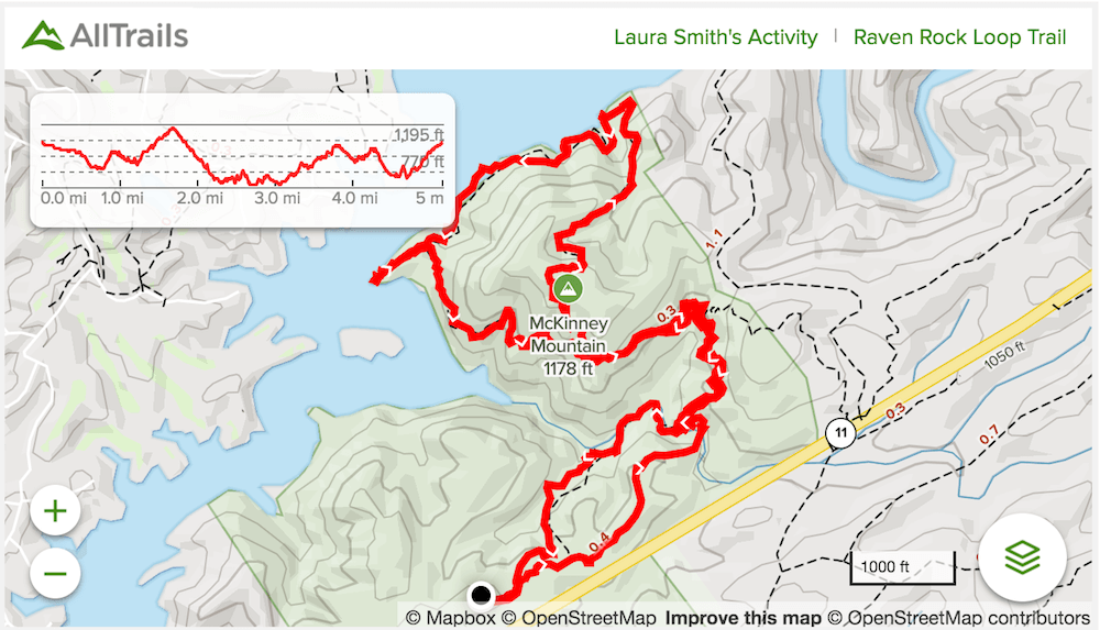
Distance: ~4.5-5 miles roundtrip
Difficulty: Moderate
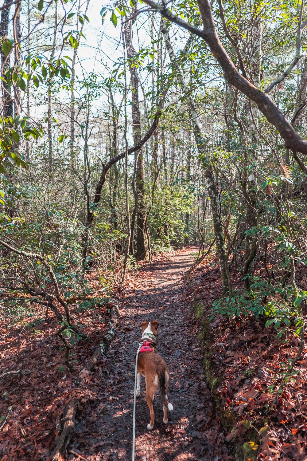
Dog Friendly: Yes
Trailhead: Behind the Park Office in Keowee-Toxaway State Park
Elevation Change: ~900ft
Time: 2.5-3 hours
You’ll start the hike inside Keowee-Toxaway State Park. The trail itself actually consists of two loops. The first being the Natural Bridge Trail, then there’s a connector trail that leads to the Raven Rock Loop. Think like a figure 8. See the map below for details.
I read before hiking that you should do the Natural Bridge Trail in a clockwise direction and the Raven Rock Loop in a counter clockwise direction. This is what I’d recommend to others as well.
(I forgot during the hike and did the whole thing counter clockwise. Which meant I hiked up the hardest part of the Natural Bridge Trail right at the end of the hike.)
How long is the hike? All Trails has this listed as 4.2 miles. However, I clocked almost 5.2 miles. Now I did go down to the lakeside primitive campsites, but even then I recorded a lot more distance. That’s why you’ll see me say this is closer to 5 miles than 4.
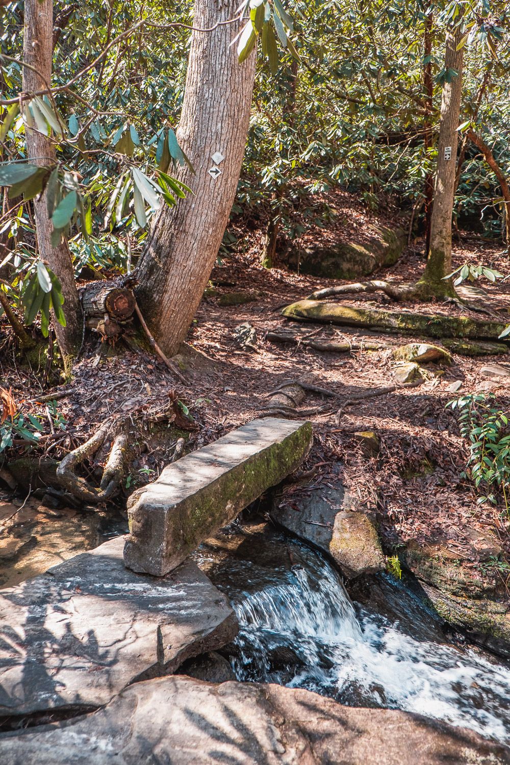
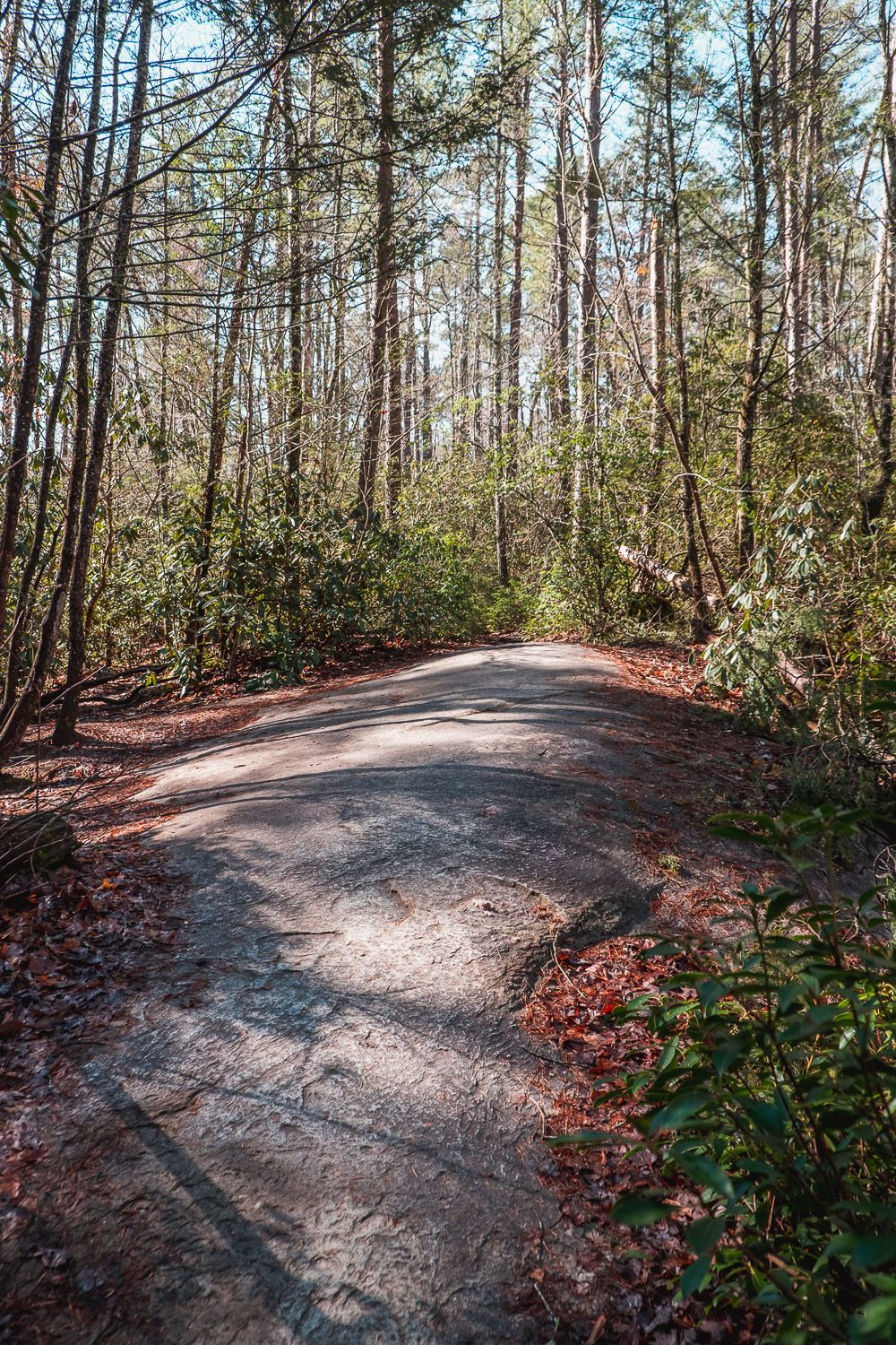
You’ll start the hike on the Natural Bridge Trail & the Palmetto Trail. After just .1 miles, the trail will split. I suggest you go left. From there, you’ll hike roughly half a mile downhill towards Poe Creek. You’ll cross by some small cascades and even over a small stone bridge.
At the far end of the loop, the Raven Rock Trail (and Palmetto Trail) will branch off to your left. Take this trail towards the Raven Rock Loop. Now you’ll hike for roughly 1/3 of a mile along some small cliff sides and rocky outcroppings. Then the Palmetto Trail will continue to the right while the Raven Rock Trail will be on the left.
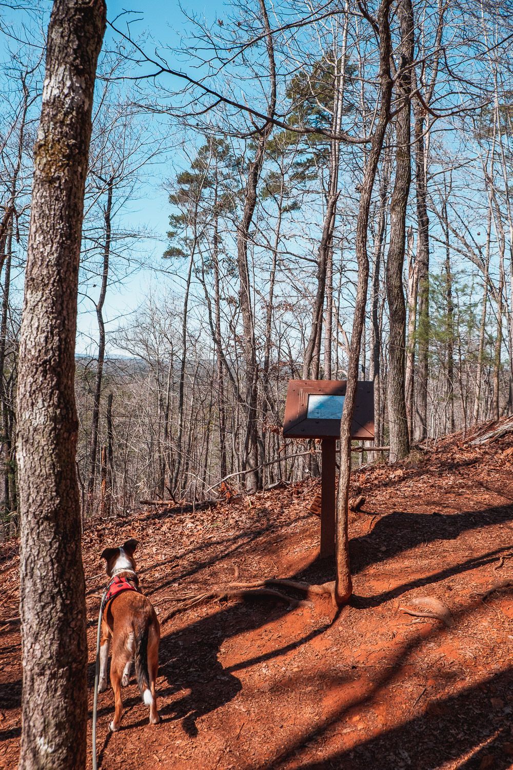
Take the left here and go another 1/3 of a mile before you hit the start of the Raven Rock Loop. There’s even a small map stand to help you orient yourself.
Hike to Station Cove Falls [Trail Guide]
If you want to hike the whole loop, definitely go right. If you just want to go to the Raven Rock viewpoint (or you’re camping) go left. But then definitely come back the same way.
To do the loop head right and you’ll hike up to the peak of McKinney Mountain before descending all the way down to the shore of Lake Keowee. There is quite a bit of elevation change here, and I was very happy to be hiking down it.
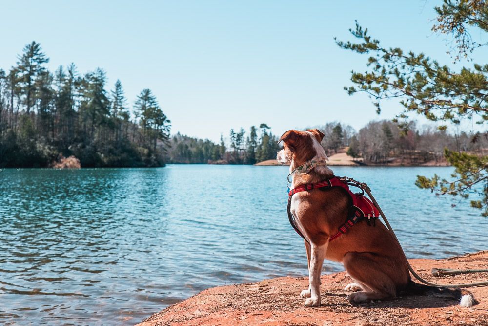
The trail then hugs the Keowee shoreline and there are couple of spots with very good views. Eventually though, you’ll make like a left turn on the shore and start climbing up the steep bank. You’ll pass by the trail to the primitive camping sites along the way.
After just .2 miles from the camping sites, you’ll come to the namesake of the trail – Raven Rock.
There are several large rocks here for you to sit back and enjoy. Just don’t get too close to the edge as it is a sharp drop. If you packed a snack (or some lunch) definitely sit back and stay awhile. This would also be a fantastic sunset spot.
From Raven Rock, continue on the trail back to the start of the loop and then back the way you came to the Natural Bridge trail. When you reach the Natural Bridge trail, definitely go left. I made the mistake and went right and had a significant climb up to the parking lot. But going left will give you a much more gradual climb.
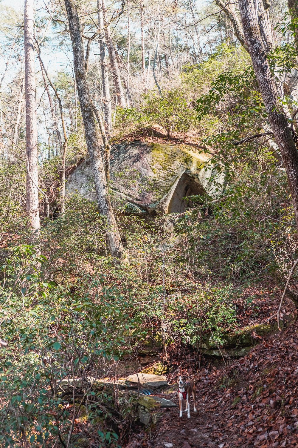
You’ll also cross over the namesake of the Natural Bridge trail. Basically a very large boulder that stretches across Poe Creek. Trust me, this thing is HUGE.
From there, just a gradual uphill climb to the parking lot (around ~.5 miles).
I hiked this in late winter, just as I was getting back into hiking shape and it was perfect.
Some elevation, but not too bad (especially if you hike it in the right direction). Some great views and stops along the way. And long enough for me to feel like I got a good workout in, but not too long that I was exhausted for days. (Looking at you Table Rock.)
4 Beautiful Trails Near Greenville, SC
Trail Map
Click the image or the buttons to view the map in more detail.
![Black Balsam Knob Hike [Trail Guide]](https://www.musingsofarover.com/wp-content/uploads/2020/12/black-balsam-knob-5-500x500.jpg)
![Hike to Rainbow Falls in Jones Gap State Park [Trail Guide]](https://www.musingsofarover.com/wp-content/uploads/2021/04/rainbow-falls-jones-gap-7-500x500.jpg)