The northwest corner of South Carolina around Greenville is an outdoor playground when it comes to hiking, waterfalls, and some amazing views.
After living here for over 10 years, I know which hikes are the most beautiful ones in the area. The ones I suggest visitors and new residents complete first. The ones with the great views and the amazing waterfalls. Here are the hikes in the upstate that I think are simply stunning.
Read Next: The Best Places to Go Hiking Near Greenville, SC
1. Table Rock Trail
Distance: ~7 miles roundtrip
Difficulty: Very Strenuous
Dog Friendly: Yes
Trailhead: Located within Table Rock State Park, there’s a parking lot for the trailhead
Fee: There is a fee to enter the State Park, see the Park Website for current admission prices ($6 per adult in 2021)
Elevation Change: ~2,300ft
Time: 4-6 hours
How could I not start this list with probably the most iconic mountain and trail in the area? Table Rock Mountain is the namesake of Table Rock State Park for a reason. Its south facing granite dome is beautiful. But the best views come to those brave enough to climb to the top.
Now the Table Rock Trail does just what you think – it’ll take you straight to the top of the mountain. But this is not an easy hike. In fact it’s the hardest hike I’ve ever done (and I’ve hiked it 3 times). This is due not just to the steepness of the hike, but also its length.
Now the views at the top are simply breathtaking. Especially since you’ll probably be dead tired by the time you get there. But if you’re in good enough shape to hike it, it’ll definitely be worth it.
My two main pieces of advice are 1.) don’t hike this in the summer and bring plenty of water – you cannot refill anywhere, and 2) get there early or hike it on a weekday. This trail is popular and the parking lot will be full by mid-morning on the weekends year round.
Lastly, if your dog is in good enough shape to hike this, be sure to bring enough water for them (at least another water bottle or two), as there really aren’t any streams.
Definitely check out my full trail guide below for my advice and photos.
Looking for something similar? If you’ve hiked Table Rock and you want more, think about heading to Pisgah National Forest and hiking Looking Glass Rock.
2. Rainbow Falls Trail
Distance: ~4.4 miles roundtrip
Difficulty: Strenuous
Dog Friendly: Yes
Trailhead: Located inside Jones Gap State Park
Fee: There is a fee to enter the State Park, see the Park Website for current admission prices ($6 per adult in 2021)
Elevation Change: ~1,300ft
Time: 2.5-4 hours
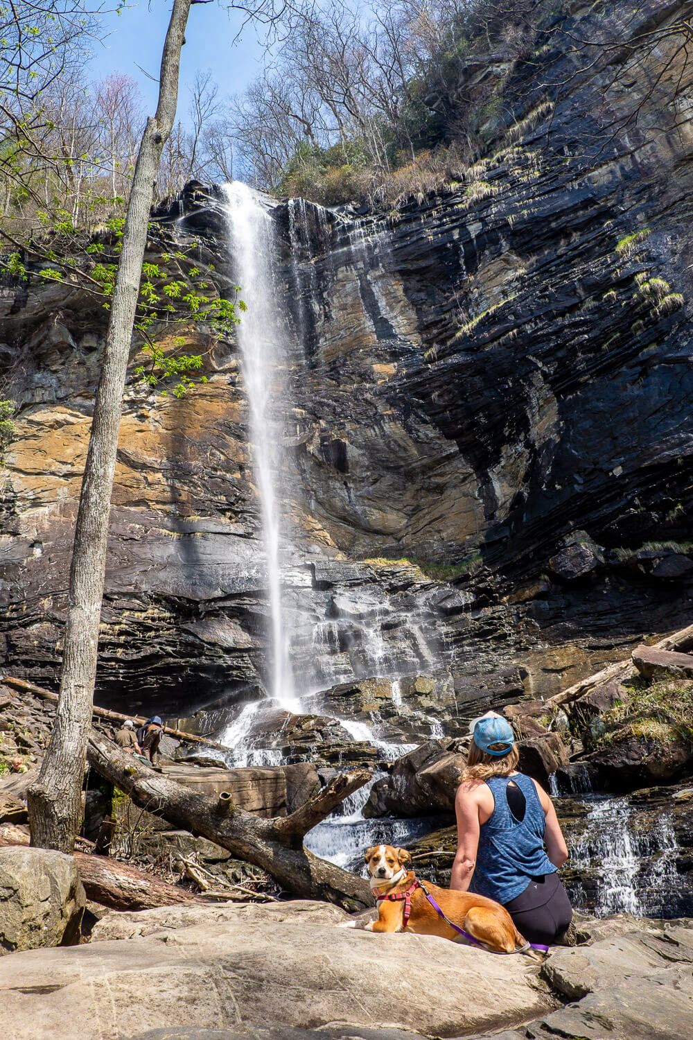
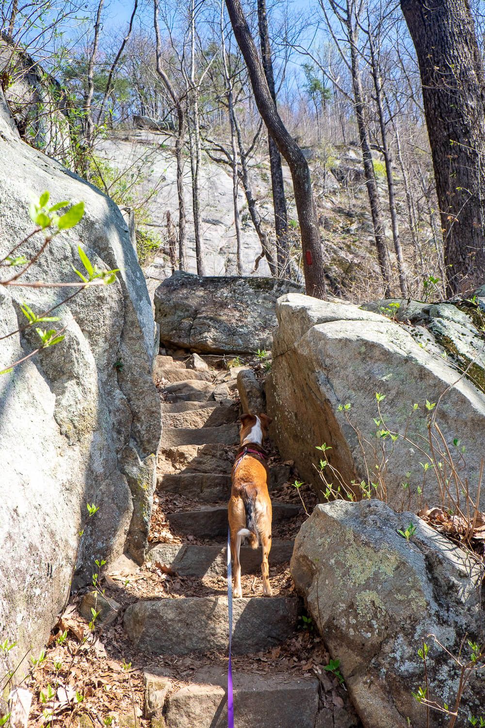
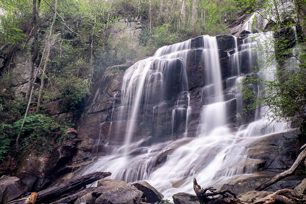
Rainbow Falls is one of the tallest waterfalls in the region. It plummets 140ft down over a ledge. And sometimes it’s wispy (during drier conditions) or it may be quite wild if we’ve gotten a lot of rain.
And though this hike is easier than the Table Rock Trail, it’s still very difficult. The second half of the hike has some serious elevation change (see that +1,000 feet above). I met several people who had to turn around.
Before you head out though, please note that Jones Gap State Park is a pretty small park. If you are going on a Friday, Saturday, or Sunday, check to see if you need to make a reservation. This is basically a $5 parking registration and is in addition to the normal admission fee to the park. AND you’ll need to make the reservation 48 hours in advance. Find all the details on the park’s website (see the travel advisory in the left sidebar).
If you can hike this during the week, I strongly suggest it. This will allow you to spread out a bit at the base of the falls and get some photos without other people in it. Because, yes, this hike is very popular.
Read Next: The Best Waterfalls Near Greenville, SC
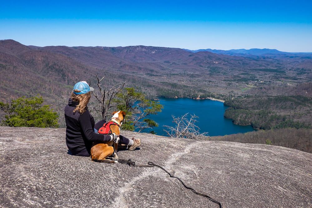
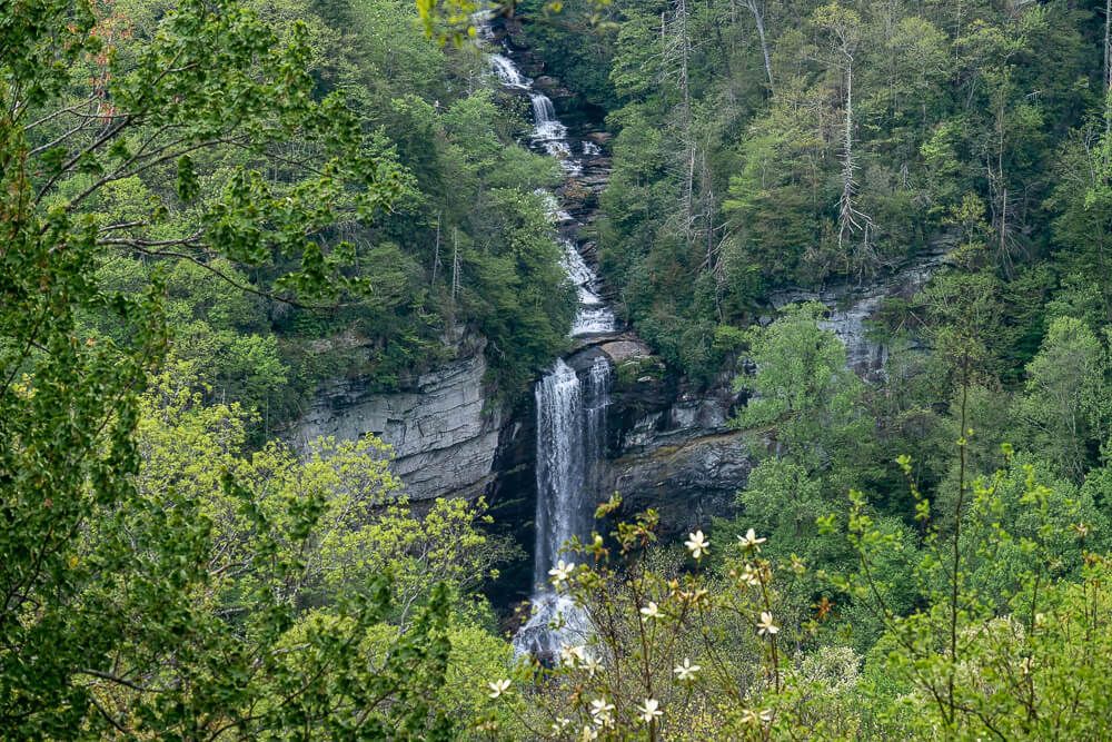
3. Raven Cliff Falls Trail (Overlook)
Distance: ~4 miles roundtrip
Difficulty: Moderate
Dog Friendly: Yes
Trailhead: Located about a mile north of the main Visitor Center on US-276
Fee: There is a fee to enter the State Park, see the Park Website for current admission prices ($6 per adult in 2021)
Elevation Change: ~750ft
Time: 2.5-3 hours
Raven Cliff Falls is the tallest waterfall in South Carolina. It cascades down 420ft and is super impressive to behold. And you can reach the overlook for this waterfall without a super strenuous hike.
Now hiking to this overlook is very popular. Caesars Head State Park is a small park and the parking lots for the trailhead fill up quickly on the weekends. (There is a fee drop box so be sure to have exact change or purchase a day pass at the main park office.)
The elevation on the trail is fairly spread out so this is perhaps the easiest hike on this list. There’s even a shelter at the end where you can stop and rest a while.
Looking for something harder? Instead of hiking to the overlook, you can hike the Dismal Loop Trail (~9 miles) which will take you closer to the waterfall (but you won’t get the full view). This has the same elevation gain as Table Rock but is longer. So it may be even harder. Plus there are ladders – yes ladders – so be sure to leave the doggos at home.
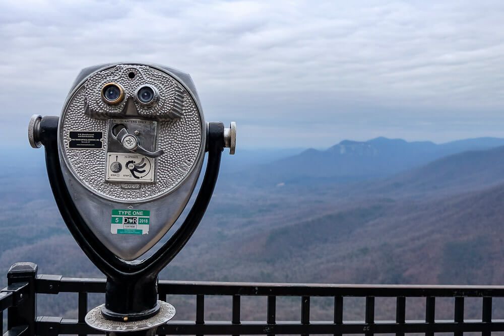
After (or before) your hike, be sure to stop at the main visitor center for Caesars Head State Park. At the back of the parking lot is a walkway that will take you to an overlook looking out towards Table Rock.
It’s one of the best views in the region. See the featured photo at the top of this article for the view!
4. Falls Creek Waterfall Trail
IMPORTANT
This trail has recently closed and is being re-done. When it re-opens, I’ll look to update the information below (as well as the full trail guide).
In the meantime, my runner-up hike – Station Cove Falls – is a great hike and is also relatively short and leads to a beautiful 60ft waterfall. Check out the full trail guide as well as my YouTube Video.
Distance: ~2.2 miles out and back
Difficulty: Moderate
Dog Friendly: Yes
Trailhead: Small trailhead via Falls Creek Rd. near Jones Gap State Park
Fee: There is no fee to hike the trail.
Elevation Change: ~900ft
Time: 1.5-2.5 hours
The Falls Creek Waterfall feels like a bit of a hidden gem in the Upstate. Since it’s not accessed through a state park or a large pull-off, this really limits the amount of people who can visit. It’s technically in Jones Gap State Park, but most of the trail is in the Mountain Bridge Wilderness Area.
And when I say limit, I mean it. The trailhead is basically tucked away into a little neighborhood and there are serious limitations on parking. There is room for maybe 3 cars to pull in, and, maybe another 5 or so to park along one side of the road. And that’s it.
The hike itself starts off mostly easy with some uphills and downhills. But the last half mile is seriously tough. It’s straight uphill to the waterfall and the trail is very rutted, rooted, and rocky. If it’s rain recently, I’d reconsider as you’ll be slipping and sliding.
The waterfall itself is split into two parts and the trail pops you out at a midway point between them. Go up to see the thinner taller section of the waterfall. And carefully head down to see the wider part in the photo above. Due to the sheer size of the waterfall, I really struggled to photograph it all together.
And though I’ve seen photos that I think were taken near the middle section of the bottom tier, the water was really moving the day we went out so I did not feel comfortable slipping and sliding my way closer to the waterfall.
People have been seriously injured on the rocks near the falls so please use your common sense!


Just a note, the Falls Creek Falls is closed currently. They are cutting in a new trail, so it will no longer exist in it’s current state.
Oh thank you for the note! I’ll keep a look out for new trail developments!