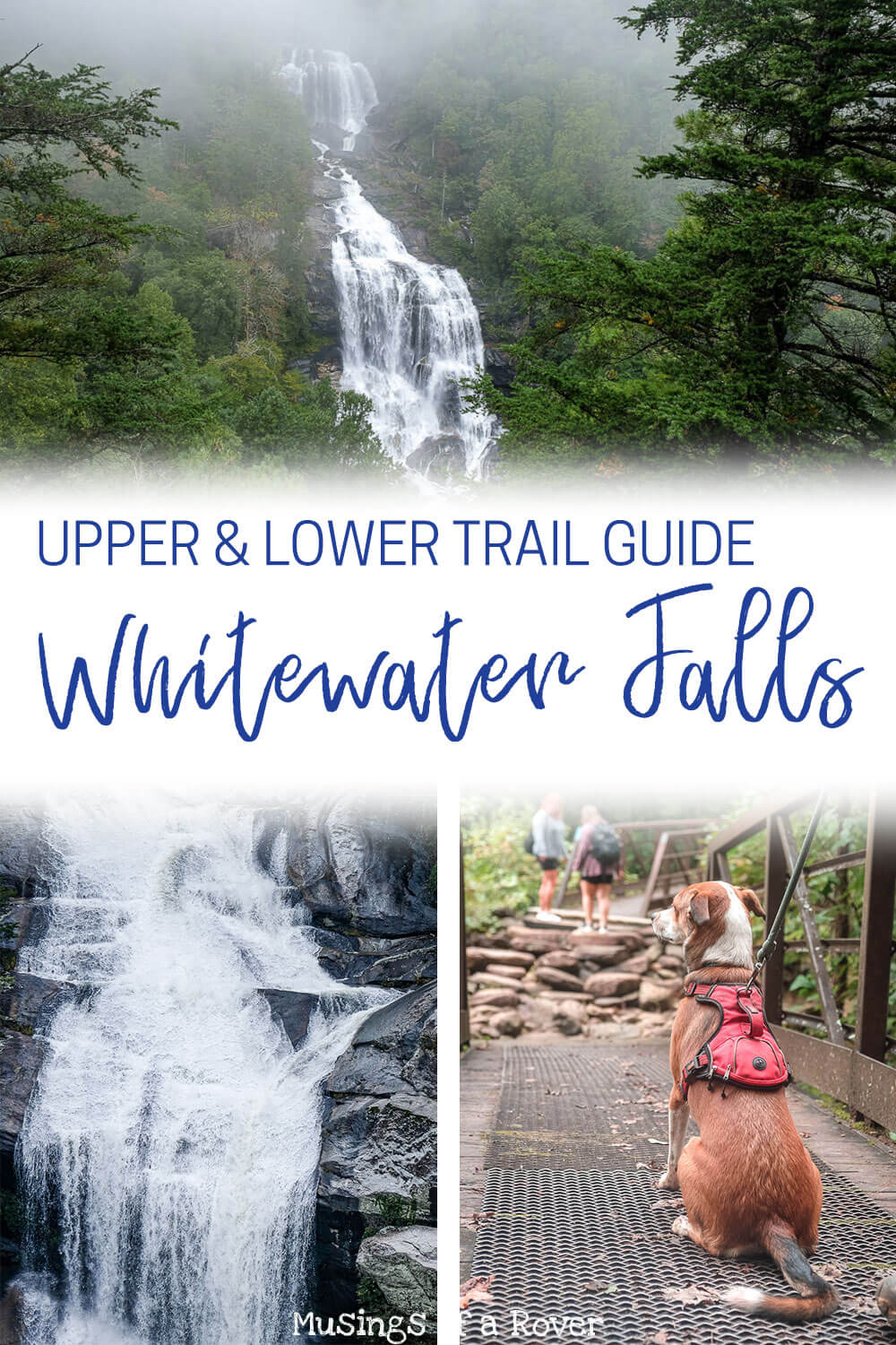
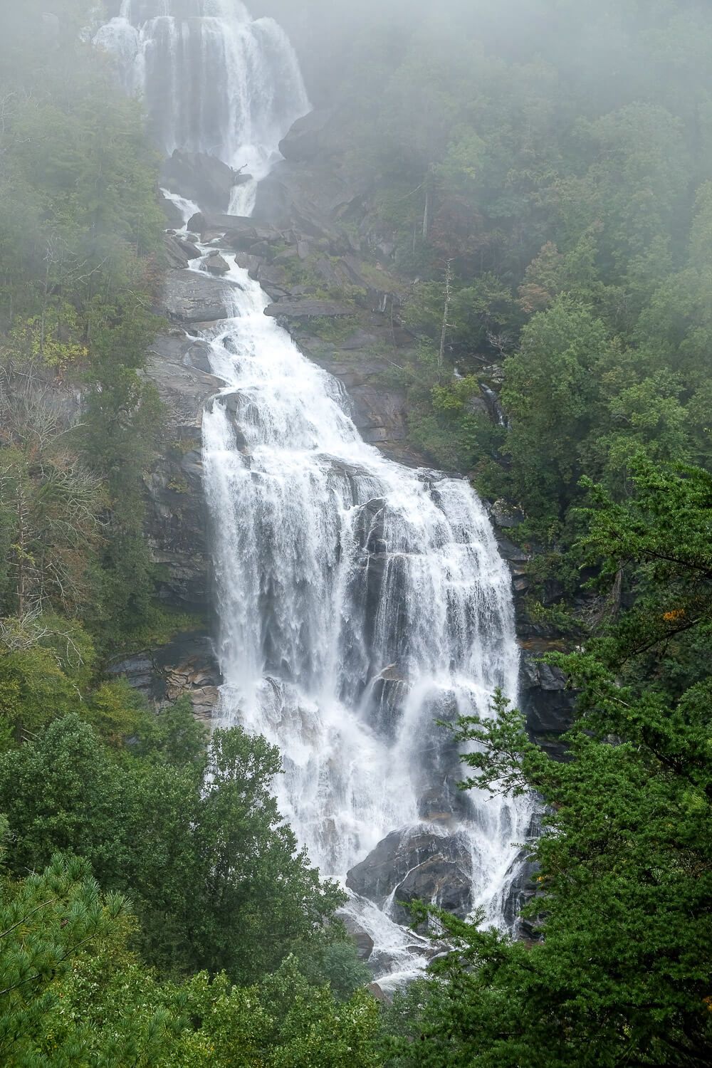
The Whitewater Falls is the tallest waterfall east of the Rockies. Yes, I lived within easy driving distance of these waterfalls for years and had no idea. And even those I hiked with hadn’t heard of them before. If you’re ready to see some super impressive waterfalls, then definitely put this one on your list.
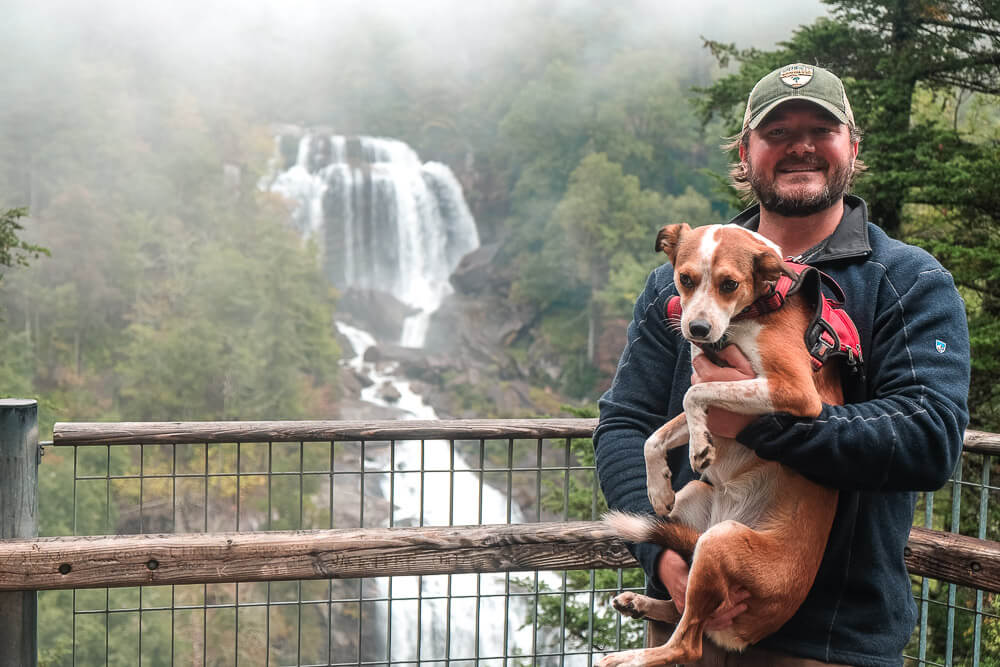
Now the Whitewater Falls is actually broken into two different sections. There’s the Upper Whitewater Falls, which is located in North Carolina and is relatively easily accessible. It tumbles 411 feet and has a great observation deck you can reach in just a 1/3 of a mile from the parking lot.
Then there’s the Lower Whitewater Falls in South Carolina. This waterfall falls another 400 feet and can be seen from an observation deck after a 2+ mile hike (4+ miles round trip).
You can easily do both in one day (which is what we did), or even hike to both along the Foothills Trail. This would be tough though. Instead my recommendation (as outlined below) is to go to the trailhead for the Lower Falls and hike to the waterfall. Then go back to your car, drive to the lot for the Upper Falls, and head to its observation deck.
The Whitewater Falls is a beautiful location. The area around the falls is very rugged and steep, which has helped to keep the area free of development. I loved both hikes and would definitely do them again.
Read Next: Discover the Lake Jocassee Waterfalls
Lower Whitewater Falls
Distance: ~4.6 miles
Difficulty: Moderate
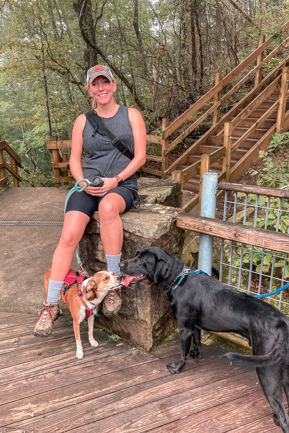
Dog Friendly: Yes
Trailhead: Located on Bad Creed Rd (off of SC-130): Google Map
Elevation Change: ~900ft
Time: 2.5-3 hours
The Lower Whitewater Falls trailhead is located off of Bad Creek Rd near the NC border on SC-130. This area (including parts of the trail) are maintained by Duke Energy. So when you turn onto Bad Creek Road, you’ll go through a Duke Energy gate. Don’t be alarmed.
The parking lot at the trailhead is quite large so you should have no problem with parking. You’ll also see signs about the Foothills Trail (especially since you’ll be on the trail for part of the hike), as well as the Lower Whitewater Falls trail.
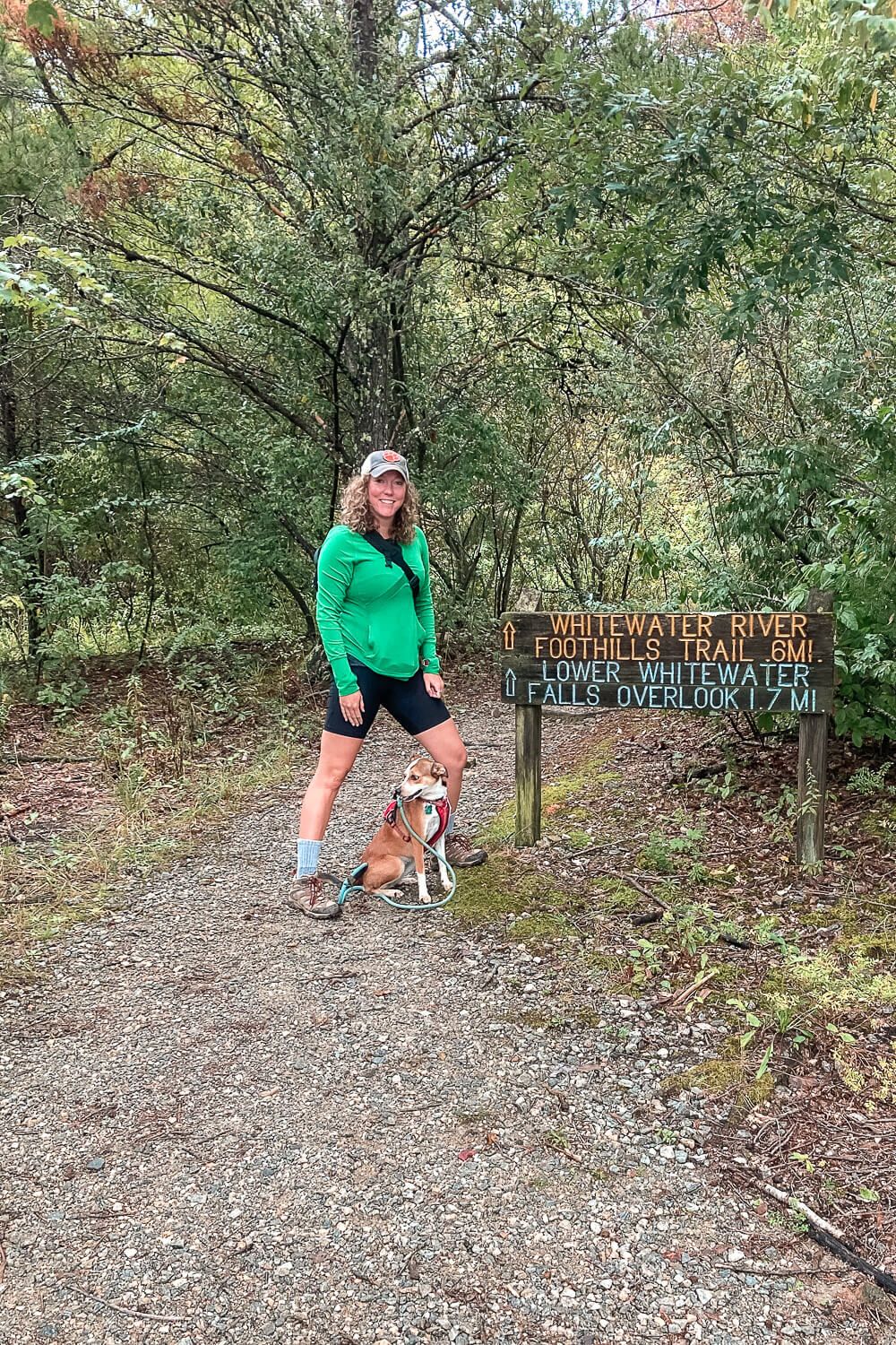
One important note here is that the sign says that it’s 1.7 miles to the overlook. All Trails mentioned 2.1 miles. But I clocked much higher at 2.3-2.6 oneway (phone vs. my watch). So I would put this out and back hike closer to the 4.5-5 mile mark. Just something to keep in mind when you’re planning.
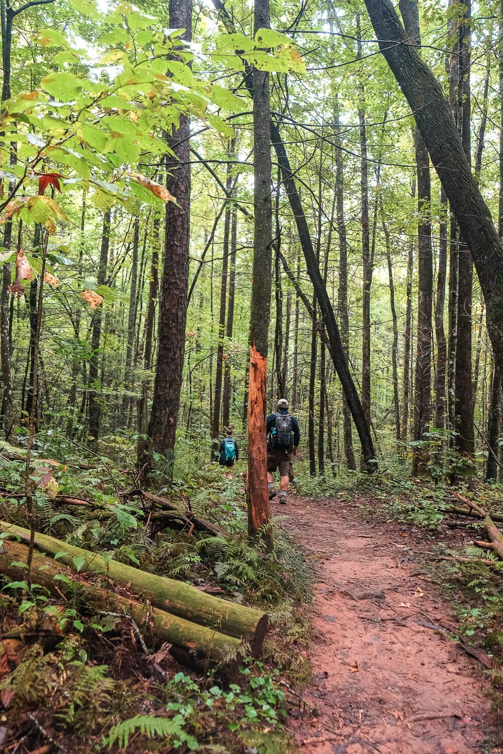
The trail itself is relatively easy. You basically follow the blue markers all the way to the overlook itself. There will be a couple of intersections along the way, but there are plenty of signs as well. If you follow the blue markers and the signs pointing to the Lower Whitewater falls, you’ll be fine.
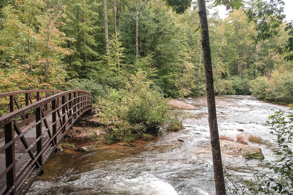
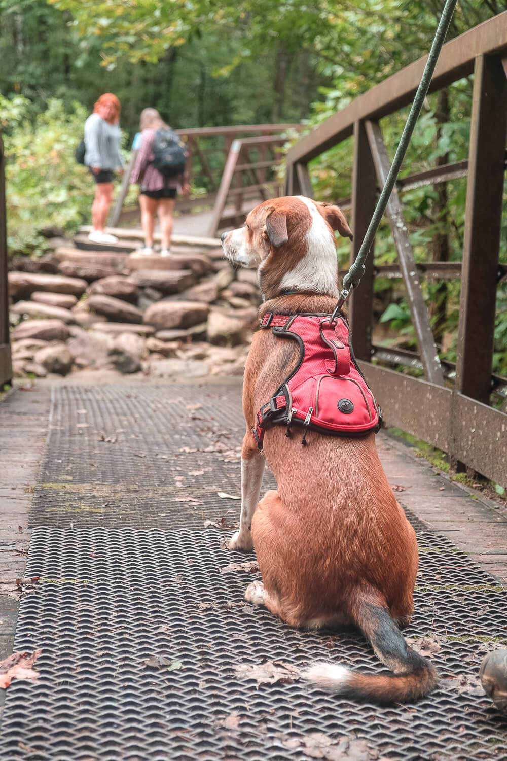
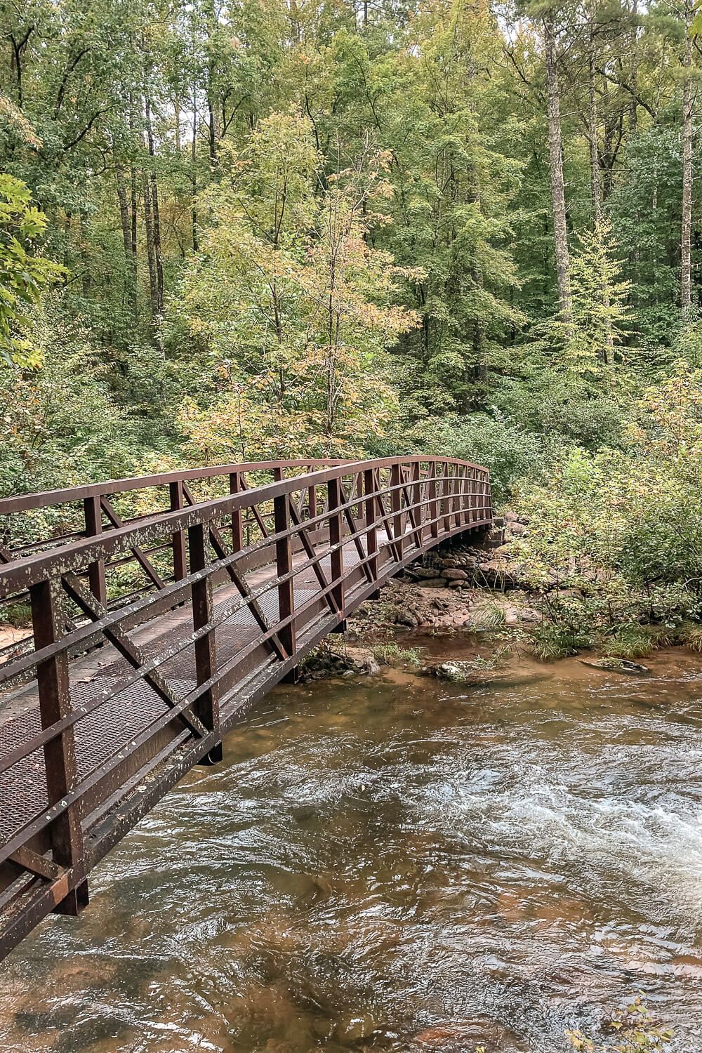
You will cross a couple of interesting footbridges over the Whitewater River. And you’ll even follow a gravel road (Musterground Rd) for a bit before the trail breaks away again.
In terms of elevation there are a couple of ups and downs on the way there, but the steepest part of the trail will be at the end as you’re descending down to the overlook. Be careful of slipping on your way down and take breaks on the way up if you need it.
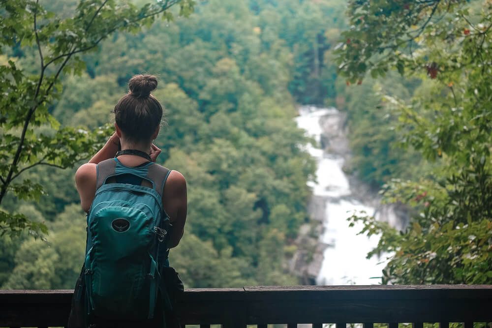
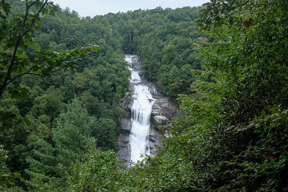
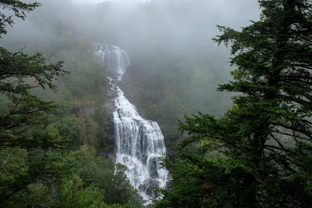
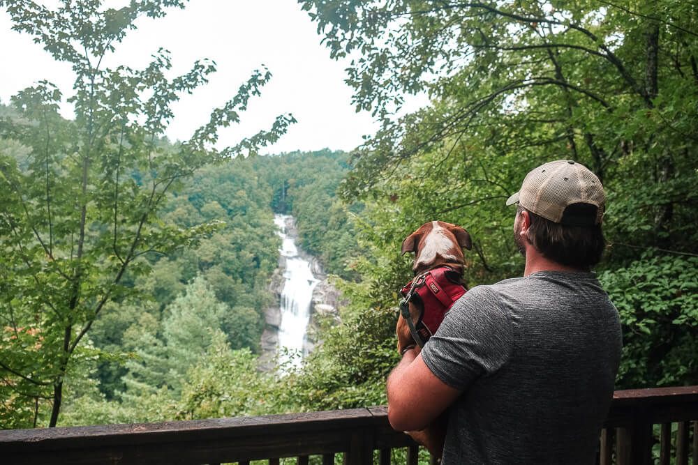
The overlook itself is placed a bit away from the waterfall. This section of the falls is 400ft tall, so you need to be back a bit from it to get a good view. Some hikers may be disappointed by this. But I still found the waterfall to be plenty impressive. I don’t need to be right up on it.
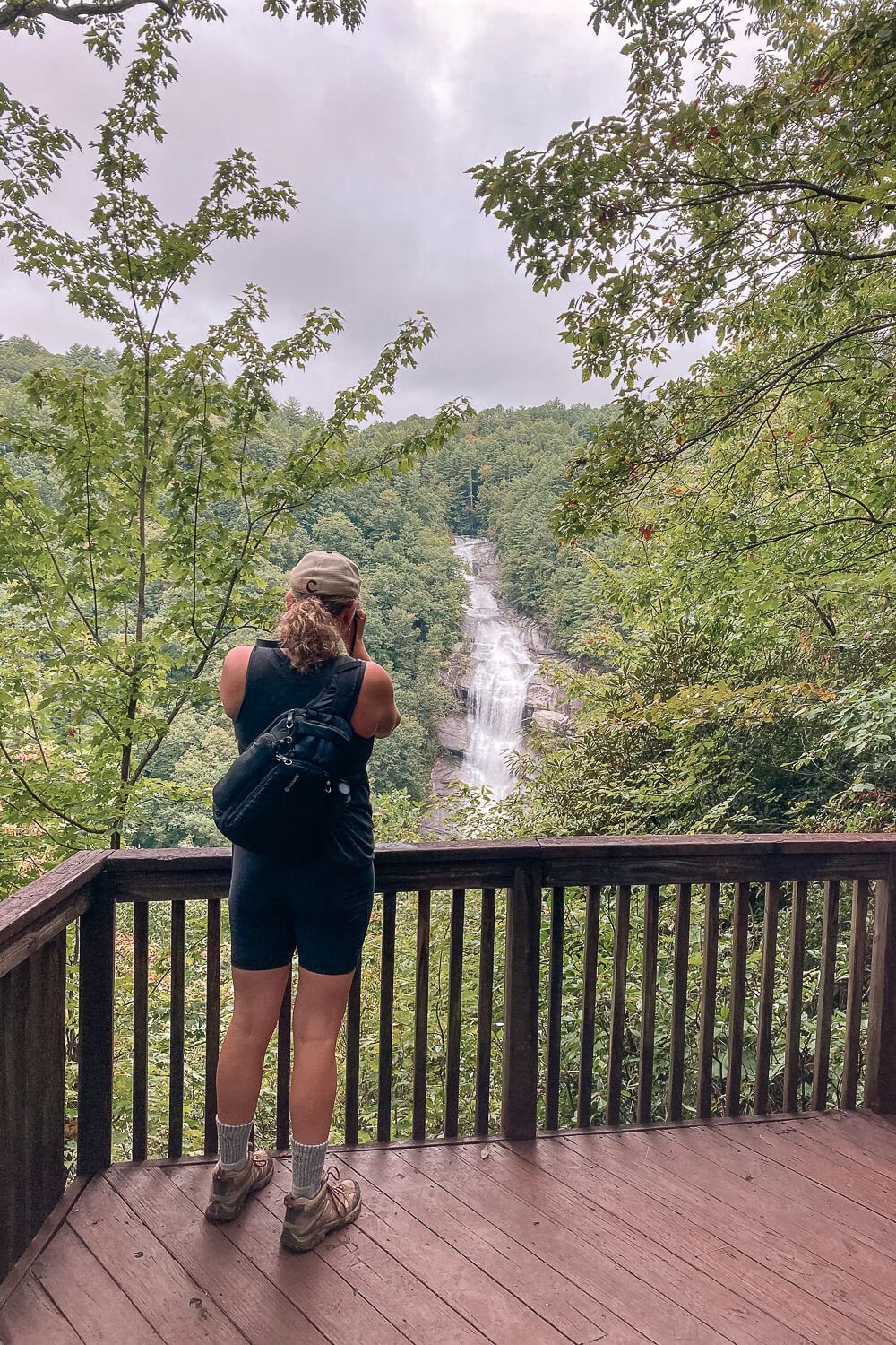
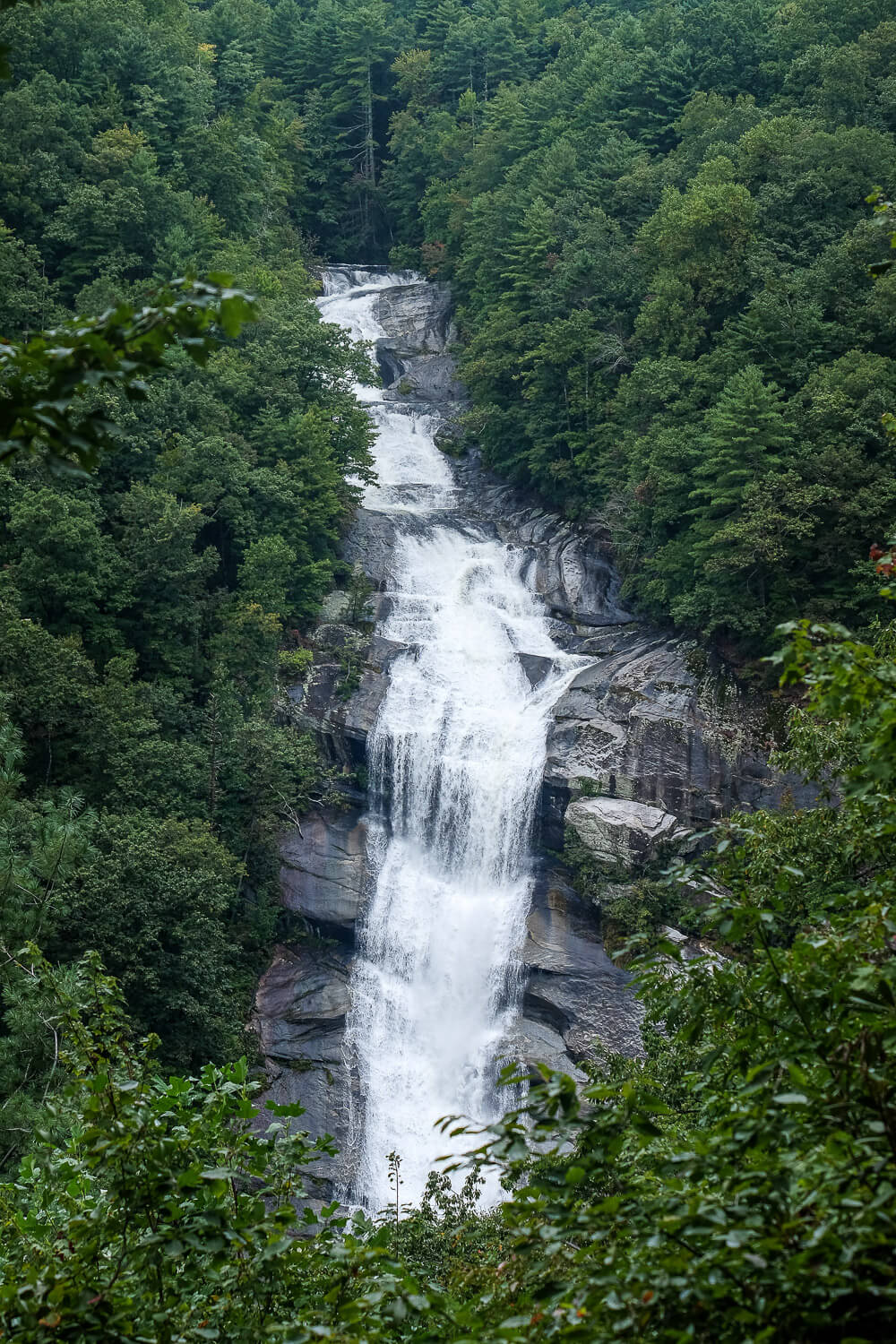
Other than my super zoomed in shots of the waterfall, I did want to include some photos showing this distance and I’ve tried to show this above.
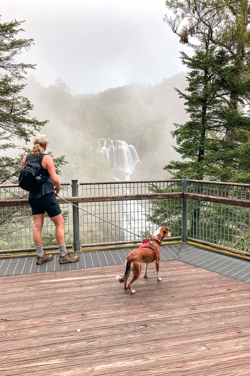
Also be careful of the slipperiness on the overlook platform itself! For us it was very slippery and we slid a few times while taking pictures. Be careful!
We did pass a few groups on the way there and then on the way back. But we did luck out and get the overlook platform all to ourselves for a good 20 minutes or so.
Lastly dogs are allowed on the trail but must be kept on leash.
Read Next: Paris Mountain State Park Hiking Guide
Upper Whitewater Falls
Distance: ~0.6 miles
Difficulty: Easy
Dog Friendly: Yes
Trailhead: Located off of NC 281: Google Map
Elevation Change: ~128ft
Time: less than an hour
The Upper Whitewater Falls trailhead is located off of NC 281 right near the South Carolina border. It’s actually only a 5 minute drive from the Bad Creek parking lot for the Lower Whitewater Falls hike. So if you want to visit both sections in one day, it’s very easy.
The parking lot and falls overlook is managed by the Forest Service. There’s a $3 fee collected via the honor system, and I strongly recommend every visitor to pay it. It’s only $3 and your money really does go a long way in keeping these areas open to the public. (And also keeping the bathrooms clean and the trash picked up. And yes there are bathrooms here.)
When turning off of NC 281 look for the Whitewater Fall Scenic Area Managed by Nantahala National Forest sign. The entrance to the parking lot will be across from this sign.
At the back of this parking lot, you’ll see a paved path and a sign saying the viewing area is in 1/2 mile. Which isn’t really true.
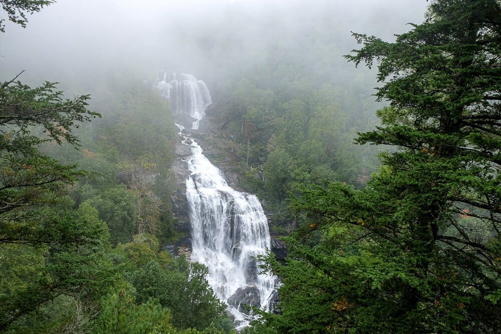
After .2 miles, you’ll come to the end of the paved path and get a small peek of the Upper Whitewater Falls. It was very foggy when we went, and we could barely see the falls.
It looks like there used to be a path to the left going to the top of the falls, but that was closed when we went. This path was also the top result for Upper Whitewater Falls on All Trails, but know that doesn’t seem to be an option anymore.
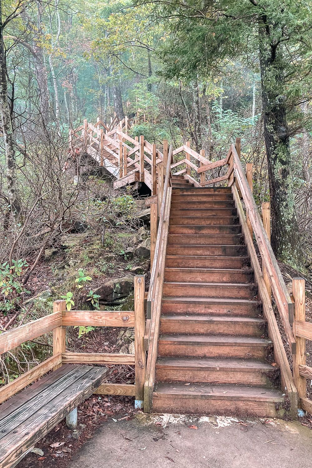
The viewing platform is actually to your right and down the stairs. It’s a lot of stairs but very doable. There’s even bench halfway down for you to rest at (may be needed on the way back up).
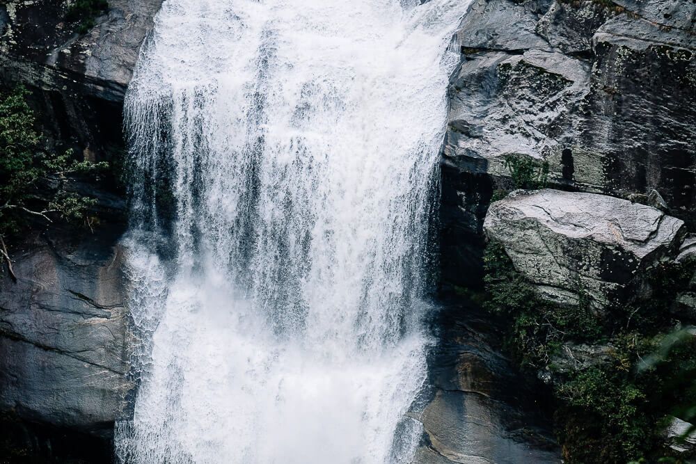
After descending the ~150ish steps, you’ll pop out on a viewing platform with incredible views of the waterfall. Even in our foggy conditions, the entire 411ft waterfall was visible. If there are a lot of people, the platform may be crowded so just be mindful of others trying to snap a photo.
The trail continues on down the hillside but, as a sign clearly states, there are no more waterfall views. So once you’ve had your fill, you can head back up to the parking lot.
One last thing to mention though is that the Upper Whitewater Falls are very popular. You most likely won’t have them to yourselves. If you’re trying to escape the crowds, avoid midday & the afternoon on the weekends as this seems to be the most popular time.
Read Next: Boat Camping at Lake Jocassee
Hiking to Both Waterfalls
As mentioned at the start of the article, it is possible to hike to both waterfalls from the same trailhead. This will be a long hike (8.8 miles), so be prepared for a full day. And it’s up to you which trailhead you’d like to park at (as both work).
The hardest part of the trail is the ascent from the Whitewater River up to the Upper Whitewater Falls viewing platform. The second being the one down to (and back up from) the Lower Whitewater Falls overlook.
The rest of the trail (it looks like) is fairly level along the Whitewater River. If you park at the Upper Whitewater Falls trailhead, this will put the hardest part (the climbing back up) at the end of the hike, so that’s something to keep in mind. If you decide to park at the Lower Whitewater Falls trailhead, you’ll do that ascent in the middle, but it will make the hike longer (by over a mile).
For full details on this option, check out this following trail guide.
And that’s it! I hope you enjoy your hikes to these impressive waterfalls. And again I’m in shock they were less than 2 hours away from my home in Greenville. Before you head out to them, be sure to check on the weather (avoid days with foggy & rainy forecasts if you can). And be sure you have the right supplies. If you’re doing the Lower Whitewater Falls hike (or the combined), you’ll need good shoes, and water at the minimum. I’m also a fan of snacks regardless of the length of the trail.
Some of my favorite hiking gear: