This quiet side trail has stunning views of Somes Sound and, amazingly, isn’t too strenuous (though it is long). Plus when hiking to the top of St Sauveur Mountain, you’re unlikely to come across lots of people.
St Sauveur Mountain is located right next to the more popular Acadia Mountain. And though the peak of St Sauveur doesn’t offer great views, the Valley Peak Trail located near the summit does.
There are several options of trails to experience St Sauveur, so make sure you know what route you want to take before you go. And maybe have a map with you (or pre-downloaded on your phone).
Distance: ~4.5 miles roundtrip
Difficulty: Moderate
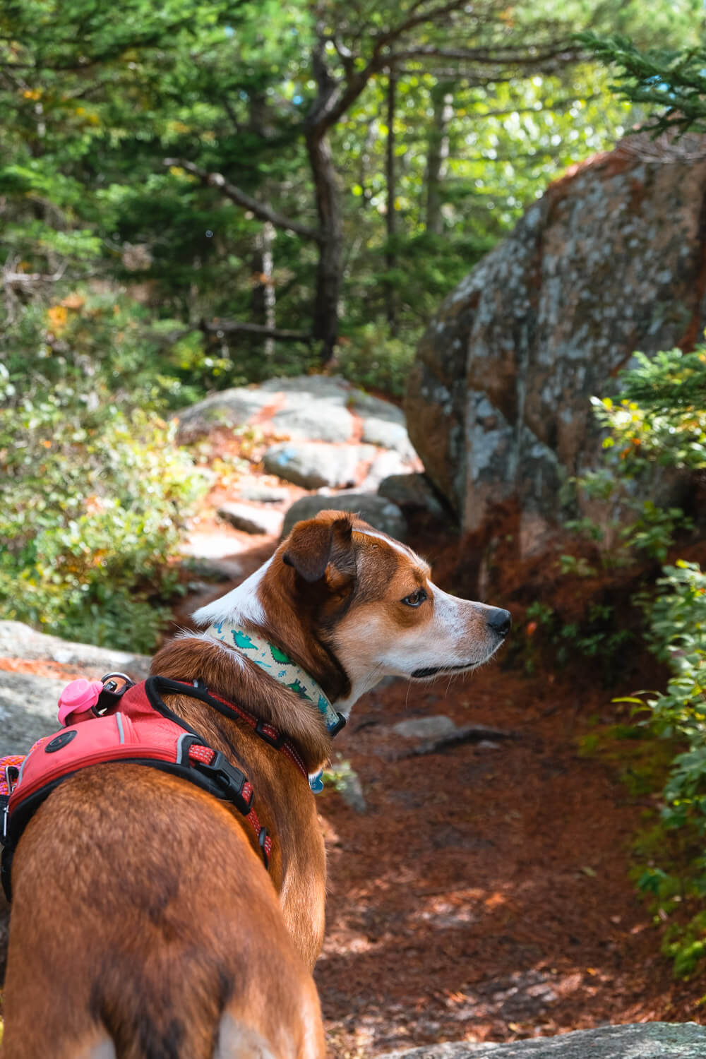
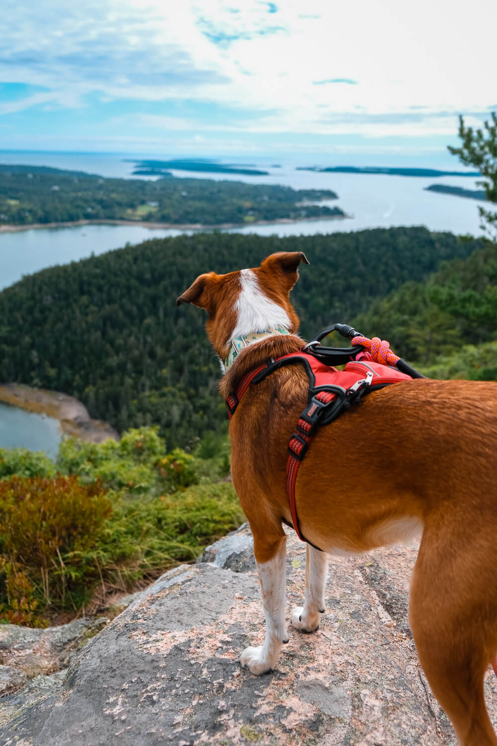
Dog Friendly: Yes
Trailhead: Located along Route 102 (on the way to Southwest Harbor), there’s a roadside parking lot across from the Acadia Mountain Trailhead and St. Sauveur Mountain Trailhead. You’ll find a small lot and a bathroom even.
Elevation Change: ~800ft
Time: 3-3.5 hours
St Sauveur Mountain Trail
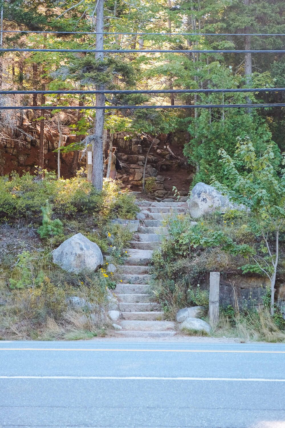
This trail guide starts from the main Acadia Mountain trailhead parking lot along Route 102. There’s a big sign, a pit toilet bathroom, and few pots. Definitely get there early because this is the main trailhead for both Acadia Mountain and St Sauveur.
You do have a couple of additional options if this lot is full (or you want to take an alternate route). See the section below for details on those. Note that I haven’t hiked them, just know about them.
Once you’ve parked at the main trailhead, cross the road and head up the steps.
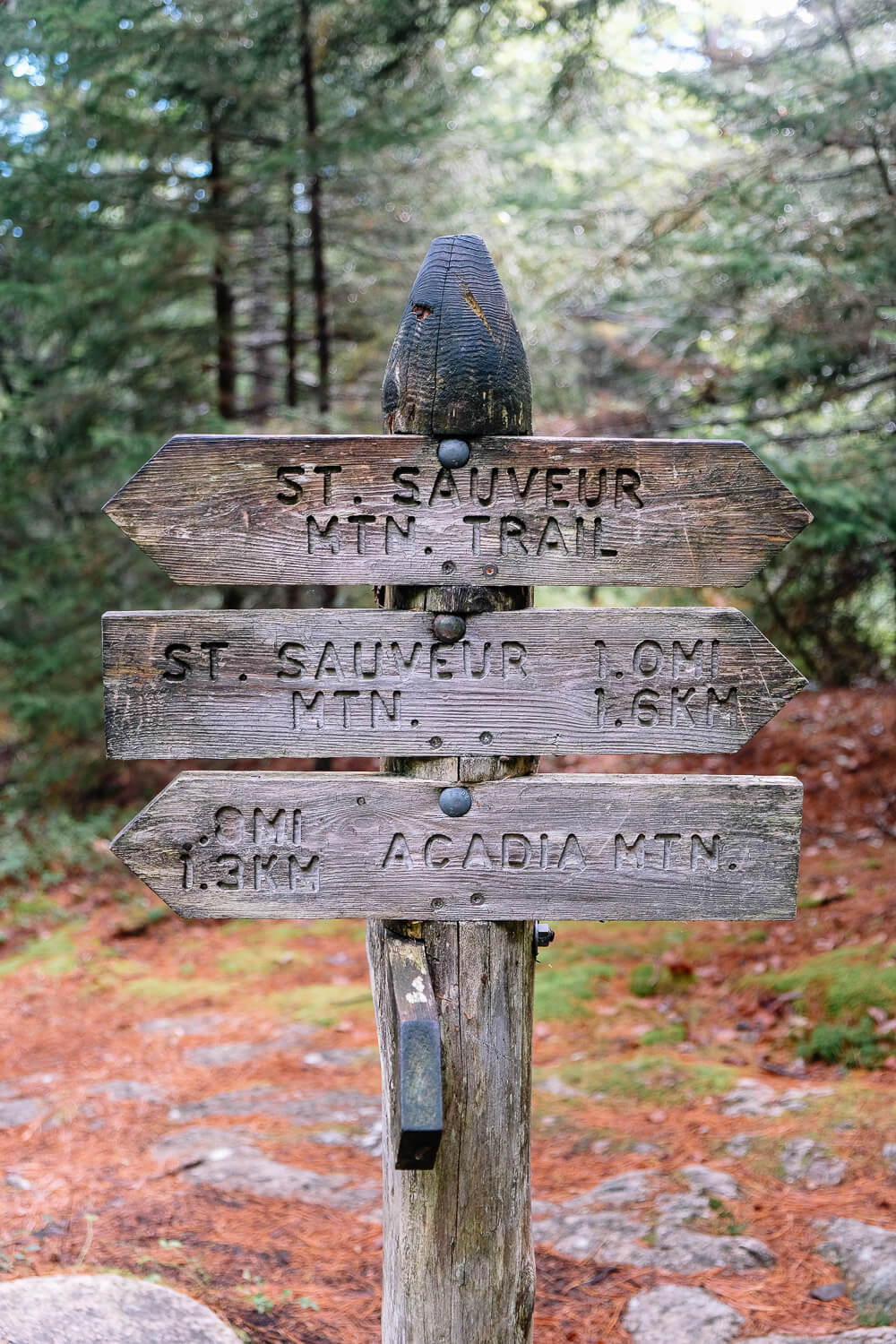
This is the starting point for Acadia Mountain as well, so look at the signs and head towards St Sauveur Mountain (you’ll head straight and then make a right).
Hike the Acadia Mountain Trail in Acadia National Park
From that right turn, you’ll start to make your ascent. But unlike many other trails in the park, this climb is actually pretty gradual. It’s one of the easier mountains to summit in my opinion (at least coming from this direction).
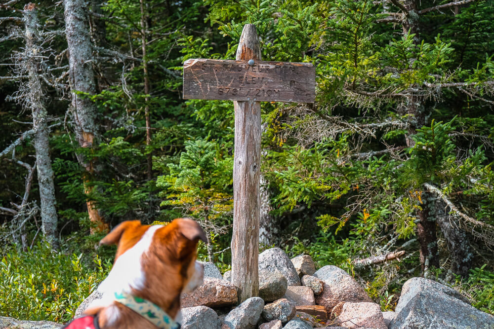
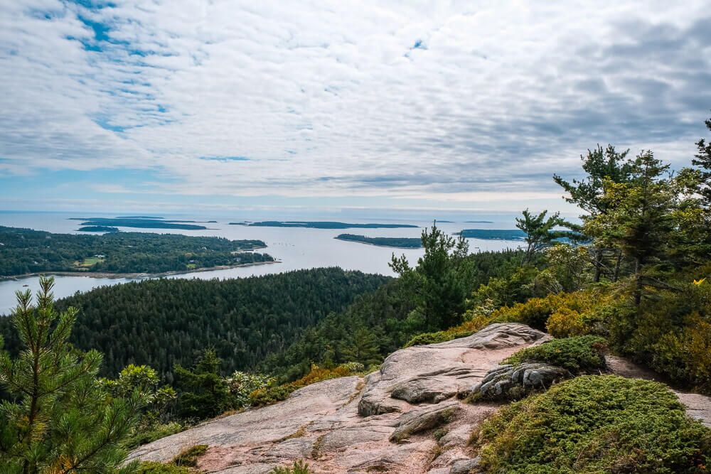
You’ll pass by the intersection from the Ledge Trail, but keep heading up and after about ~1.5 miles you’ll reach the summit. There’s not much here (since you’re still under tree cover), but the views are coming.
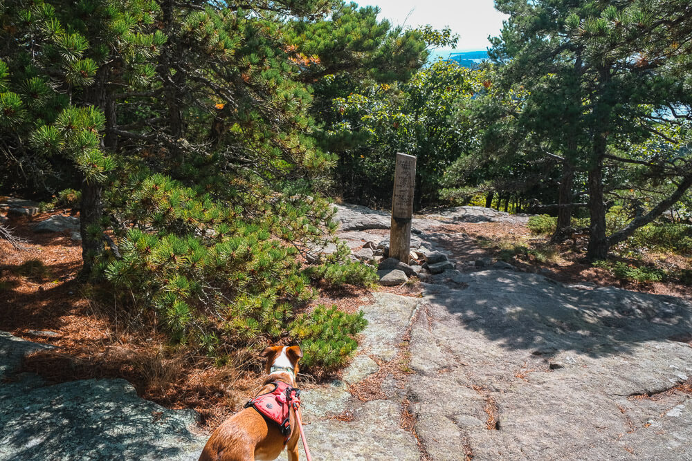
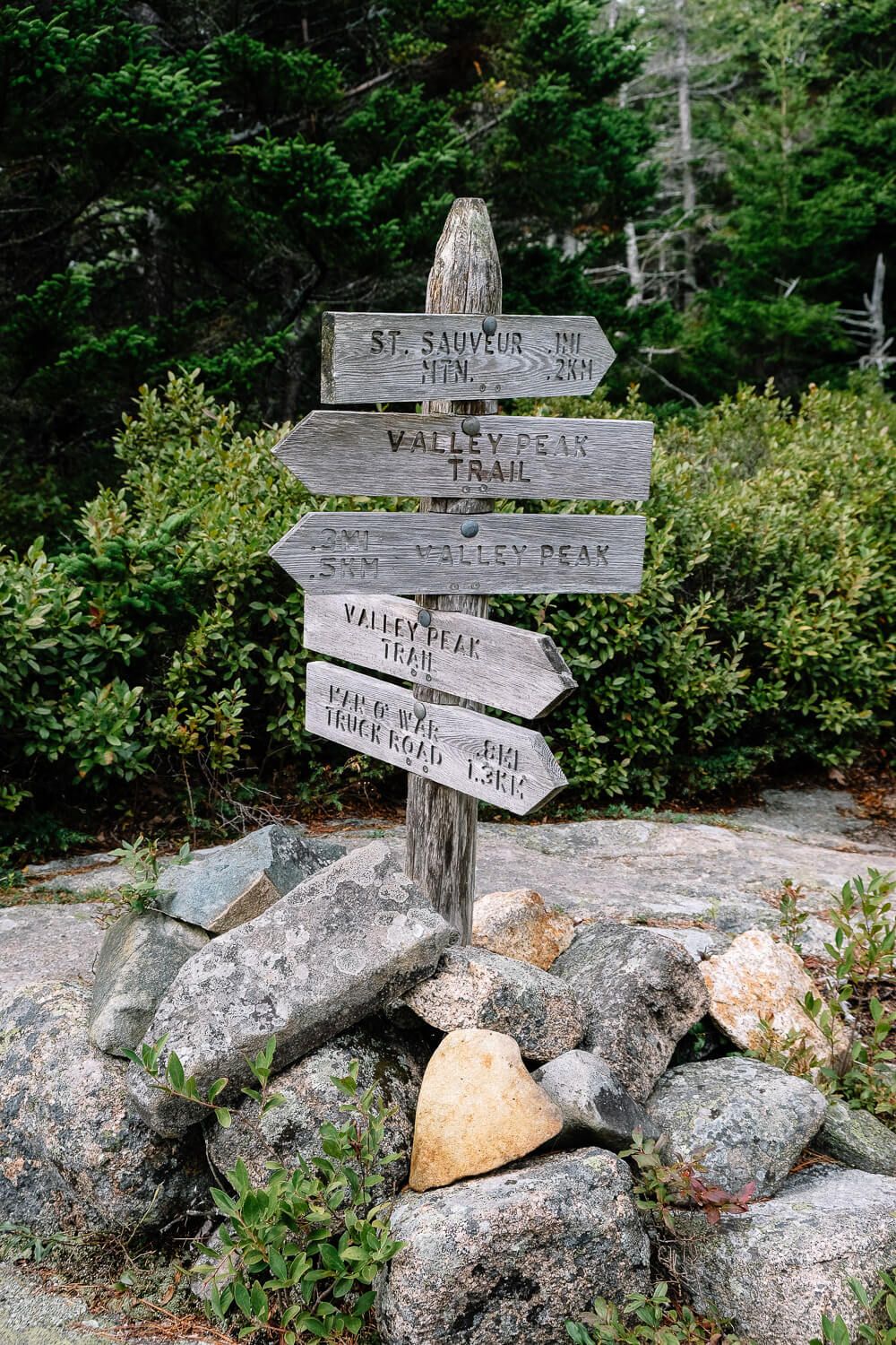
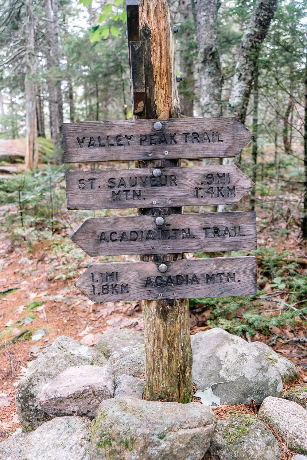
Continue on the trail until you reach the intersection with the Valley Peak trail. This trail makes a loop around the top of St Sauveur Mountain and it’s a bit confusing since both directions are labeled Valley Peak on the signs.
I would hike the Valley Peak trail in a counter clockwise direction (so go straight/right at the first intersection). This will take you down through a forested section for about a half mile, before you reach another intersection.
Here turn left to continue the loop (the other way is also labeled Valley Peak, but heads down the mountain and isn’t part of the loop).
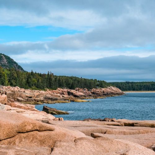
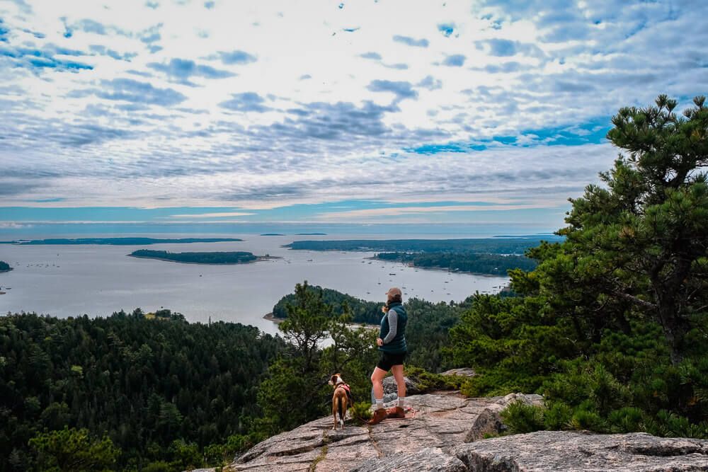
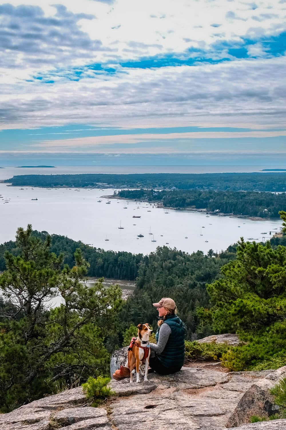
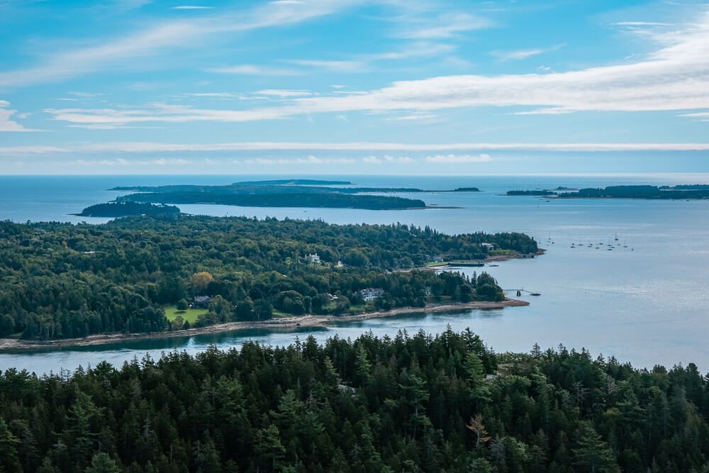
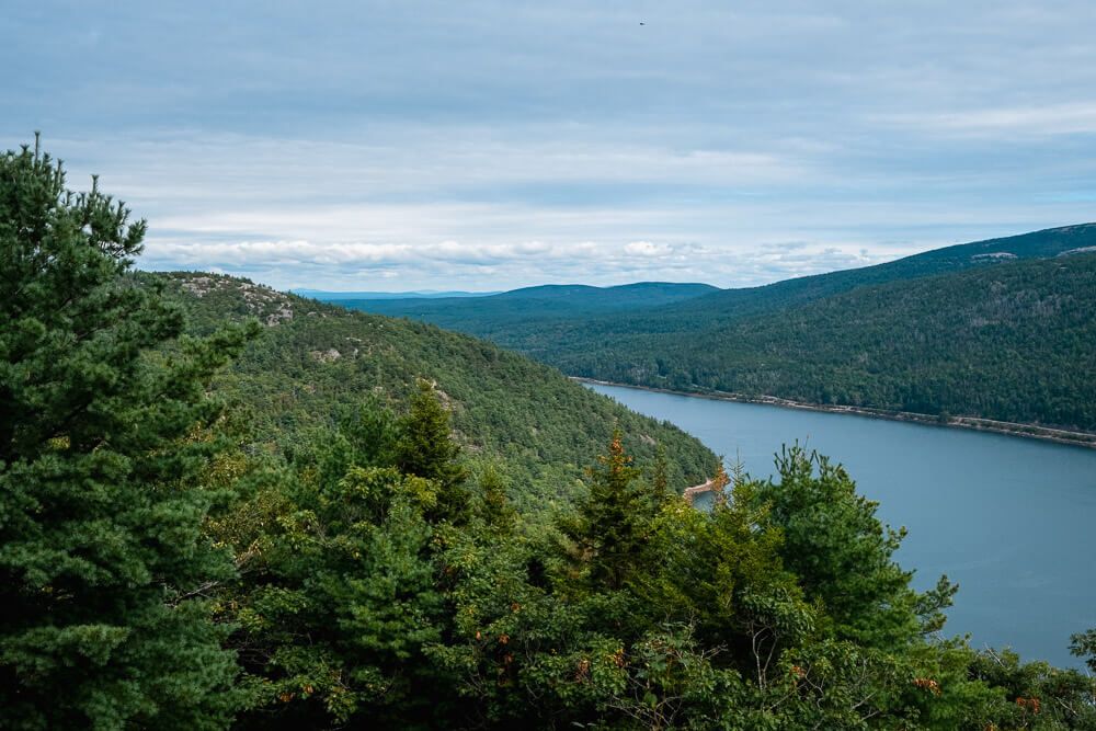
Right after this intersection, you’ll emerge out of the forest and along the cliff edge that faces Somes Sound. This was my favorite view along the trail.
Continue along the loop (heading north) and you’ll be treated to many more overlooks along the way. Take your time.

As the loop nears the end, you’ll come across one last intersection. You’ll want to head straight/right to start coming down. This direction is also labeled Valley Peak.
If you go left, it’ll take you back towards the summit and the start of the loop.
You can make a left here and then head down the way you came up (down the St Sauveur Mountain Trail). This way is much more gentle so consider this if you struggle on steep sections or have an older/smaller dog with you.
As you head down this section of the Valley Peak Trail, you’ll have several more views off to your right of Somes Sound. I actually saw several eagles here when I hiked in September.
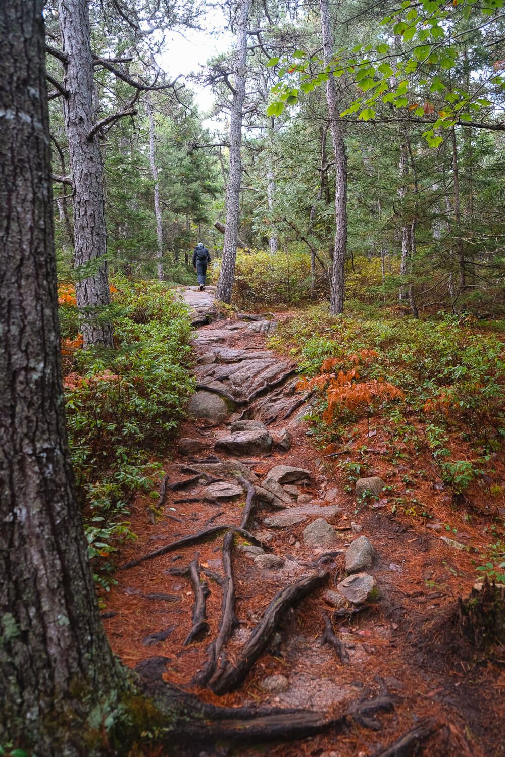
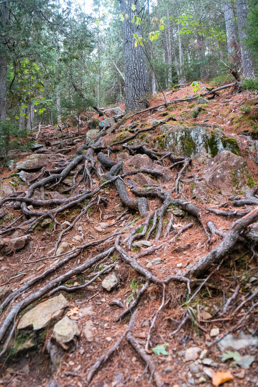
Eventually you’ll descend back into the forest. This section is very steep and rocky and covered in tree roots. I found it very difficult to descend.
Definitely take your time or consider skipping this section and hiking back the way you came up.
You’ll eventually reach the bottom and hit a 4-way intersection. Make a left here towards the Man O’War Truck Road (may be labeled Man O’War Brook Trail).
This dirt road will take you back towards the parking lot. You’ll have one more 4-way intersection on the way. You can head left (which is what I did), but I actually recommend going straight.
This little trail will take you along a flatter section near the road and pop you out right at the trailhead.
The 5 Best Hikes in Acadia National Park
Alternate Trailheads & Options
Due to the number of trails and intersections, you have several different options for changing things up (to make it shorter, longer, or if the main parking lot is full).
Make it shorter. You can make this trail shorter by making this an out and back. When you reach the first intersection with the Valley Peak Trail, go left (clockwise). This will take you to the cliffs, then go south a bit for a couple of different viewpoints and then head back the way you came.
Continue to Acadia Mountain. When you come down the mountain on the Valley Peak Trail, instead of turning left on the Man O’War road, continue straight and climb up towards Acadia Mountain. Note that this ascent is very steep and rocky. But it will take you up and over Acadia Mountain and bring you back towards the parking lot.
Ledge Trail. This trail starts at the smaller parking lot about a mile south of the main roadside parking lot. This 1/2 mile trail is much more steep, rocky, and tree root filled as it quickly climbs up towards the St Sauveur Mountain trail.
Flying Mountain. You can also summit St Sauveur Mountain by coming up from the Flying Mountain parking lot. Head north on the Valley Cove Trail and then make a left onto the Valley Peak Trail. You can make this an out and back (~2 miles total I think) if you go up to summit and back. Or you can make it a loop by going up to the summit as mentioned, and then keep going down the Valley Peak trail. When you reach the intersection with the Man O’War and Acadia Mountain trails, make a right and come back on the Valley Cove Trail (a little over 3 miles).
FAQs for St Sauveur Mountain
Is the trail dog friendly? Acadia National Park is dog friendly as long as you keep them on a 6ft (or less) leash (and you pick up their poop). Be careful coming down the Valley Peak Trail.
Where should you park? There is a small lot across from the St. Sauveur Mountain trailheed with a bathroom. I suggest parking here and getting there early in order to get a spot. Plus there’s a pit toilet bathroom!
If these lots are full, you can park at the Ledge Trail parking lot or even the Flying Mountain parking lot. See the section above for these alternate starts.
Is there a fee? You’ll need a park pass to enter Acadia National Park.
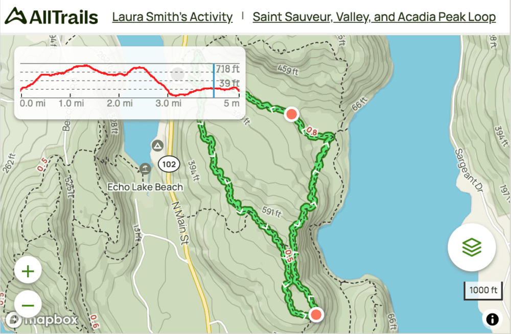
Is there a trail map? Check out my trail map below!
Click the image or the buttons to view the map in more detail.
Planning your trip to Acadia National Park & Bar Harbor?
Itineraries & Guides
- Ultimate Guide to Visiting Acadia National Park
- One Week in Bar Harbor Itinerary
- 5 Awesome Things to Do in Acadia National Park
- One Day in Acadia National Park
- The 5 Best Hikes in Acadia National Park
- The Best Lobster Pounds in Bar Harbor
- The Best Restaurants in Bar Harbor
- 20 Photos of Bar Harbor
- Bar Harbor in September
- Discover the Iron Rung Hikes in Acadia National park
Hiking Trails
- Jordan Pond Path
- Ocean Path
- Great Head Trail
- Bubble Rock Trail
- North Bubble Loop Trail
- Acadia Mountain
- Jordan Cliffs Trail
- Beech Cliff Trail
- Beehive Trail
- Gorham Mountain Loop Trail
- Precipice Trail
Other Things to Do in the National Park and in Bar Harbor:
- Biking the Carriage Roads
- Rock Climbing
- Sea Kayaking
- Bass Harbor Lighthouse for sunset
- Whale Watching Tour
- Walk to Bar Island
- Atlantic Brewery Tour
- Ghost Tour
Where to Stay:
On our first trip to Bar Harbor we stayed at the Holiday Inn Regency. It was a little outside of town but was on the Island Explorer bus route which was handy.
If you want to stay in one of the classic Bar Harbor inns though, you can’t beat the Bar Harbor Inn & Spa. This is literally in the heart of Bar Harbor.
When my whole family goes, we usually rent a house with VRBO or Airbnb. The extra space for 4 adults really comes in handy. There are several options in Bar Harbor and on Mount Desert Island.
There’s also a few campgrounds in Acadia National Park as well if you’d like to stay in the park. Make sure to check the location of where they are.