Hiking to the top of Table Rock is a fantastic but extremely difficult and long trail. So what if you want something on the easy side but that has amazing views of Table Rock Mountain? That’s where the Lakeside Trail comes in.
This short and flat-ish trail loops around Pinnacle Lake at the base of Table Rock Mountain. I really liked it for its views, the lakeside feel, and the fact that there weren’t a lot of people on the trail. In fact we only bumped into one other group the whole time.
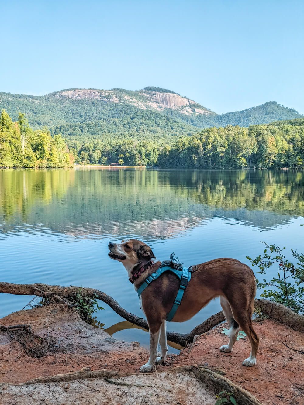
Ellie loved exploring all the sights and smells. Plus if your dog likes the water, there are plenty of chances to splash around in the creek and in the lake!
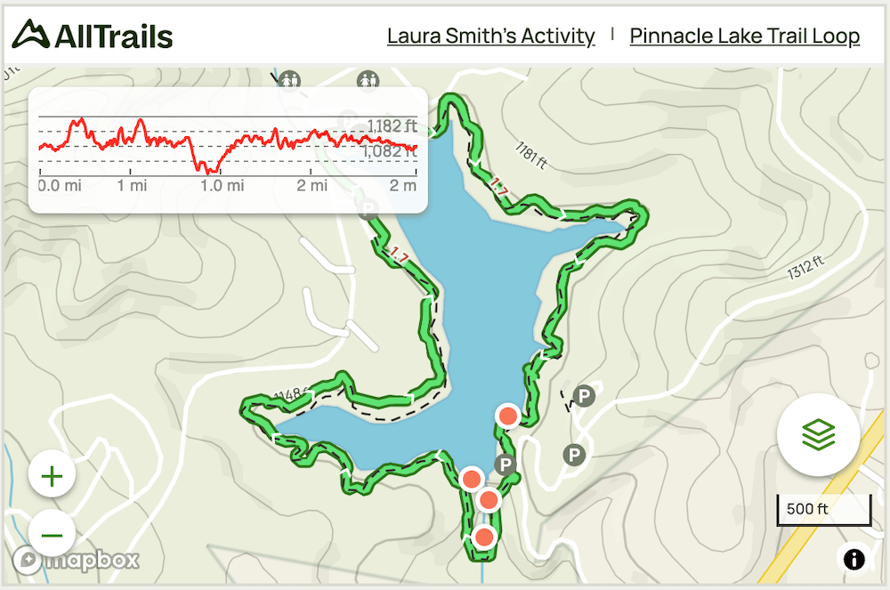
Finally there are two lakes at Table Rock State Park. This trail loops around the smaller Pinnacle Lake near the Nature Center and the trailhead for the other hikes in the park. The larger Lake Oolenoy is by the visitor center.
Distance: ~2 miles roundtrip
Difficulty: Easy
Dog Friendly: Yes
Trailhead: By Pinnacle Lake near the Nature Center
Elevation Change: ~140ft
Fee: There is a fee to enter Table Rock State Park (check current prices).
Time: 1 hour
Lakeside Trail Guide
There are two main parking lots you can start from. There’s the larger lot near the Nature Center and the beach. The other smaller parking lot (and there’s actually a sign that says Lakeside Trail) is right next to it. Either one works.
You can also hike this trail in either direction. This guide will explain it in a clockwise direction (as that’s the way we went). Look for the purple blazes as you go.
After we parked, we headed towards the beach. You’ll see a sidewalk at the top of the beach that loops around towards an old boathouse and a bunch of paddle boats. Take that to the end of the sidewalk and you’ll see the trail start along the side of the lake.
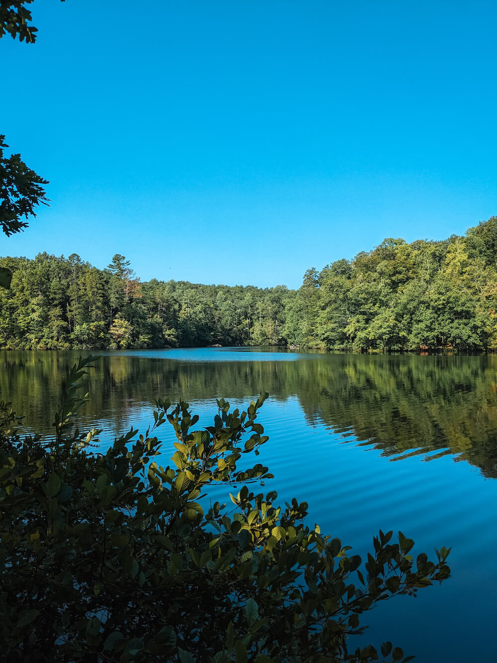
The trail is fairly level but there are some small ups and downs as it winds its way around the lake. Watch your footing as the trail is a natural surface and there are a fair amount of roots and rocks to be found.
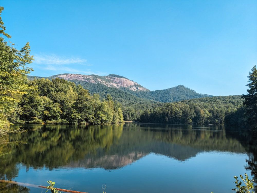
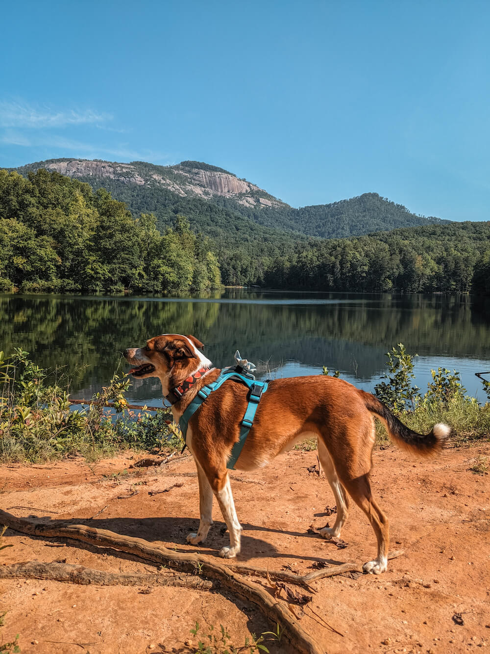
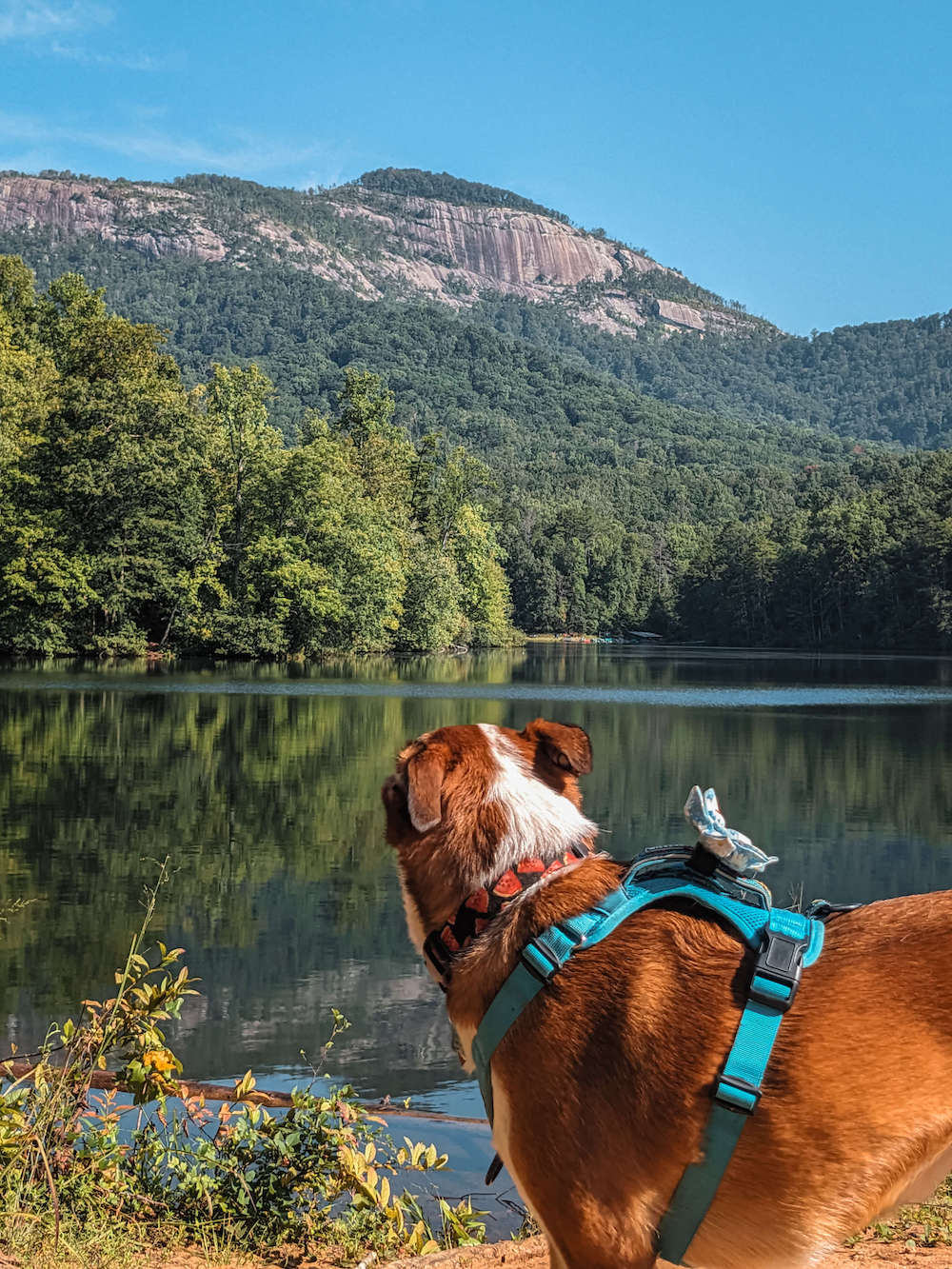
You’ll pass a couple of good viewpoints that point towards Table Rock. And there are even benches that allow you to sit back and relax a bit.
At one point there will be a split in the trail (right after one of these viewpoints). Keep following the path close to the water. If you accidentally head up the hill instead, you’ll find yourself at Gaines Lodge. Just head back down and continue.
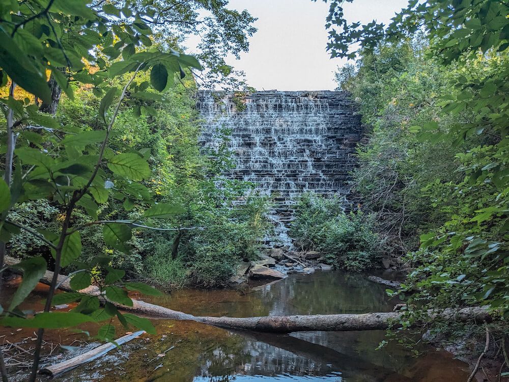
At the southern end of the lake, you’ll come upon the dam and spillway (constructed by the Civil Conservation Corp). It’s a pretty feature and there’s even a small pool just south of the dam that is a nice wading spot for a dog.
There’s also an additional parking area and trail access here you can use if the other lots are full.
After crossing a small bridge over Carrick Creek, you’ll see another viewpoint to your right after a small incline. This is my favorite view of Table Rock.
After that, the trail is pretty level as it makes its way towards the parking lots. The first one you’ll reach is the Lakeside parking lot. If you parked at the larger one near the beach, just take the sidewalk next to the road over the bridge and you’ll be there.
The “trail” between the Lakeside parking lot and the beach/boathouse isn’t a real trail. Just a combination of sidewalks and parking lots. But as long as you stay close to the lake, you’ll be fine.
Trail Map
Click the image or the buttons to view the map in more detail.