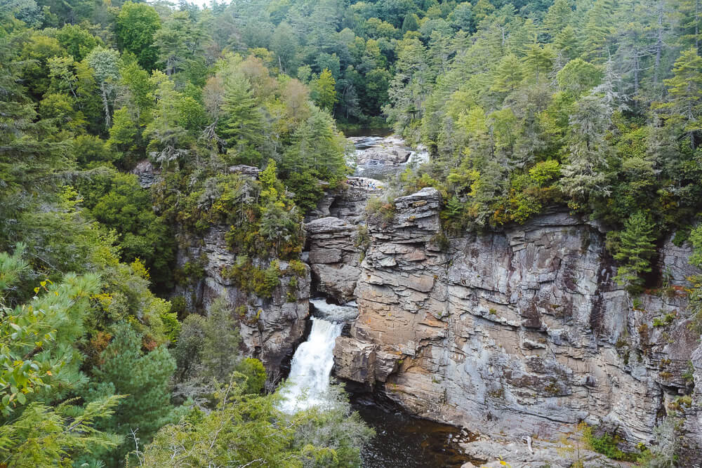
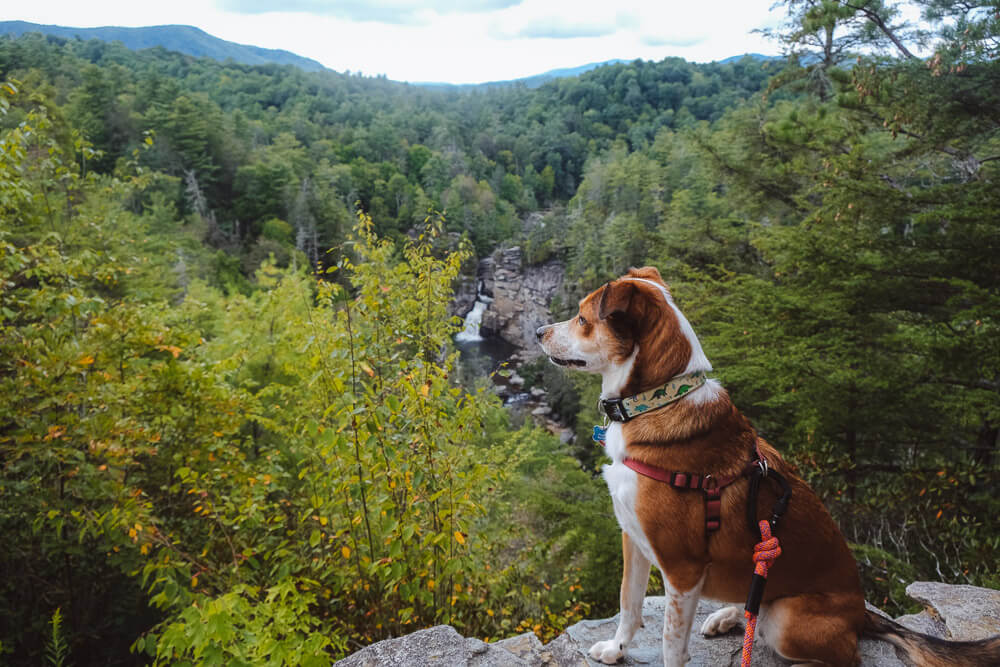
The Linville Gorge (mm 316) is one of the best stops along the Blue Ridge Parkway. The gorge itself is known as the “Grand Canyon of the Southern Appalachians. And the Linville Falls may be the most famous waterfall in the Blue Ridge Mountains. This Linville Falls hiking guide will help you make the most of your visit!
Devil’s Courthouse on the Blue Ridge Parkway [Trail Guide]
Linville Falls Trail Guide
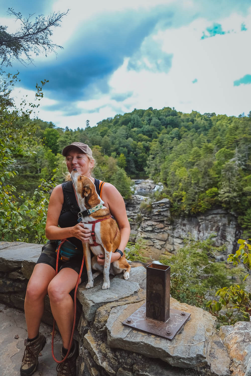
You’ll want to start your hike at the Linville Falls Visitor Center. This stop is very popular, so expect crowds on the weekends. (I read that the center gets 350,000 visitors annually.) I would suggest getting arriving early or late to avoid most of the crowds if you come on a Saturday or Sunday.
Do not climb on the rocks or swim in the water around Linville Falls. You may really die.
You have a couple of options for hiking. If you want to see Linville Falls from above, you’ll be heading to the main viewpoints above the falls. If you want to be closer, you’ll be heading down.
Both directions will have a fair amount of elevation. But heading down to the Plunge Basin is a harder, more technical route. I’ve also heard it’s less popular.
Erwins View Trail
Distance: ~2.3 miles roundtrip
Difficulty: Moderate
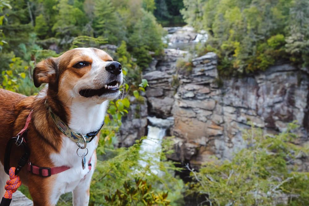
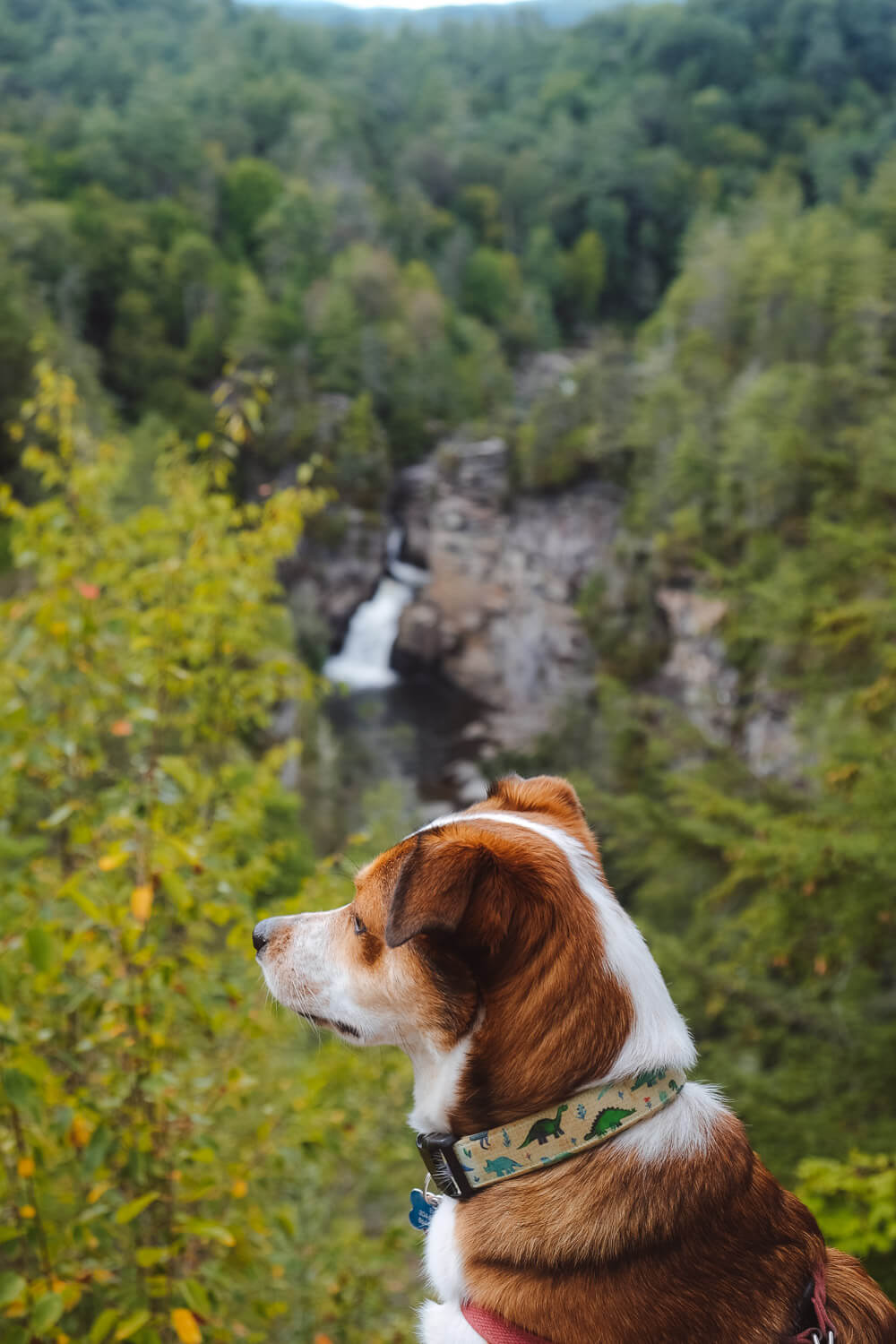
Dog Friendly: Yes
Trailhead: Linville Falls Visitor Center: MM 316 off the Blue Ridge Parkway
Elevation Change: ~400ft
Time: 1.5 hours
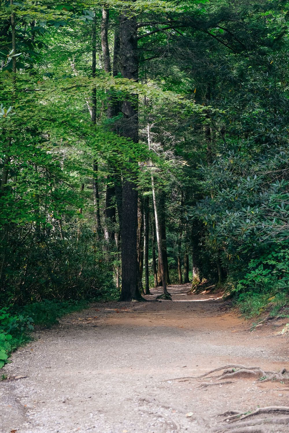
This is the main trail that heads up to the four main overlooks. It’s slightly less elevation and the trail is well maintained.
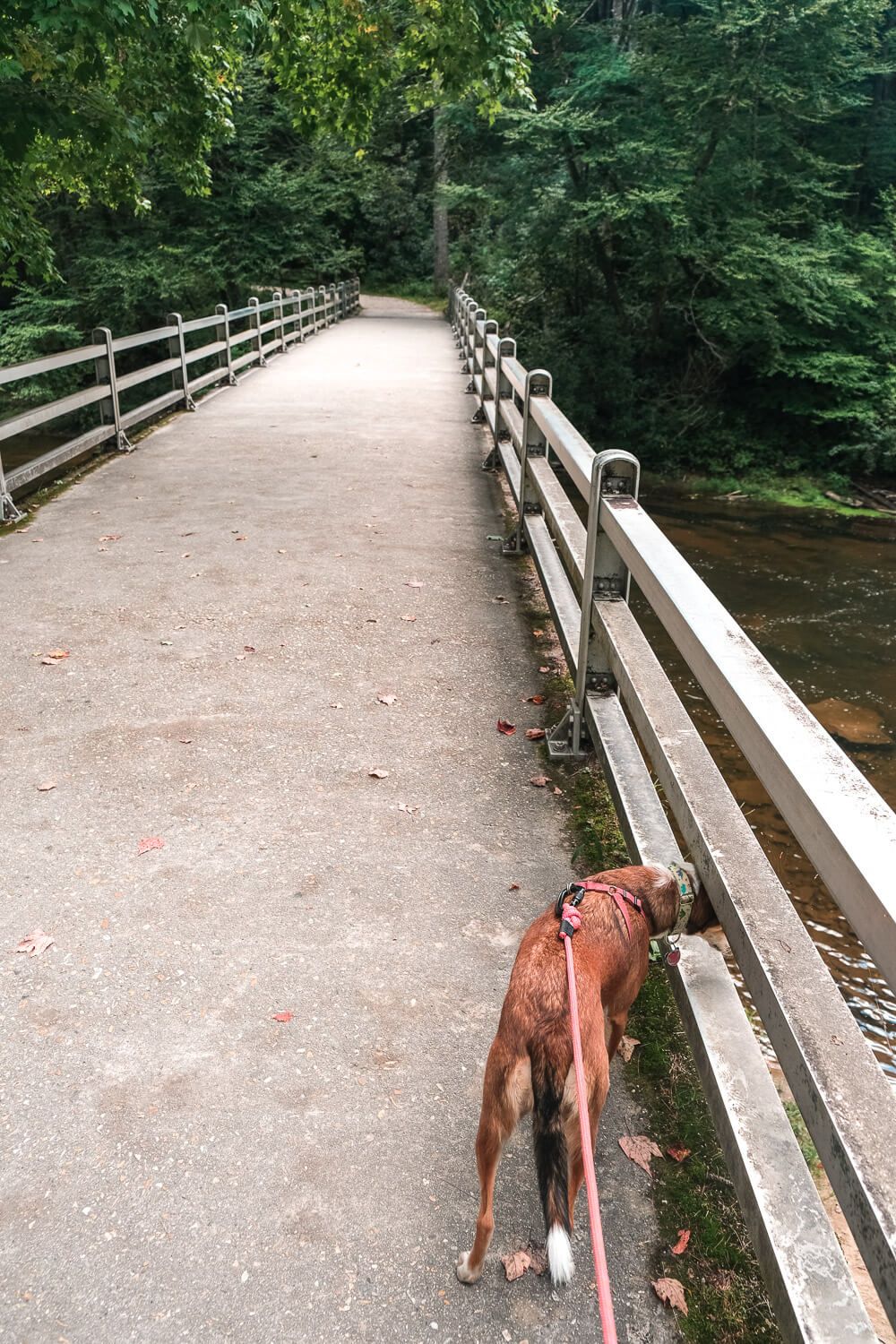
From the parking lot, you’ll head through the visitor center and then over the bridge on the other side. Stay on the trail until you reach an intersection with a sign pointing towards the Upper Falls to your left.
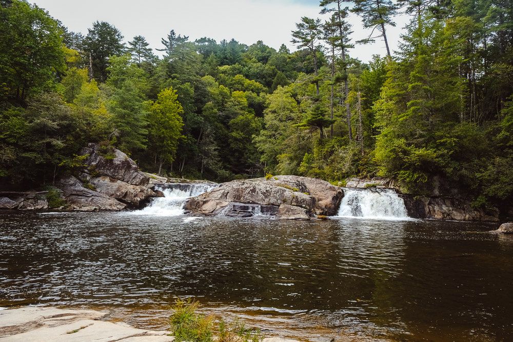
Head down this spur trail to your first overlook (1/2 mile from the visitor center): Upper Falls. Here you’ll be able to see the smaller waterfalls above the main Linville Falls. Be very careful and do not go into the water. You can also see how the river twists and turns and then plunges down and out of sight.
Once you’ve had your fill, backtrack to the intersection and continue heading down the trail.
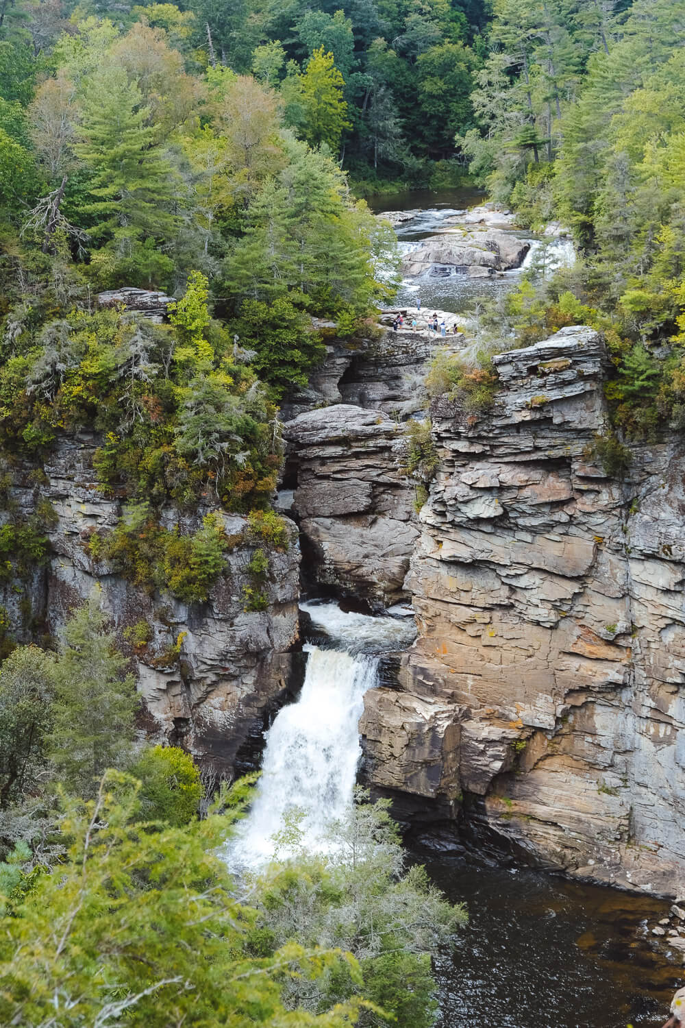
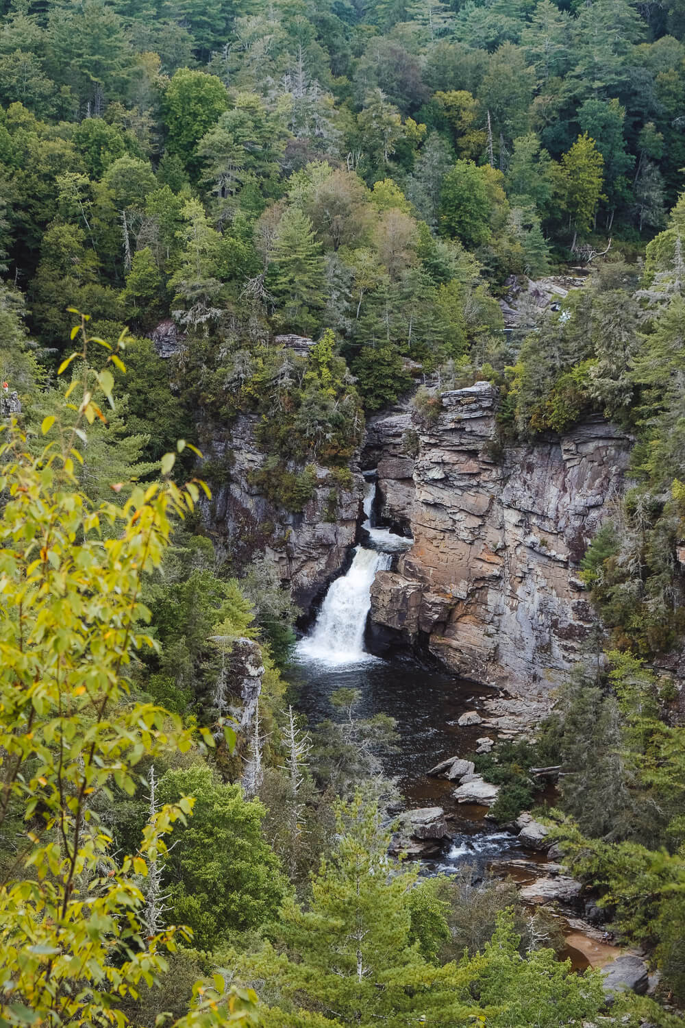
The next overlook you’ll reach is Chimney View (.7 miles from the visitor center). This is the first overlook where you can see the Lower Falls (and what many would consider the main Linville Falls).
You’re also closer here so you’ll have a pretty good view of both the lower and upper falls. There are a number of steps down to the overlook, so be prepared for that.
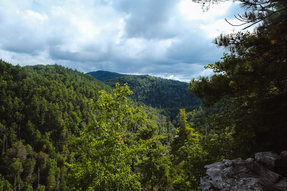
Then it’s back to the trail and onwards to the Gorge View Overlook. This view actually doesn’t point towards the falls. Instead it’s facing downriver of the falls.
I still enjoyed stopping here and taking in the scenery of the Linville Gorge Wilderness Area.
The last overlook, Erwins View Trail (.8 miles from Visitor Center), is the namesake for this trail. There’s a small wooden platform here you’ll climb up to get a view of the Linville Falls.
You’ll be much farther away from the falls here, but it’s still very impressive. Plus you’re so high up now that you’ll have a good view of the gorge around you.
Once you’ve had your fill, head back towards the visitor center.
Black Balsam Knob Hike [Trail Guide]
Linville Gorge Trail
Distance: ~1.7 miles roundtrip
Difficulty: Moderate
Dog Friendly: Yes
Trailhead: Linville Falls Visitor Center: MM 316 off the Blue Ridge Parkway
Elevation Change: ~525ft
Time: 1-1.5 hours
This is also known as the Plunge Basin Trail. Instead of heading across the bridge from the visitor center, you’ll want to find the trail that starts off the left side of the visitor center.
This short trail will lead just about a quarter of a mile from the Visitor Center before it forks. The right fork will take you to the Plunge Basin Overlook next to the lower falls.
The left fork will take you down to the Plunge Basin at water’s edge just a little bit past the lower falls.
You’ll be able to see the lower Linville Falls from both. These trails are steeper, windier, and less maintained. Expect to scramble a bit and for things to be slippery. The left fork (the one that leads down to the water.
To visit both trails, I suggest going right first to the overlook. Then backtrack to the intersection and then take the left fork down to the water’s edge. Once you’re done there, head back to the visitor center
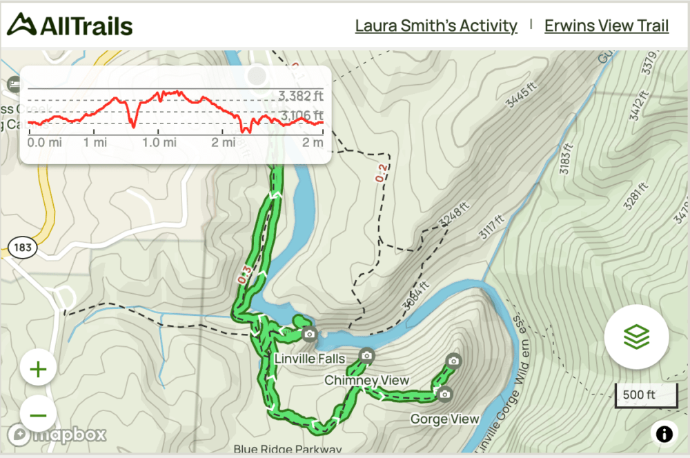
Linville Falls Trail Maps
Below I have the official Linville Falls Map (the trails are on the right side). And then below that, I have a map (and links) of my route on All Trails.
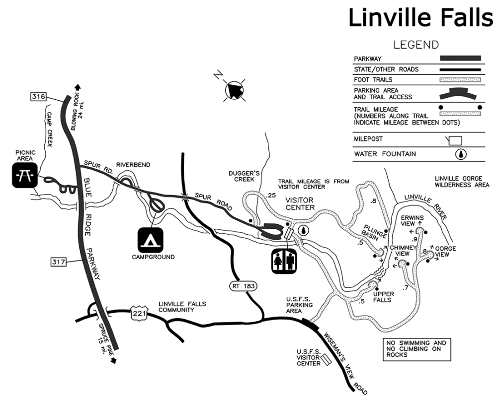
Click the image or the buttons to view the map in more detail.